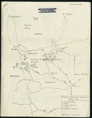
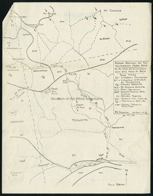
Physical- White background with map and writing in black.
This is a map that outlines the surficial deposits in Wonanlancet Area, NH in 1972.
Collection
Newton Collection
Acquisition
Accession
MWM2012.0001
Source or Donor
Newton, John W. (Jack) and Anne H.
Acquisition Method
Gift
Lexicon
Nomenclature 4.0
Nomenclature Secondary Object Term
Map
Nomenclature Primary Object Term
Cartograph
Nomenclature Sub-Class
Graphic Documents
Nomenclature Class
Documentary Objects
Nomenclature Category
Category 08: Communication Objects
LOC Thesaurus for Graphic Materials
Geology
Search Terms
New Hampshire (United States : state), Wonalancet (Carroll county, New Hampshire : inhabited place), Wonalancet, Mount (Grafton county, New Hampshire : peak)
Archive Details
Date(s) of Creation
1972
Primary Language
English
Archive Notes
Date(s): 1972
Publication Date: 1972
Condition
Notes
Stamp on front.
General Notes
Note
Notes: Donor's personal stamp on front.
Scan ID#: WM201300405; WM201300406