Name/Title
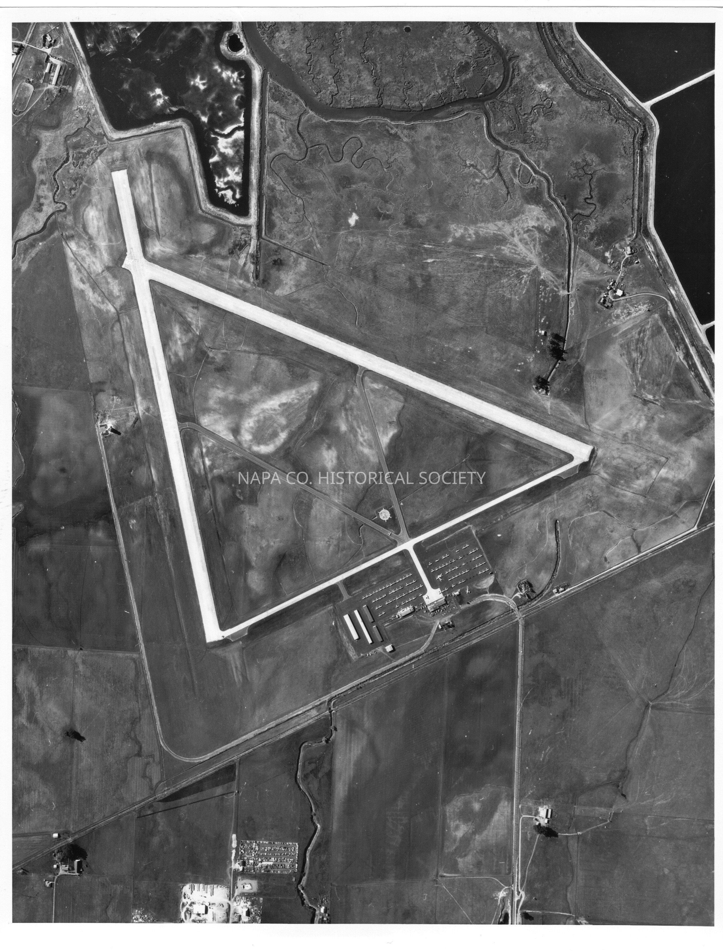
Aerial photograph of the Napa County airport.Entry/Object ID
2011.61.1489Description
Black and white aerial photograph taken above the Napa County airport.
Backside of photograph reads: THIS IS AN ENLARGEMENT OF A SECTION OF A NATIONAL OCEAN SURVEY AERIAL PHOTO TAKEN AT AN ALTITUDE OF 3 MILES. THE AERIAL PHOTOS, SUPPLEMENTED BY FIELD SURVEYS, WILL BE USED TO PROMOTE SAFETY AT NAPA COUNTY AIRPORT, NAPA, CALIFORNIA.
Location: PF108E #11179Collection
PhotographsAcquisition
Accession
2011.61Source or Donor
Napa Valley RegisterAcquisition Method
GiftLexicon
Nomenclature 4.0
Nomenclature Secondary Object Term
Print, PhotographicNomenclature Primary Object Term
PhotographNomenclature Sub-Class
Graphic DocumentsNomenclature Class
Documentary ObjectsNomenclature Category
Category 08: Communication ObjectsLOC Thesaurus for Graphic Materials
Aerial photographsSearch Terms
Napa County Airport, Aerial photographsCreate Date
November 15, 2011Update Date
May 14, 2024