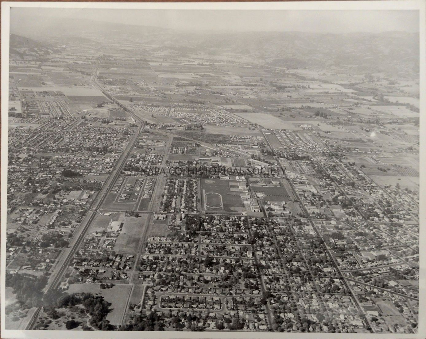
Aerial View of Napa

Name/Title

Aerial View of Napa

Entry/Object ID

1998.3.2

Description

Black and white aerial view of Napa looking north. Label on back reads "This photo shows on the right side of the photo Jefferson Street. On the left side Hwy 29. Middle of photo Lincoln Ave. Notice Napa High. On upper right side, the white buildings are Queen of the Valley 1960"
Collection

Photographs

Acquisition

Accession

1998.3

Source or Donor

Millhouse, Jane

Acquisition Method

Gift

Made/Created

Studio

John Stutzman's Photography Center

Date made

1960 - 1960

Place

Location

1625 Jefferson Street, Napa, CA

Notes

Date: 10/01/1960

Lexicon

Nomenclature 4.0

Nomenclature Secondary Object Term

Print, Photographic

Nomenclature Primary Object Term

Photograph

Nomenclature Sub-Class

Graphic Documents

Nomenclature Class

Documentary Objects

Nomenclature Category

Category 08: Communication Objects

Search Terms

Napa City, Highway 29

Create Date

November 2, 2011

Update Date

May 22, 2026