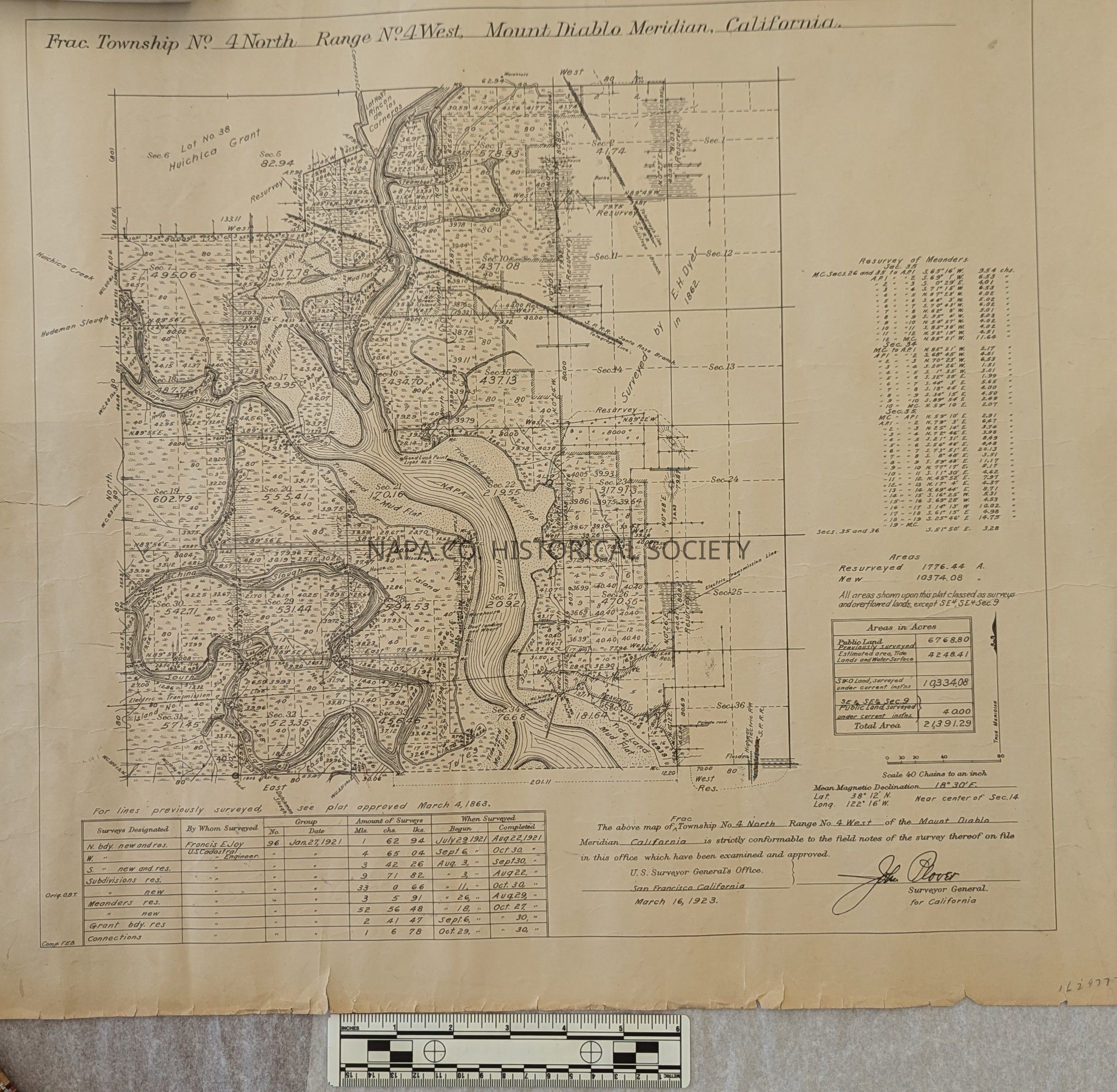
Frac. Township No. 4 North, Range No. 4 West, Mount Diablo Meridian
Entry/Object ID
2024.11.1
Description
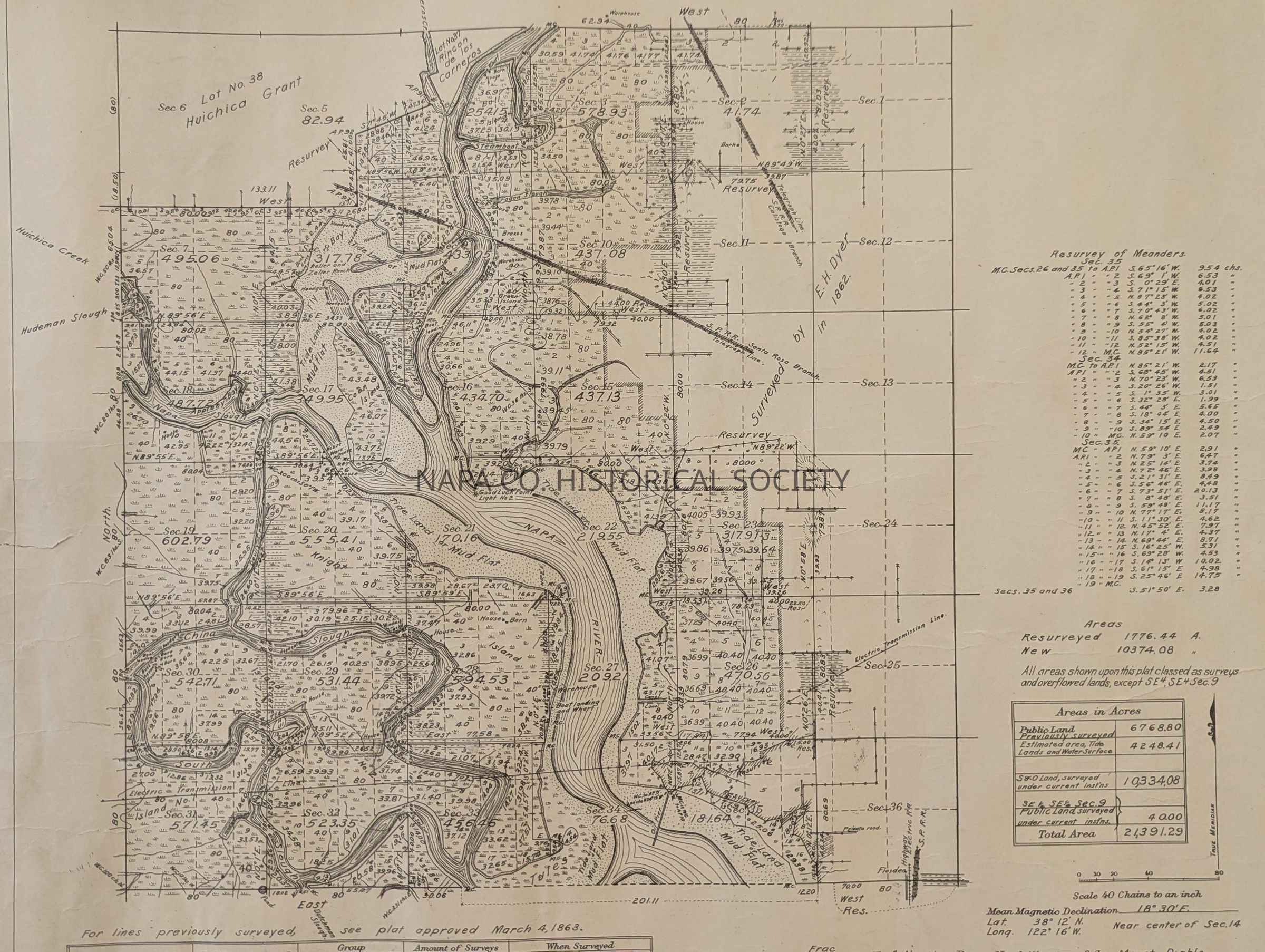
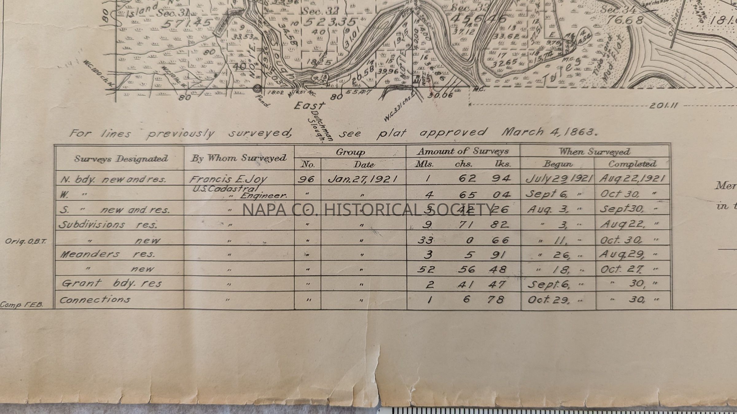
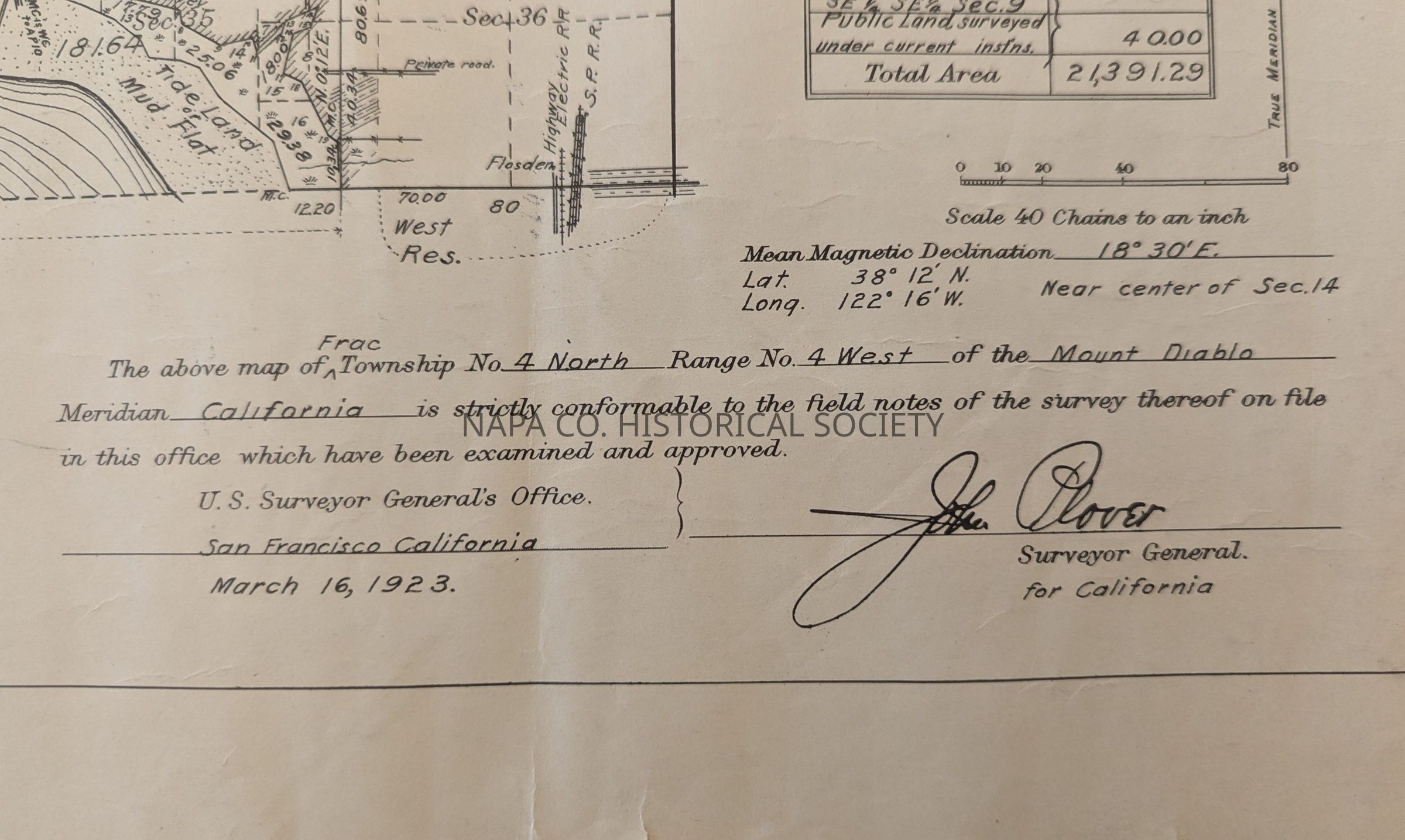
A surveyor map for the area of Township No. 4, range No. 4 West, Mount Diablo Meridian, California, accepted by the Surveyor General's Office on November 8, 1923. A note states that 1776.44 acres were resurveyed and 10,374.08 areas were newly surveyed. Some land-owner and water feature names are noted. Rail lines, barns, warehouses, and landing wharves are also noted.
Collection
Maps
Acquisition
Accession
2024.11
Source or Donor
Cal Poly Humboldt Special Collections
Acquisition Method
Donation
Lexicon
Nomenclature 4.0
Nomenclature Secondary Object Term
Map
Nomenclature Primary Object Term
Cartograph
Nomenclature Sub-Class
Graphic Documents
Nomenclature Class
Documentary Objects
Nomenclature Category
Category 08: Communication Objects
Search Terms
Huichica Grant, Tide lands, Keller and Zeller Ranch, Fly, Coon Island, Knight, China Slough, Appleby Bay Slough, Good Luck Point
Map Details
Place Published
Location
San Francisco, CA
Date Published
Nov 8, 1923
Relationships
Related Person or Organization
Person or Organization
Dyer, E. H.
Notes
Part of this map was originally surveyed by Dyer in 1862.