HUB
Collections
Classifications
About
App
Map
Map
-
Napa County Historical Society
Name/Title
Map
Entry/Object ID
2011.11.2
Description
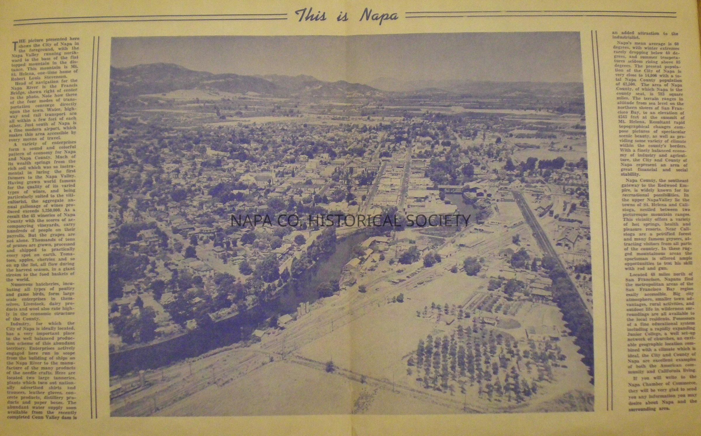
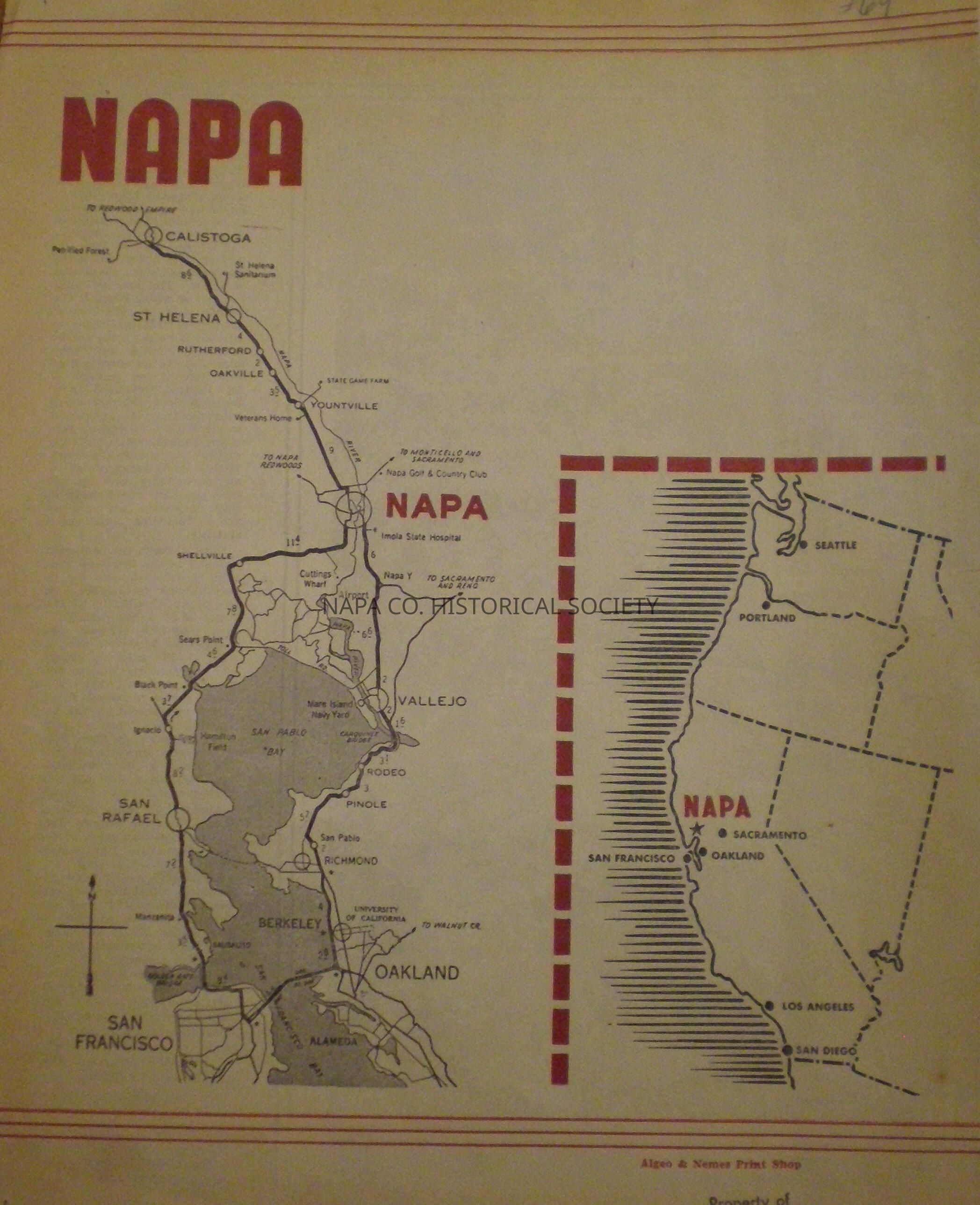
Map of the Napa Valley in relation to the Bay Area on one side, other side shows aerial photograph of downtown Napa circa 1945-1948 Location: Flat Map Box #1, map 2
Collection
Maps
Acquisition
Accession
2011.11
Acquisition Method
Gift
Lexicon
Nomenclature 4.0
Nomenclature Secondary Object Term
Map
Nomenclature Primary Object Term
Cartograph
Nomenclature Sub-Class
Graphic Documents
Nomenclature Class
Documentary Objects
Nomenclature Category
Category 08: Communication Objects
LOC Thesaurus for Graphic Materials
Aerial photographs
Search Terms
Aerial photographs,
Bay Area,
Napa County
Map Details
Area or Region
Location
Napa Valley
Date Published
1945 - 1948
Create Date
January 6, 2011
Update Date
June 23, 2021