HUB
Collections
Classifications
About
App
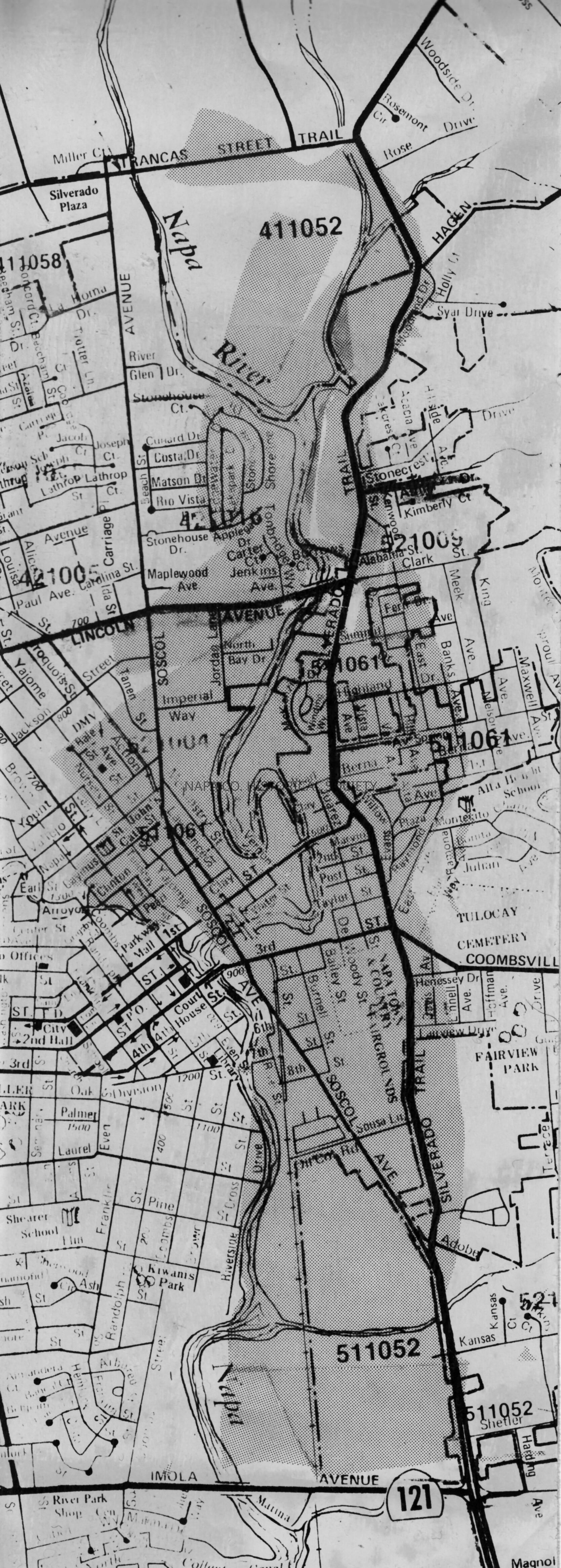
Map of Areas Affected by the 1986 Flood
Photograph
-
Napa County Historical Society
Name/Title
Map of Areas Affected by the 1986 Flood
Entry/Object ID
2011.61.2096
Description
A black and white photo of a map showing most of downtown Napa. The shaded areas of the map are the areas affected by the 1986 flood. Location: PF 117A
Collection
Photographs
Acquisition
Accession
2011.61
Source or Donor
Napa Valley Register
Acquisition Method
Gift
Made/Created
Date made
1986
Lexicon
Nomenclature 4.0
Nomenclature Secondary Object Term
Print, Photographic
Nomenclature Primary Object Term
Photograph
Nomenclature Sub-Class
Graphic Documents
Nomenclature Class
Documentary Objects
Nomenclature Category
Category 08: Communication Objects
LOC Thesaurus for Graphic Materials
Floods,
Maps
Search Terms
Floods,
Flooding,
1980s,
Maps,
Downtown
Dimensions
Height
12 in
Width
4 in
Create Date
June 6, 2014
Update Date
June 23, 2021