The McLaughlin Mine pit of the Homestake Mining Company, looking SE toward Napa-Yolo County line.
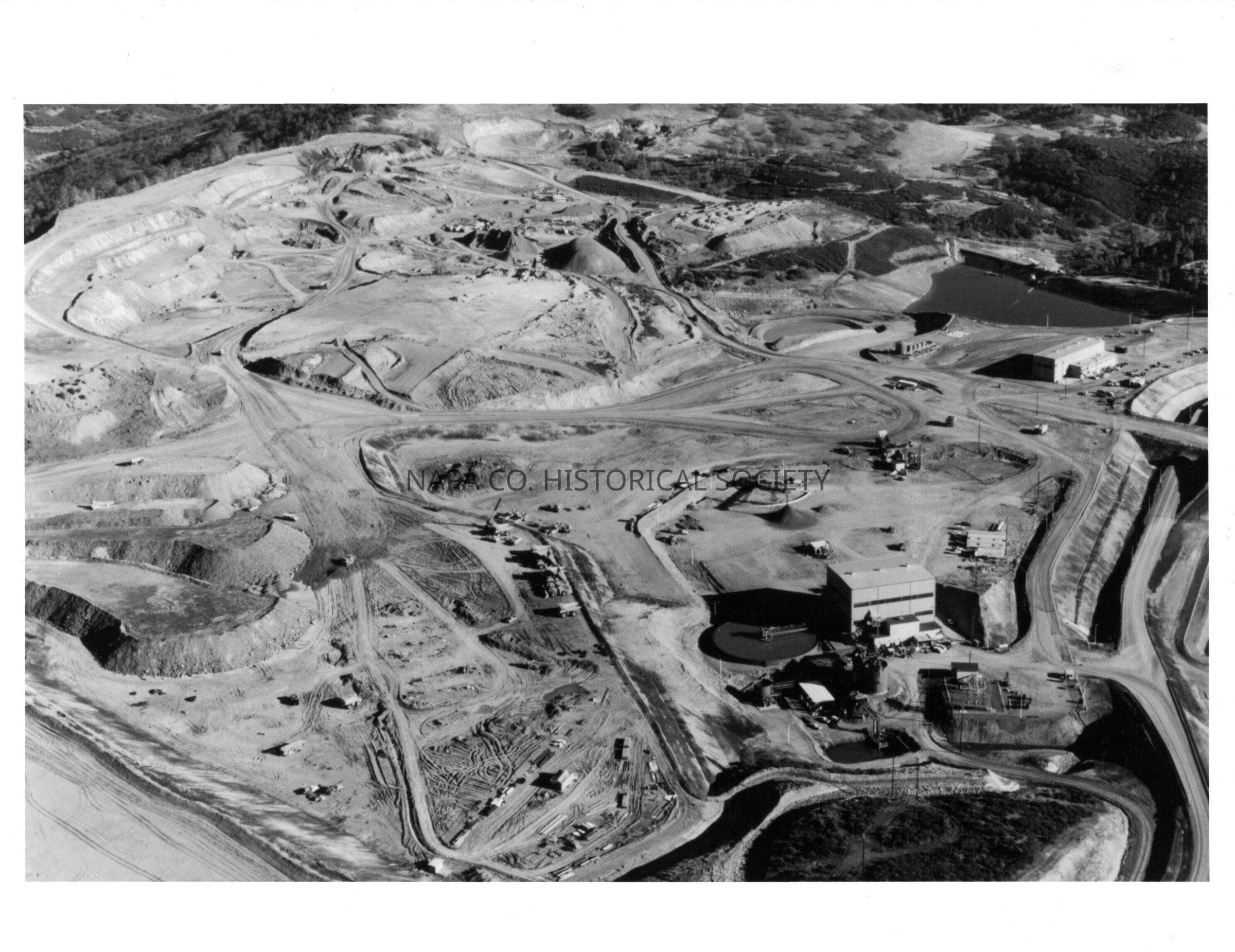
The McLaughlin Mine pit of the Homestake Mining Company.: Origsize: 8" x 10"; Origformat: Print-Photographic
The McLaughlin Mine pit of the Homestake Mining Company.

Origsize: 8" x 10"; Origformat: Print-Photographic

Name/Title

The McLaughlin Mine pit of the Homestake Mining Company, looking SE toward Napa-Yolo County line.

Entry/Object ID

2011.61.1064

Description

Black and white aerial photograph of the McLaughlin Mine pit of the Homestake Mining Company. Accompanying paper identifies the photograph as such: Homestake Mining Company: McLaughlin Mine/ Aerial view of McLaughlin Mine pit. This is a view of the McLaughlin Mine pit area looking southeast toward the Napa-Yolo County line. At left are low-grade ore stockpiles. Buildings at lower right house the crushing and grinding facilities where rock is crushed, water added and ground into a find mud. This mixture of water and rock is thickend in vats and pumped to processing plant 4.7 miles away in Lake County. Top right is the M1 sediment control pond. Location PF 145

Collection

Photographs

Acquisition

Accession

2011.61

Source or Donor

Napa Valley Register

Acquisition Method

Gift

Lexicon

Nomenclature 4.0

Nomenclature Secondary Object Term

Print, Photographic

Nomenclature Primary Object Term

Photograph

Nomenclature Sub-Class

Graphic Documents

Nomenclature Class

Documentary Objects

Nomenclature Category

Category 08: Communication Objects

LOC Thesaurus for Graphic Materials

Aerial views

Search Terms

Homestake Mining Company, McLaughlin Mine, Aerial views

Dimensions

Height

8 in

Width

10 in

Create Date

January 10, 2012

Update Date

March 7, 2026