Name/Title
Canadian Pacific Track Layout Map in SudburyEntry/Object ID
2021.583.01Description
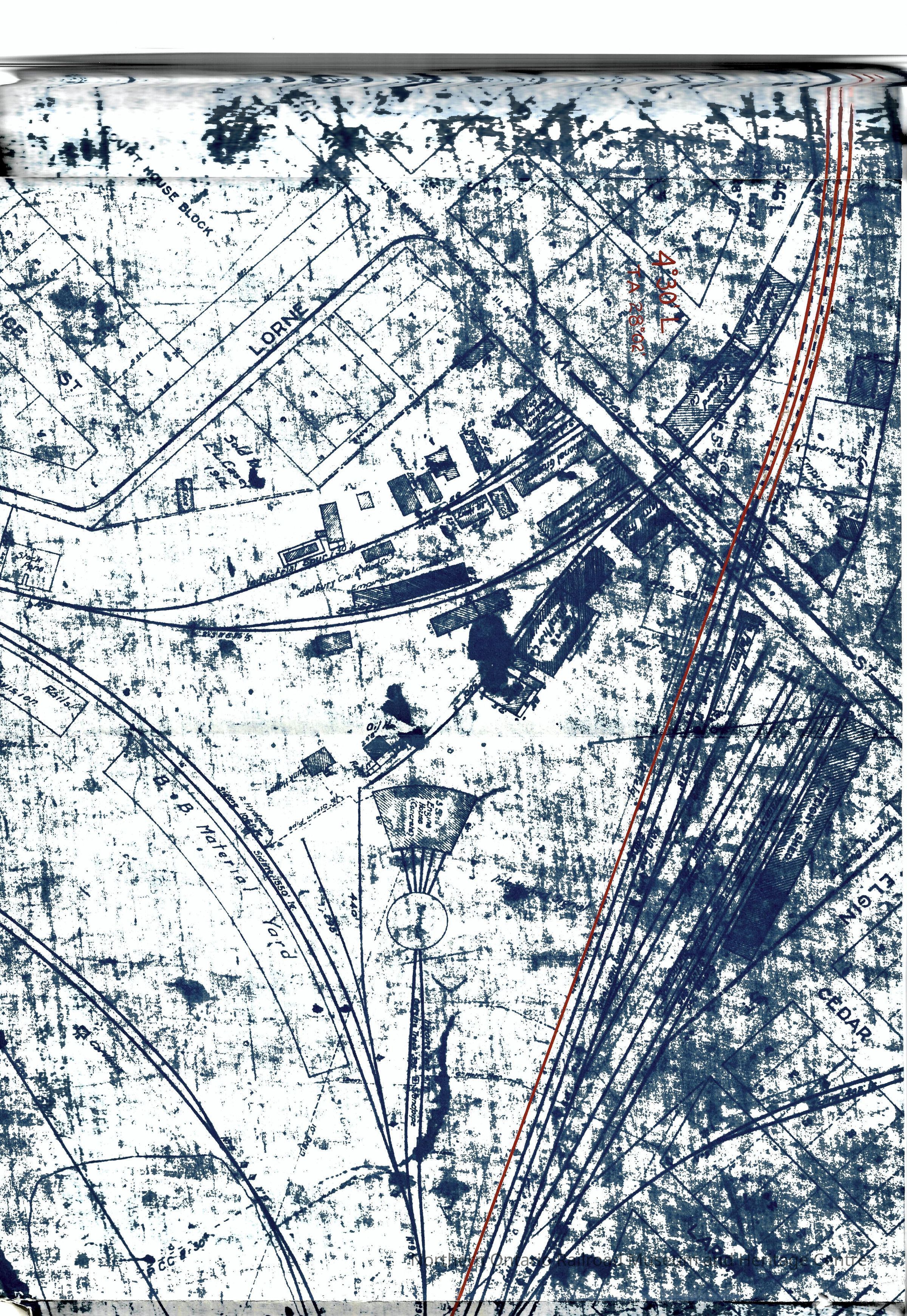
Canadian Pacific published map of the track layout in Sudbury Ontario. The map appears to have been cut in half at some point, removing the year of publication. Visible on the map is the original roundhouse in downtown Sudbury, plus a track plan showing that there was a wye connection between the main line on the right and the Algoma/Sault branch to the left.
Distinguishing Features: noneContext
Historic map of the track layout for Canadian Pacific tracks in Sudbury. The year is unknown although the original roundhouse in downtown Sudbury is visible and was 'out of service' as early as 1907Collection
Library ArchiveAcquisition
Source (if not Accessioned)
Dale WilsonNotes
Date Acquired: June 7, 2021
Method of Acquisition: DonationLexicon
Nomenclature 4.0
Nomenclature Secondary Object Term
MapNomenclature Primary Object Term
CartographNomenclature Sub-Class
Graphic DocumentsNomenclature Class
Documentary ObjectsNomenclature Category
Category 08: Communication ObjectsPublication Details
Author
Canadian PacificPlace Published
City
Greater SudburyCountry
CanadaContinent
North AmericaState/Province
OntarioISBN
n/aNotes
Materials: paper, ink
Date: unknownInscription/Signature/Marks
Other Names and Numbers
Other Numbers
Number Type
Item NumberOther Number
32574Dimensions
Height
12 inWidth
45-1/2 inLocation
Location
Shelf
Capreol History SectionRoom
Dale Wilson Reference LibraryBuilding
NORMHC Heritage Centre, Northern Ontario Railroad Museum and Heritage Centre* Untyped Location
Capreol, OntarioDate
March 10, 2022Condition
Notes
Fair condition, half of the map is cut off and there are signs of damage. Handle with caution.Created By
admin@catalogit.appCreate Date
March 14, 2022Updated By
normhclibrary@gmail.comUpdate Date
June 18, 2022