Name/Title
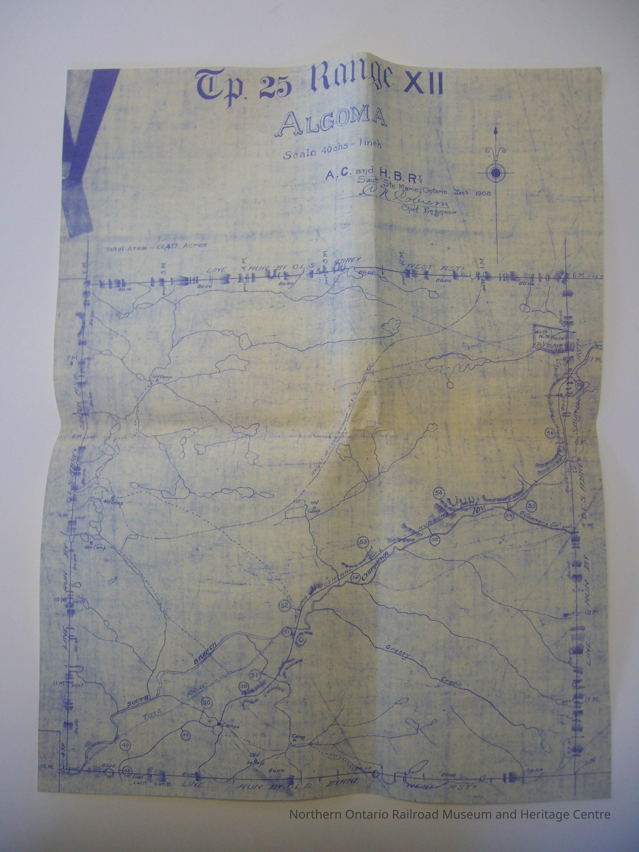
Map - Township 25 Range XII, AlgomaEntry/Object ID
2013.29.9Description
Copy of a map of township 28 range XVI, Algoma, including Grassy Creek, Chippewa River. Map by Algoma Central and Hudson Bay Railway Company.
Printed in blue ink.Collection
Library ArchiveLexicon
Legacy Lexicon
Category
Oversized DocumentsMap Details
Maker or Creator
Algoma Central RailwayPlace Published
City
Sault Ste. Maire, OntarioState/Province
OntarioCountry
CanadaContinent
North AmericaDate Published
Jan 1908Map Notes
Materials: PaperOther Names and Numbers
Other Numbers
Number Type
Item NumberOther Number
3951Dimensions
Height
45-3/8 inWidth
35.3 cmLocation
Location
Wall
Canadian National SectionRoom
Dale Wilson Reference LibraryBuilding
NORMHC Heritage Centre, Northern Ontario Railroad Museum and Heritage Centre* Untyped Location
Capreol, OntarioDate
March 10, 2022Condition
Notes
Digital Copy Only (Matthew Gill 2015)Created By
admin@catalogit.appCreate Date
March 14, 2022Updated By
normhclibrary@gmail.comUpdate Date
April 21, 2022