Name/Title
Map of the Town of Valley EastEntry/Object ID
2022.404.01Tags
District of Sudbury, Valley East, Ontario, Capreol, Ontario, Hanmer, Ontario, Val Caron, Ontario, Mcrea Heights, Blezard Valley, Val ThereseScope and Content
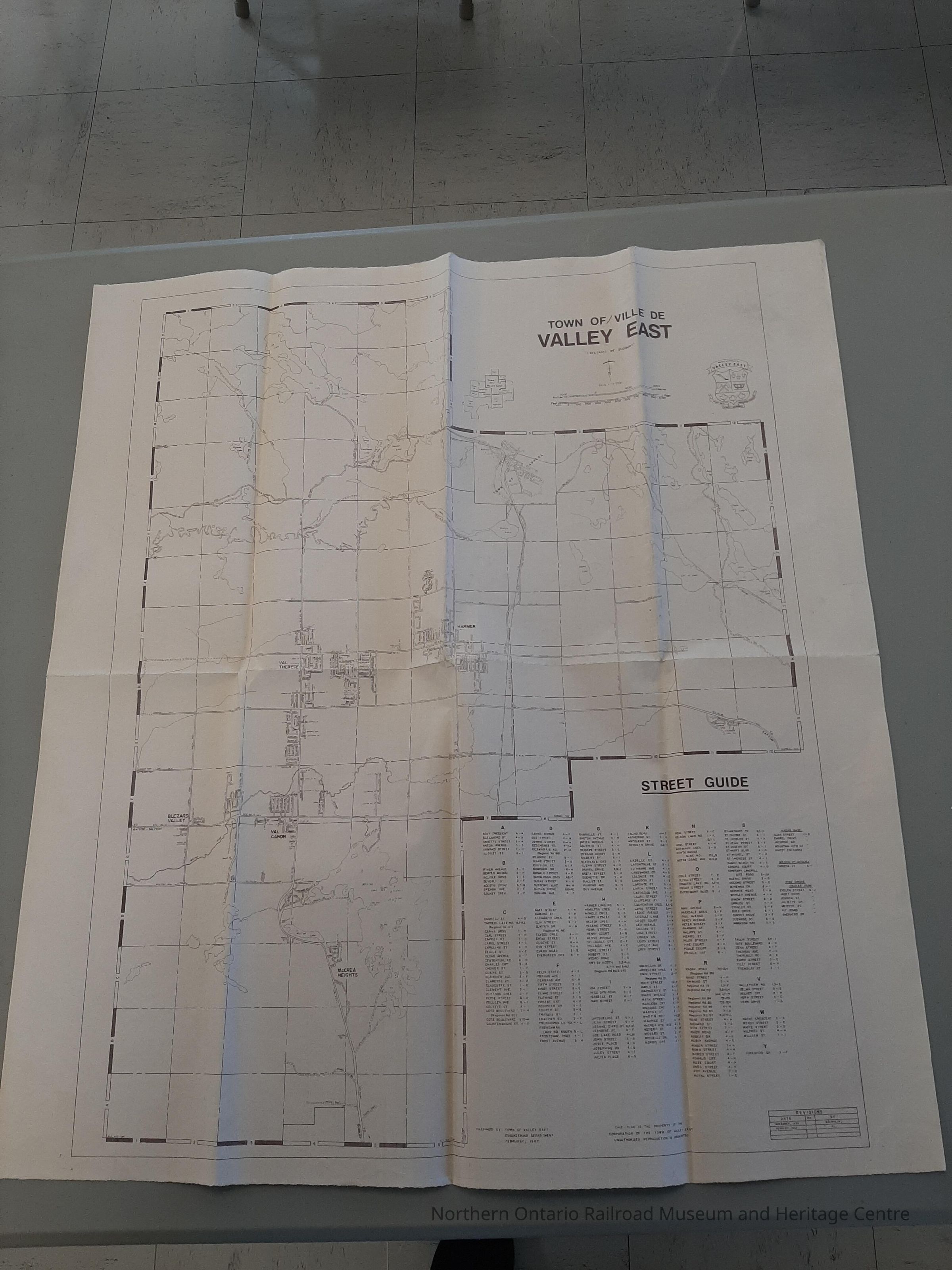
Map showing the town of Valley East, Ontario drawn in February of 1987Context
The map shows:
- Town of Capreol
- Town of Valley East
- Hanmer
- Val Therese
- Val Caron
- Blezard Valley
- Mcrea Heights
It also includes a street guide, presented in alphabetical order as well as all lakes and riversCollection
Sudbury History, District of Sudbury Collection, Capreol HistoryCataloged By
Kat BezaireLexicon
Nomenclature 4.0
Nomenclature Secondary Object Term
MapNomenclature Primary Object Term
CartographNomenclature Sub-Class
Graphic DocumentsNomenclature Class
Documentary ObjectsNomenclature Category
Category 08: Communication ObjectsArchive Details
Creator
Town of Valley EastDate(s) of Creation
1973Primary Language
EnglishArchive Items Details
Title
Map of the Town of Valley EastDescription
Map showing the town of Valley East, Ontario drawn in February of 1987Creator
Town of Valley EastDate(s) of Creation
1987Subjects
Maps, Municipal governmentEthnography
Cultural Region
Town
Valley East, OntarioCity
Greater SudburyCountry
CanadaContinent
North AmericaState/Province
OntarioOther Names and Numbers
Other Numbers
Number Type
Photo NumberOther Number
P0073Dimensions
Width
24 inLength
26-1/2 inLocation
Location
Shelf
Sudbury History SectionRoom
Dale Wilson Reference LibraryBuilding
NORMHC Heritage Centre, Northern Ontario Railroad Museum and Heritage Centre* Untyped Location
Capreol, OntarioDate
March 21, 2022Notes
In the Valley East SectionProvenance
Provenance Detail
Ken ReisOwner/Agent
Ken ReisRole
Owner/DonorPlace
City
Greater SudburyCountry
CanadaContinent
North AmericaState/Province
OntarioAcquisition Method
GiftNotes
Donated on January 15, 2022Created By
normhclibrary@gmail.comCreate Date
March 21, 2022Updated By
normhclibrary@gmail.comUpdate Date
March 21, 2022