Name/Title
Canadian National Blueprint Showing Mile 111.06, The Old Nipissing JunctionEntry/Object ID
2022.816.01Tags
Canadian National, District of Nipissing, Nipissing, OntarioScope and Content
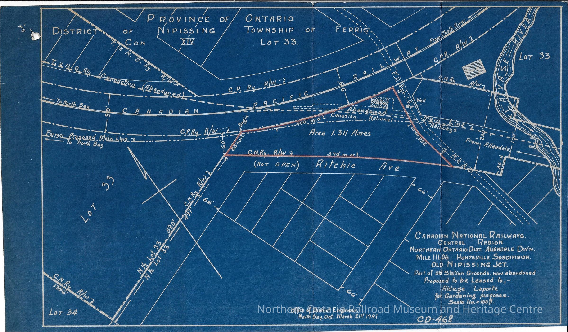
Canadian National branded blueprint showing mile 111.06 of the Central Region's Northern Ontario District, Allandale Division, Huntsville Subdivision.Context
It shows the Old Nipissing Junction, as well as part of the old station grounds which were abandoned at the time the print was drawn. The area was proposed to be leased to Aldege Laporte for gardening purposes.
Canadian National was created following the end of the First World War, by combining five lines which were financially troubled. It soon became the largest railway in the country.
Canadian National Railways was founded in 1919 as a combination of several railways that had become bankrupt and were being ran by the Canadian Government Railways, its primary service was freight but also operated passenger service until 1978 until it was absorbed by VIA rail. The Canadian National Railways was created by the Government of Canada as a means to fund the failing railway corporations including: Intercolonial Railway of Canada, National Transcontinental Railway, Prince Edward Island Railway, and Hudson's Bay Railway.Collection
Canadian National, District of Nipissing CollectionCataloged By
Kat BezaireAcquisition
Source (if not Accessioned)
Dale WilsonLexicon
Nomenclature 4.0
Nomenclature Secondary Object Term
BlueprintNomenclature Primary Object Term
Copy, ReprographicNomenclature Sub-Class
Other DocumentsNomenclature Class
Documentary ObjectsNomenclature Category
Category 08: Communication ObjectsArchive Details
Creator
Canadian NationalDate(s) of Creation
1919Primary Language
EnglishArchive Items Details
Title
Canadian National Blueprint Showing Mile 111.06, The Old Nipissing JunctionDescription
Canadian National branded blueprint showing mile 111.06 of the Central Region's Northern Ontario District, Allandale Division, Huntsville Subdivision.Creator
Canadian NationalDate(s) of Creation
Mar 21, 1941Subjects
Blueprints, Railways, Stations, RailroadEthnography
Cultural Region
City
North Bay, OntarioState/Province
OntarioCountry
CanadaContinent
North AmericaOther Names and Numbers
Other Numbers
Number Type
Photo NumberOther Number
P0338Location
Location
Box
Canadian National Box #1Room
Dale Wilson Reference LibraryBuilding
NORMHC Heritage Centre, Northern Ontario Railroad Museum and Heritage Centre* Untyped Location
Capreol, OntarioDate
April 11, 2022Condition
Reason for Exam
At AcquisitionOverall Condition
Very GoodCondition Detail
Creasing, Missing Areas / HolesDate Examined
Apr 11, 2022Examined By
Kat BezaireMaterials
paper, inkStructure
The item has large crease/fold lines and also a hole in the upper left hand cornerProvenance
Provenance Detail
Canadian NationalOwner/Agent
Canadian NationalRole
Owner/PublisherPlace
City
Montreal, QuebecState/Province
QuebecCountry
CanadaContinent
North AmericaAcquisition Method
GiftCreated By
normhclibrary@gmail.comCreate Date
April 11, 2022Updated By
normhclibrary@gmail.comUpdate Date
April 11, 2022