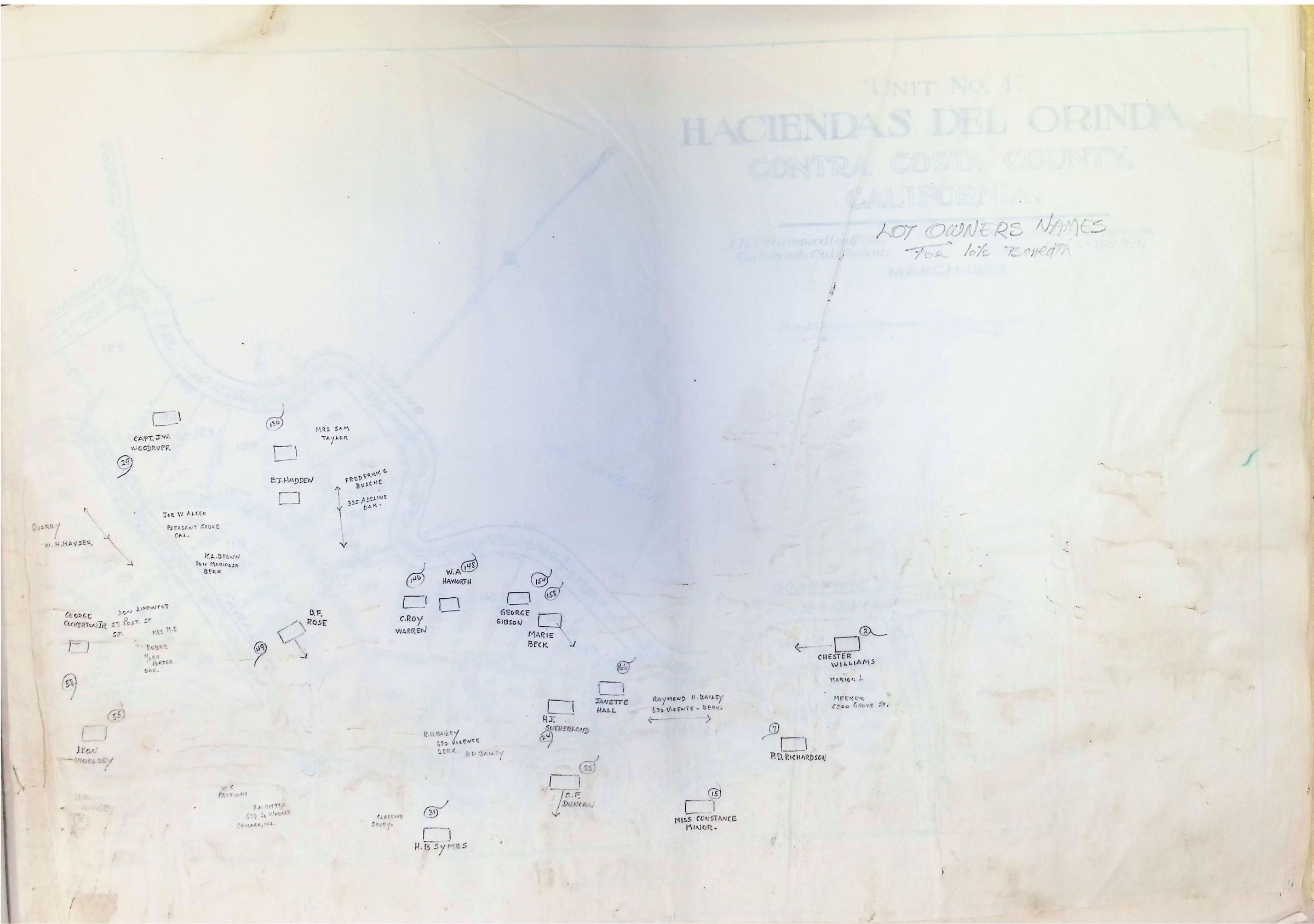
Haciendas Del Orinda, Unit No. 1 - 1924 (Page 2 of 3)
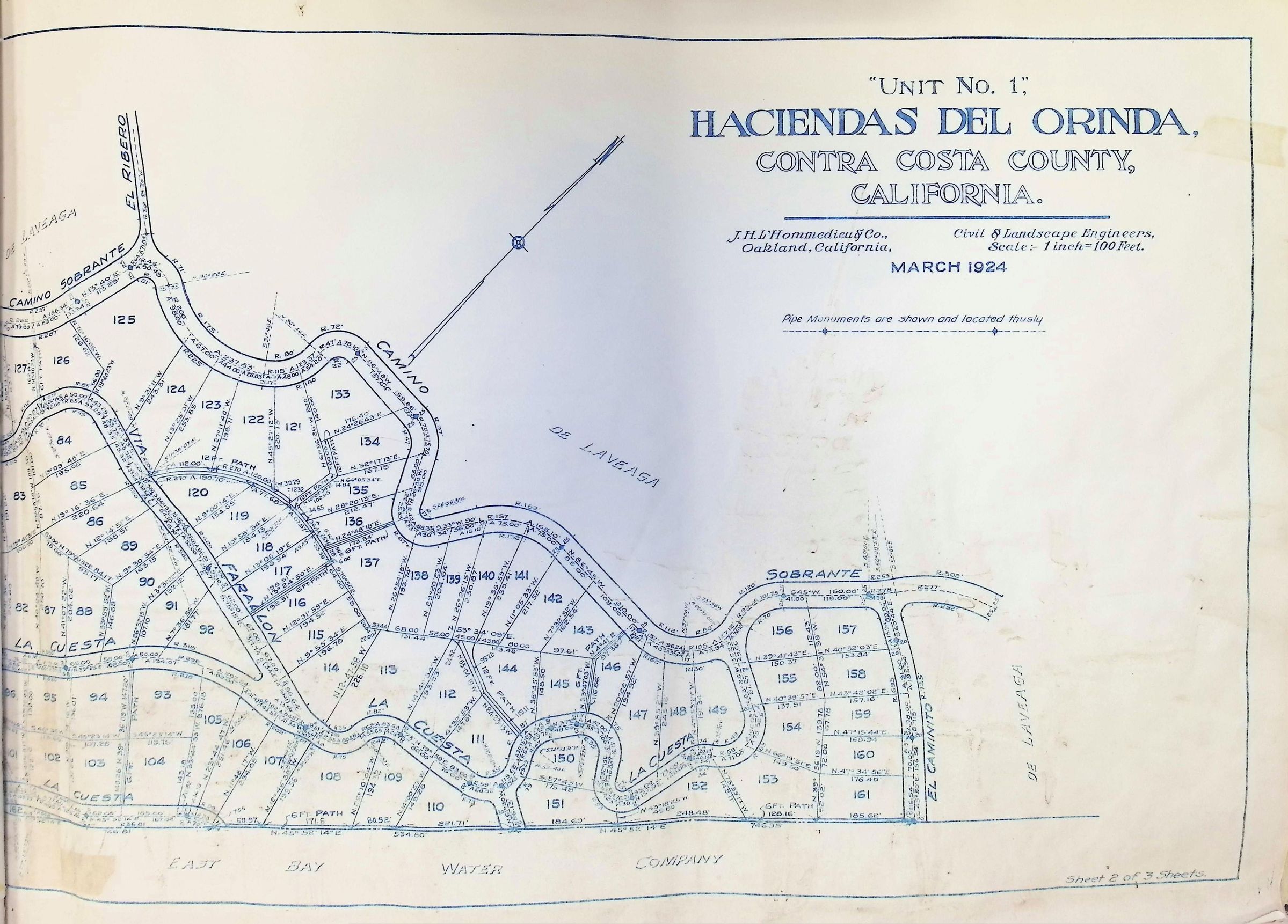
The image is a detailed map titled "Unit No. 1, Haciendas Del Orinda, Contra Costa County, California," prepared by J.H. Lhommedieu & Co., Civil and Landscape Engineers, in March 1924, with a scale of 1 inch to 100 feet. It depicts a planned residential layout featuring curved roads such as Camino Sobrante, El Mirador, La Cuesta, and Farallon, which intersect various parcels numbered systematically from 84 to 161. These parcels are delineated with precise measurements, showing dimensions in feet along the edges. To the north, the map highlights areas labeled "De Laveaga" and shows a point of reference by depicting a pipe monument for navigation. The southern boundary is marked by the East Bay Water Company, aligning with a curved waterway. The map is sheet 2 of 3, providing a thorough insight into early 20th-century land planning practices.