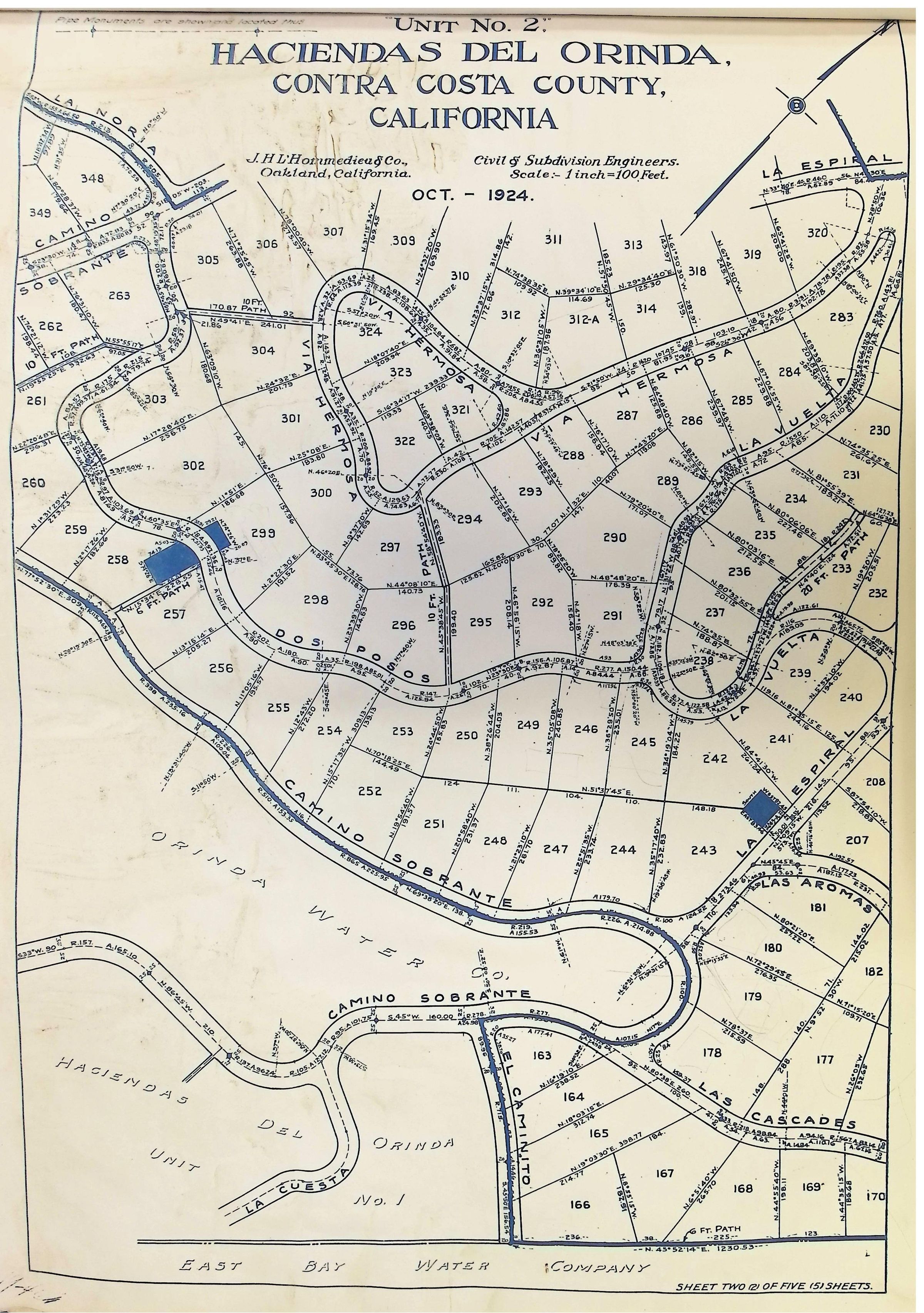
Name/Title
Haciendas Del Orinda, October 1924, Unit 2 (Page 2 of 5)Description
This image is a vintage map from October 1924, titled "Haciendas del Orinda, Contra Costa County, California," showing a detailed subdivision layout labeled as Unit No. 2. The map, prepared by J.H. Hernandez & Co., Civil and Subdivision Engineers from Oakland, California, is scaled at 1 inch to 100 feet, featuring a network of winding streets such as "Camino Sobrante," "Dos Posos," "La Espiral," "Las Aromas," and "Camino de Las Cascadas," with numerous numbered lots plotted throughout the region. Boundaries and paths, including water company properties, are meticulously drawn. The map is labeled as "Sheet Two of Five Sheets," indicating it is part of a larger collection and appears marked with geographic and property details necessary for historical or municipal reference.