Fairway Acres Orinda Country Club - June 1928
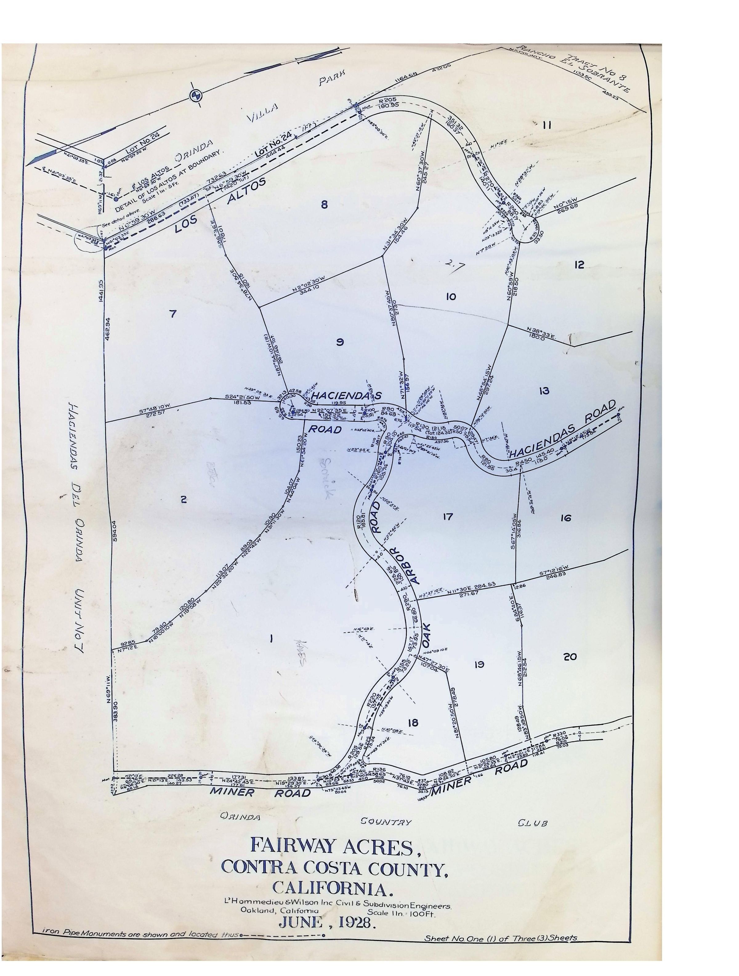
The image displays a detailed map titled "Fairway Acres, Contra Costa County, California," surveyed and drawn by L'Hommedieu & Wilson Inc. Civil & Subdivision Engineers from Oakland, California, in June 1928, showing a layout of parcels labeled with numbers and corresponding roads like Haciendas Road and Miner Road, with surrounding features such as Los Altos, Villa Park, and indications of surrounding areas connected by detailed boundary lines.