Name/Title
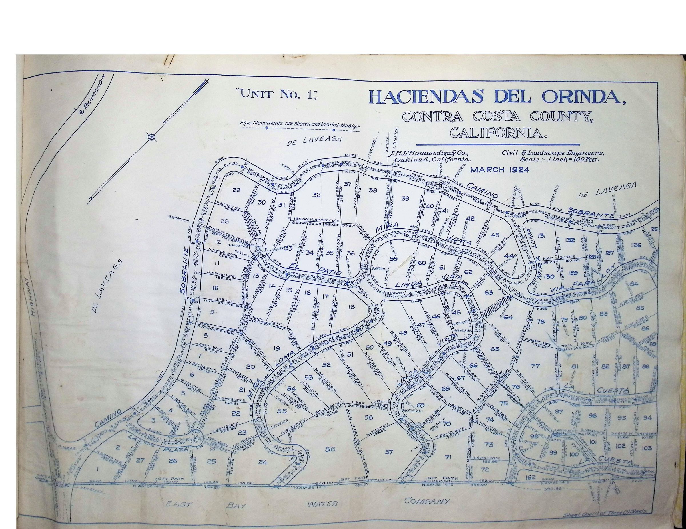
Haciendas Del Orinda, Unit No. 1 - 1924 (Page 1 of 3)Description
This is a detailed map titled "Haciendas Del Orinda, Contra Costa County, California" created by J. H. L'Hommedieu & Co., Civil & Landscape Engineers, Oakland, California. The map, dated March 1924, outlines Unit No. 1 and features a detailed subdivision with numbered lots and streets. Pipe monuments are marked to indicate specific locations, and the scale is set at 1 inch to 100 feet. Streets such as Mira Loma, El Patio, Linda Vista, Via Farallon, La Cuesta, La Plaza and Camino Sobrante are visible. The map provides information on lot dimensions, streets, and is bordered by areas labeled as highway paths and water company land.
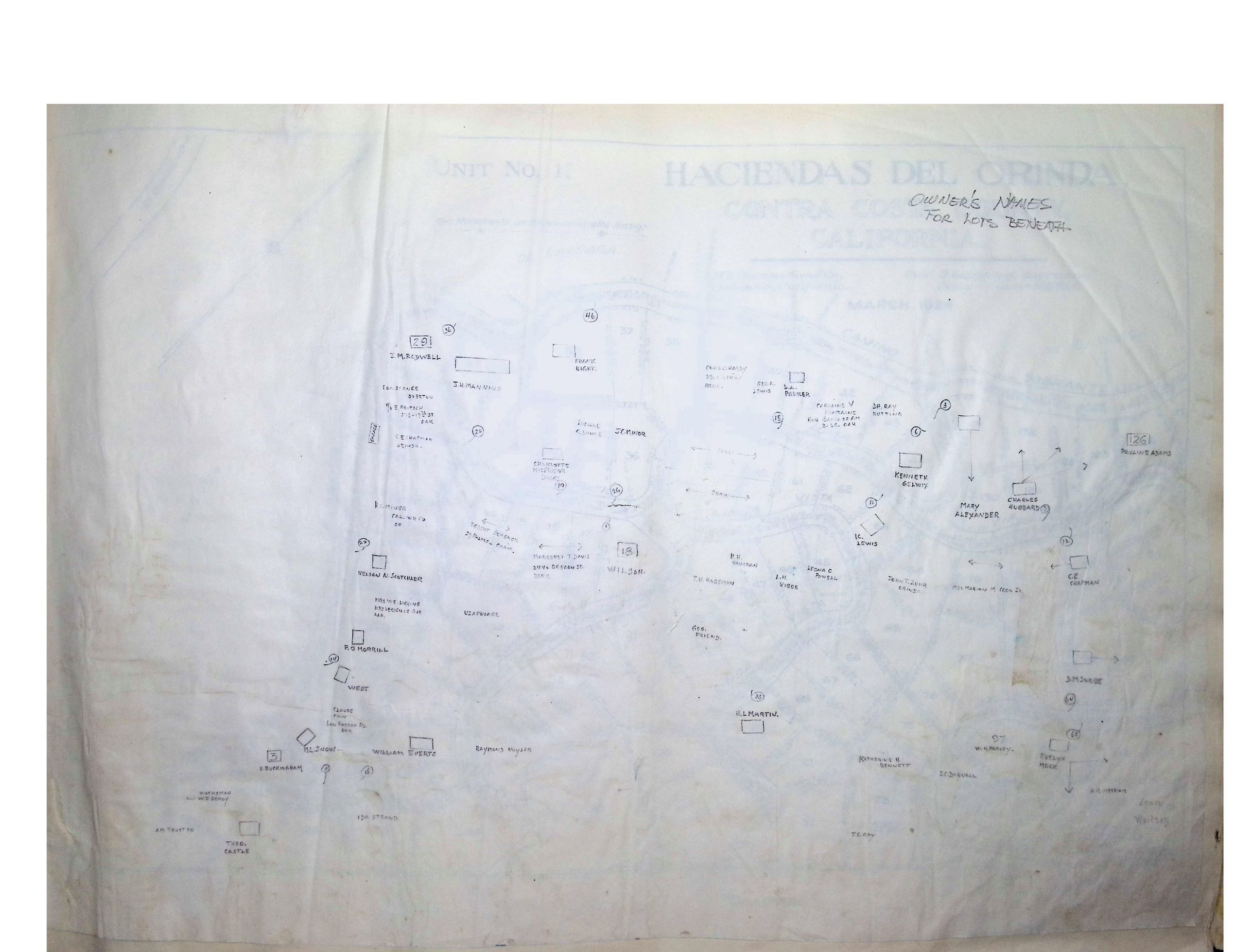
Also bound with this map is an overlay showing "Owner's Names for Lots Beneath" including: J. M. Rodwell, J. H. Manning, Frank Hight, Chas. C. Hardy, Geo. A. Lewis, D. A. Parker, Caroline V. Fontaine, Dr. Ray Nutting; Kenneth Gelwix, Mary Alexander, Charles Hubbard, Pauline Adams, C. E. Chapman, Marian M. Cook Jr. , I. C. Lewis, John T. Zuur, Shaw, Leona C. Powell, L.H. Kibbe, H. H. Vaughan, T. H. Hageman, Wilson, J. C. Minor, Lucille G. Dunne, Charlotte MacGregor Boggs, Margaret T. Davis, Egbert Schenck, Constance Overton, C. E. Chapman, H. L. Miner, Nelson N. Scotchler, Mrs. W. E. Licking, Uza Fovage (Uzafovage), F. O. Morrill, George Friend, West, Claude Faw, M. L. Snow, William Everts, Raymond Nayler, H. L. Martin, E. Buckingham, Katherine H. Bennett, E. C. Darwall, W. H. Farley, Evelyn Mock, D. M. Swobe, H. R. Merriam, H. C. Ady, Ida Strand, Theo. Castle, A. M. Trust Co. Wachsman and W. J. Serdy, Leotl Woolsey