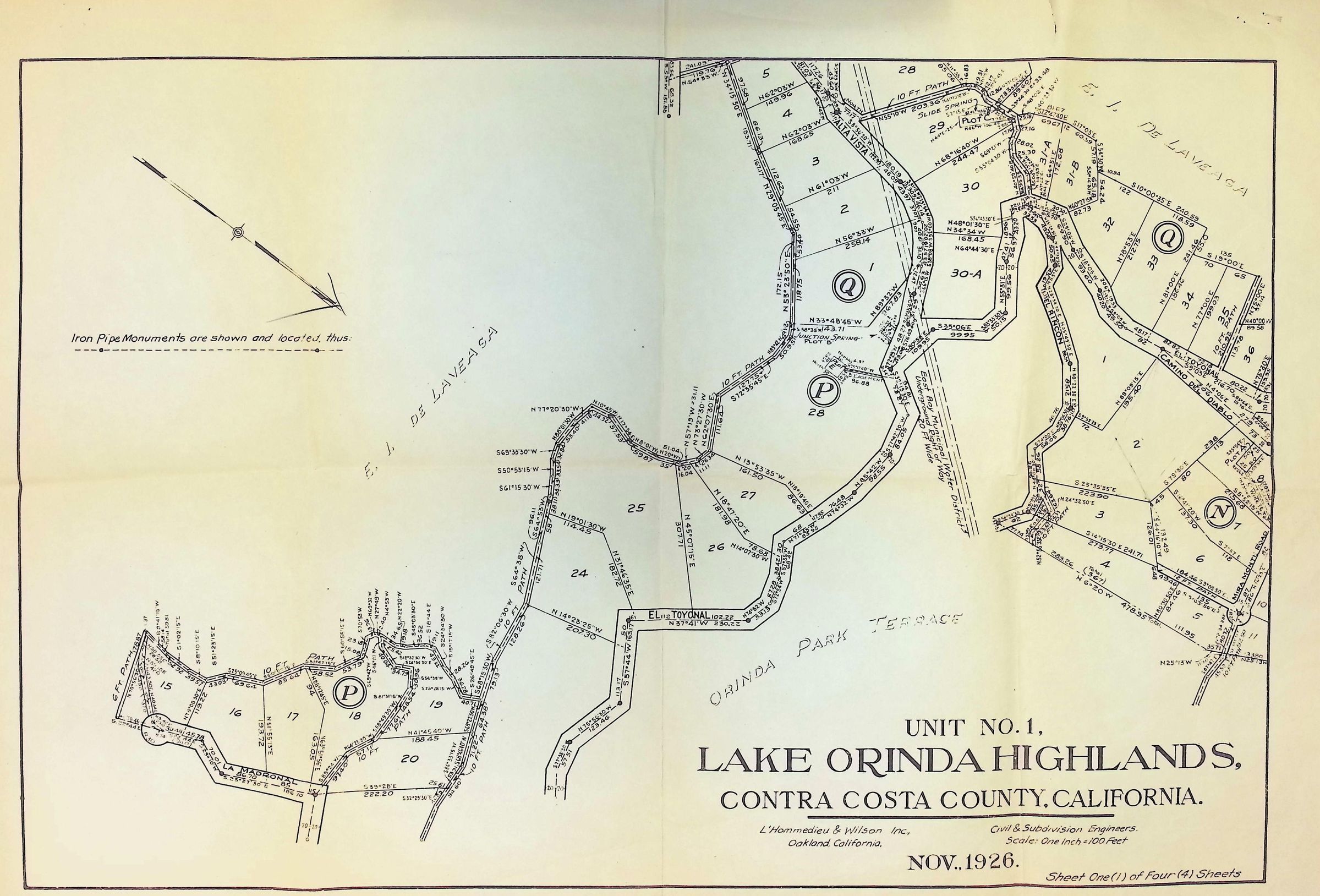
Name/Title
Lake Orinda Highlands 1 of 4Description
The image is a detailed map from November 1926, titled "Unit No. 1, Lake Orinda Highlands, Contra Costa County, California," created by L'Hommedieu & Wilson Inc., civil and subdivision engineers. The map illustrates the layout of various plots of land, marked numerically, with boundaries defined by lines and numerous angles indicating precise measurements. The map also includes numerous streets including El Toyonal, Alta Vista, Camino Del Diablo, and El Ricon, located with precise illustrations. In the top left corner, there is an indication that iron pipe monuments are shown and located on the map.