Name/Title
Oak Springs Unit No. 2 (1 of 3)Description
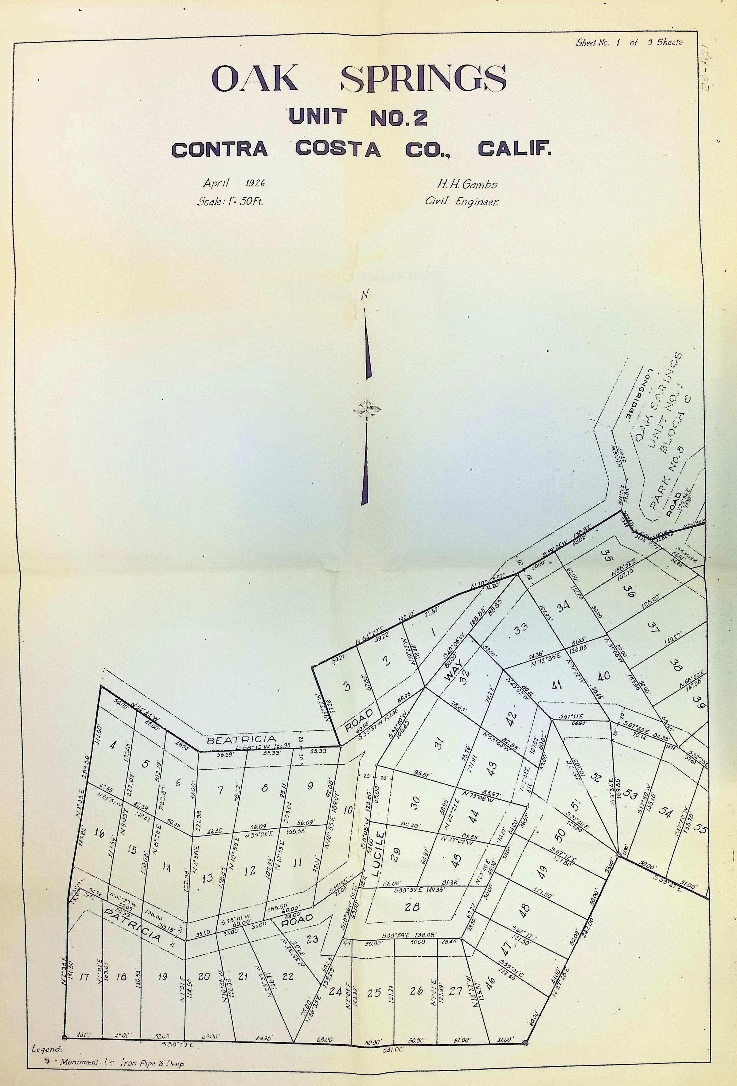
The image is a detailed map labeled "Oak Springs, Unit No. 2" in Contra Costa County, California, dates April 1926, and prepared by H.H Gambs, a civil engineer. The map shows plots of land with boundary lines, numbers, and measurements, along with several roads intersecting the area, including roads labeled as Beatricia, Patricia, and Lucile. The map also provides a label for the Monument Iron Pipes noted throughout the map.