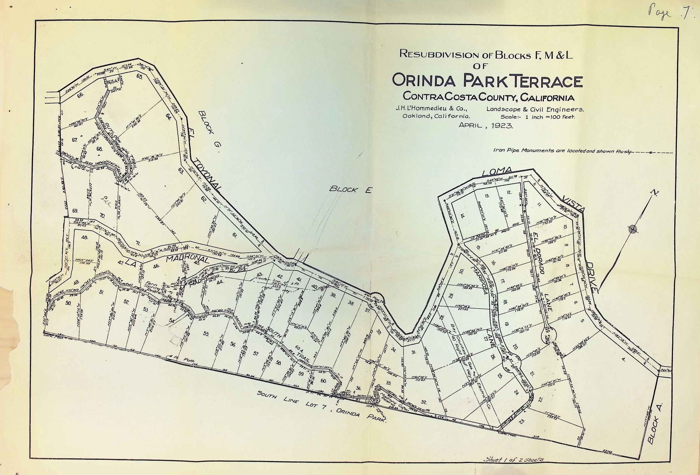
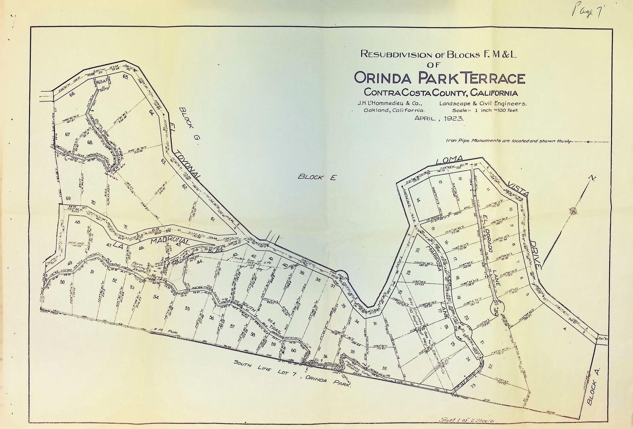
Name/Title
Orinda Park Terrace - Resubdivision of Blocks F, M, & LDescription
The image is a detailed survey map from April 1923, illustrating the resubdivision of Blocks F, M, and L of Orinda Park Terrace in Contra Costa County, California, created by J.H. L’Hommedieu & Co., civil and landscape engineers from Oakland; it delineates various plots with their respective lot numbers and boundaries, road names such as El Toyonal, Loma Vista, Mariposa, and La Madrinal.