Name/Title
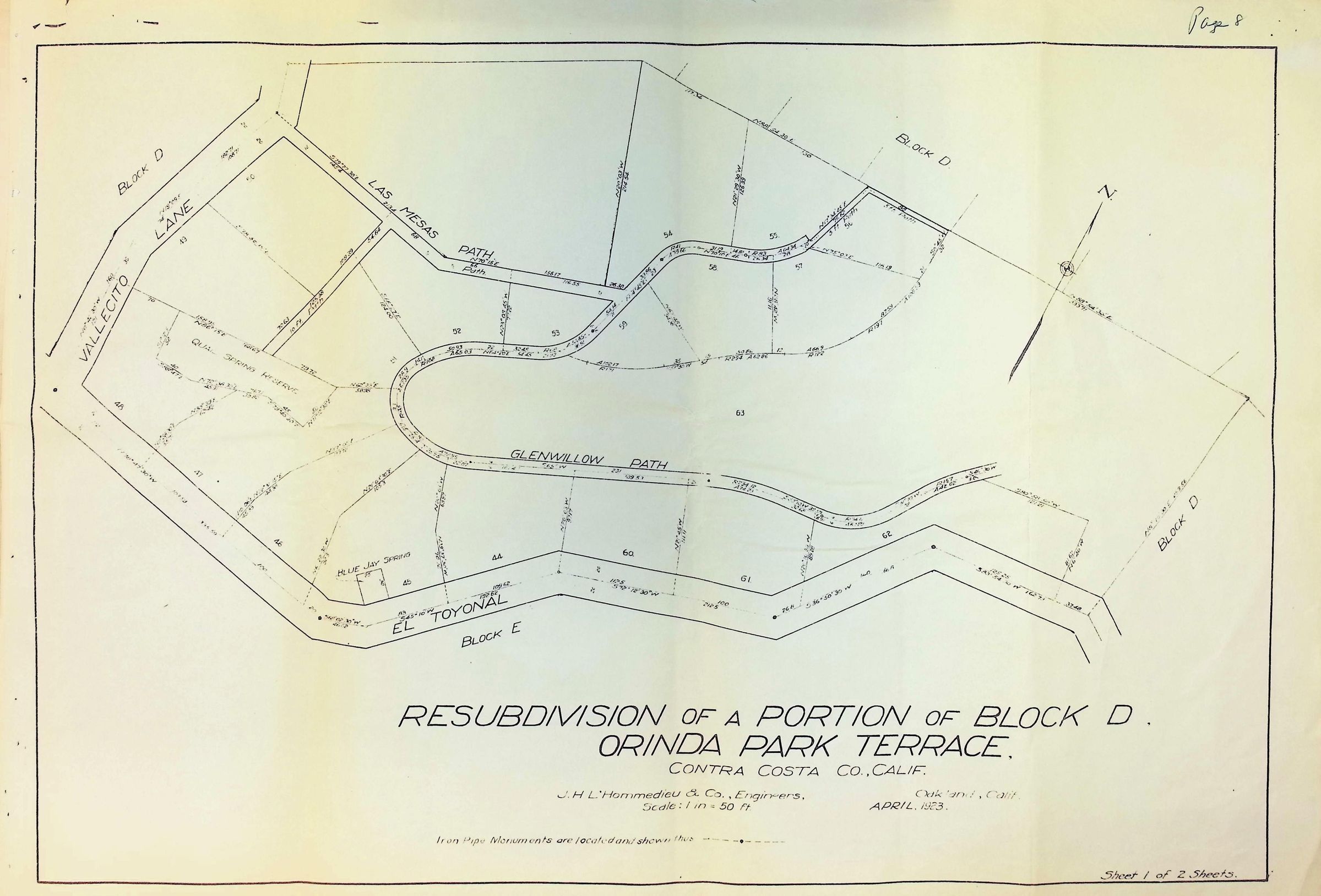
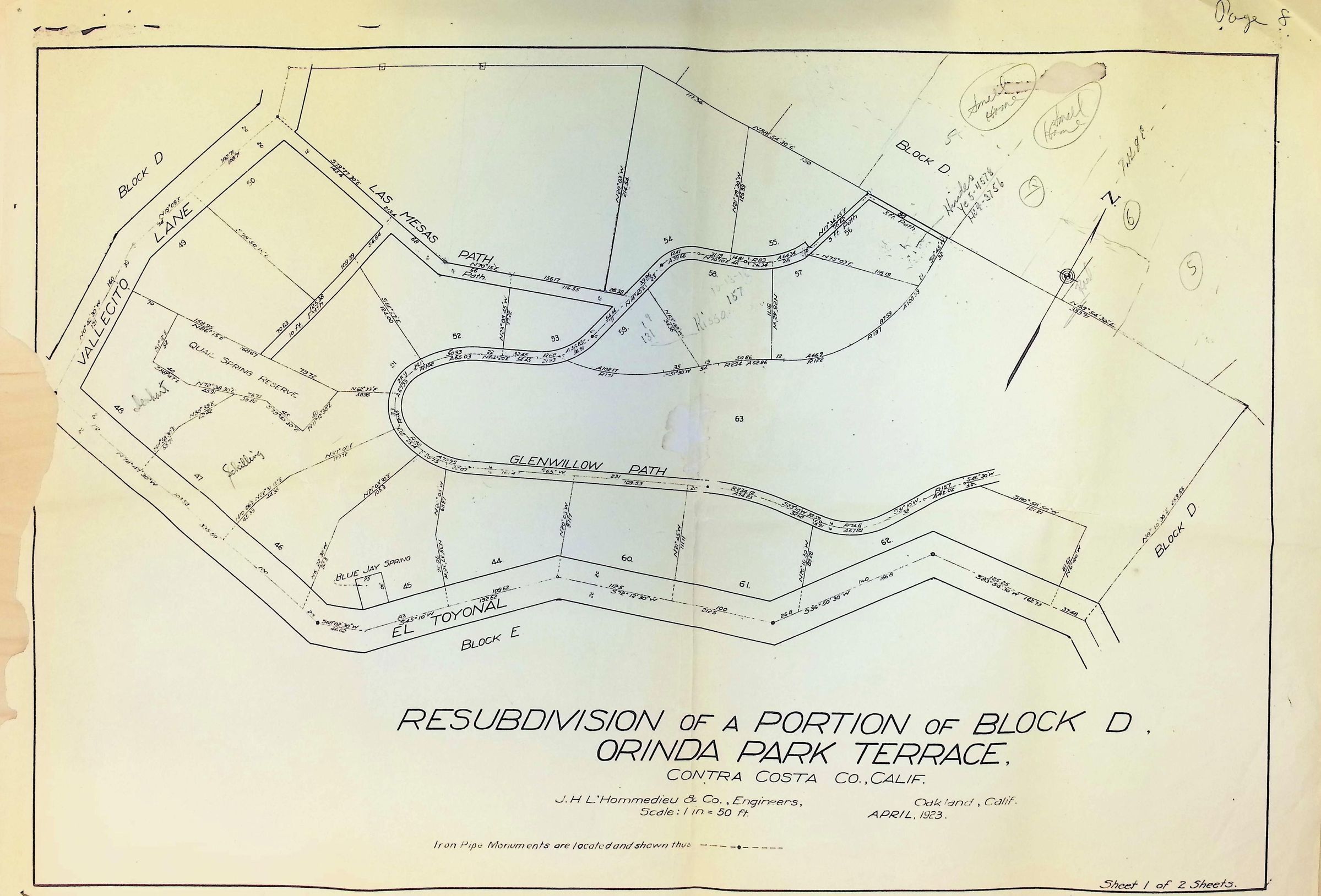
Orinda Park Terrace - Resubdivision of Block DDescription
The image is a detailed plan of the resubdivision of a portion of Block D in Orinda Park Terrace, Contra Costa County, California, created by J.H. L’Hommedieu & Co. Engineers in April 1923, featuring plots labeled with numbers, and roads named El Toyonal, Vallecito Lane, Glenwillow Path, and Las Mesas Path, with a scale of 1 inch to 50 feet.