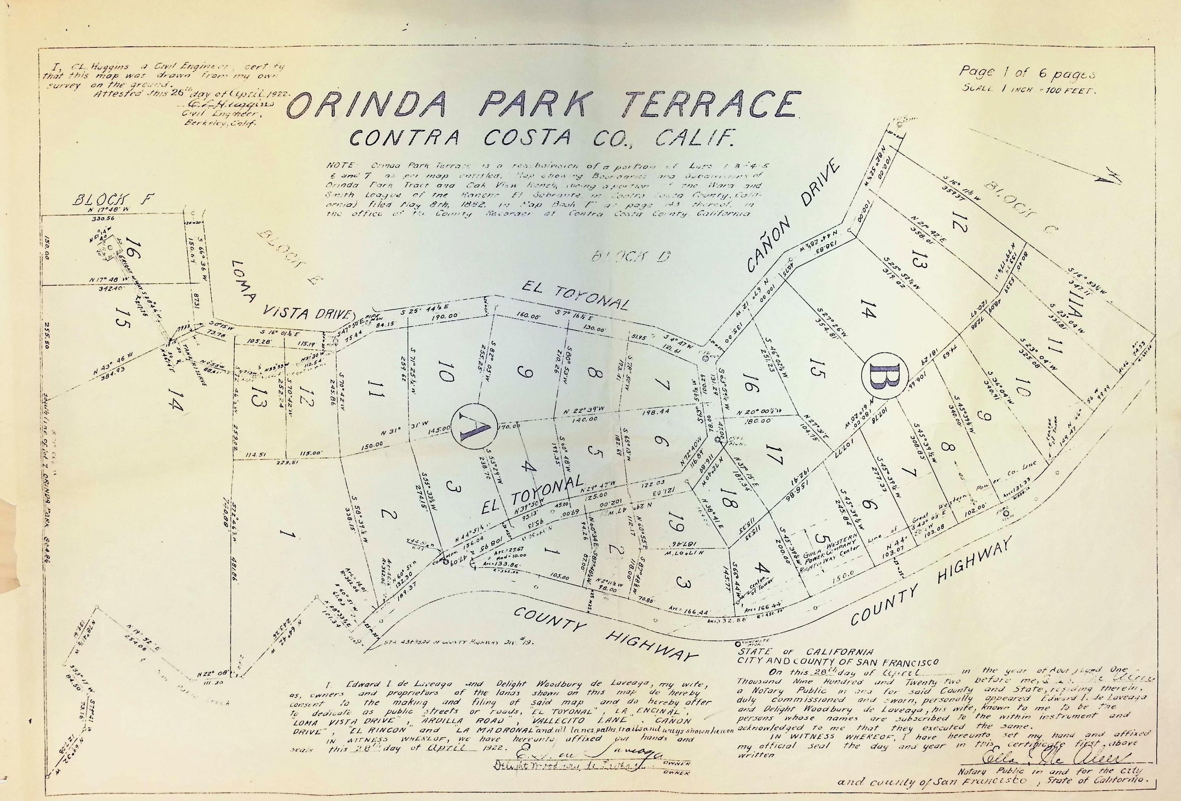
Orinda Park Terrace 1 of 6
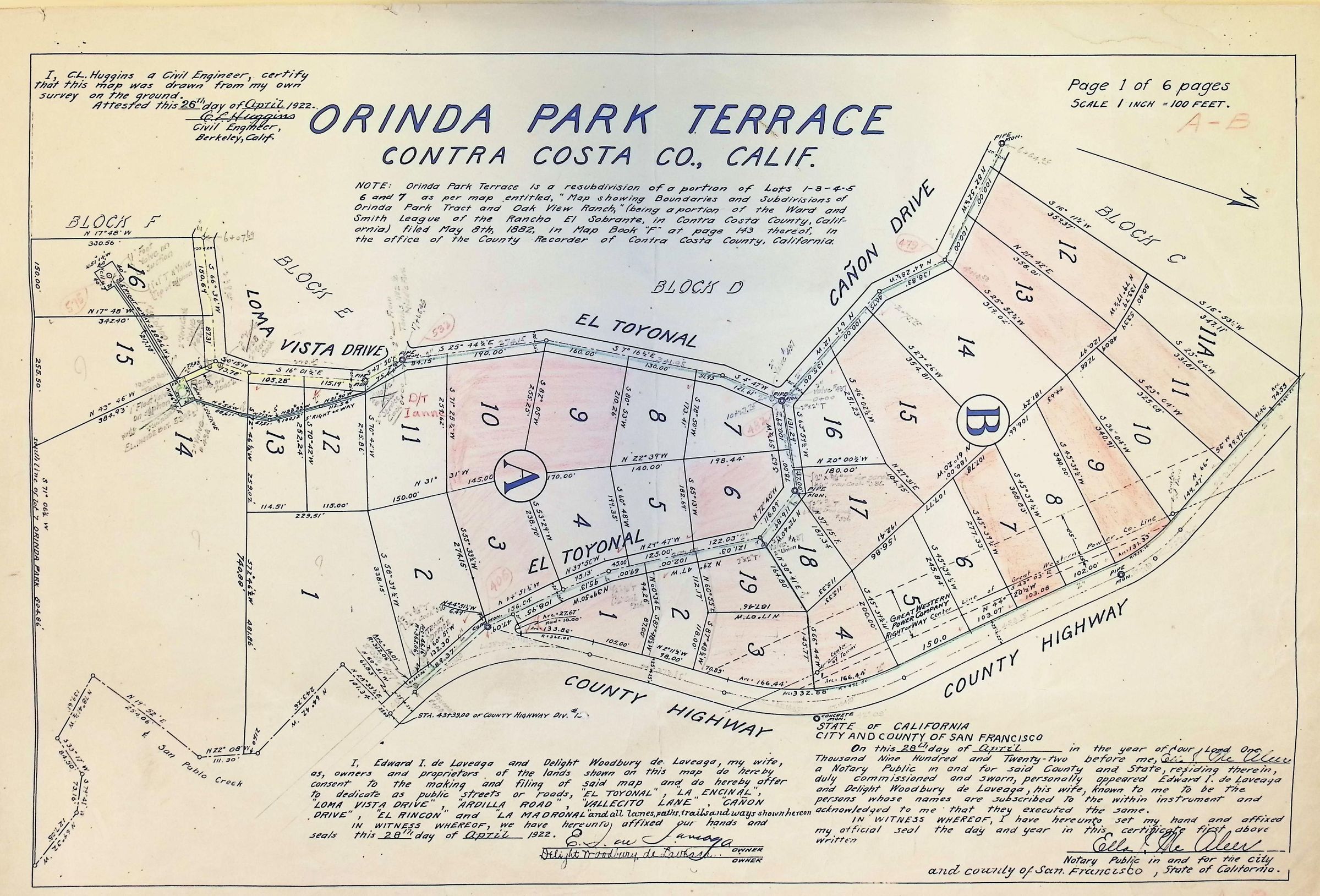
The image is a detailed blueprint map titled "Orinda Park Terrace" located in Contra Costa County, California, showing a subdivision layout with individual numbered lots and blocks labeled A to B, bordered by roads such as Loma Vista Drive, El Toyonal, Cañon Drive, and County Highway; the map includes measurements and notations for each plot, a certification by a civil engineer named C.L. Huggins dated April 1922.