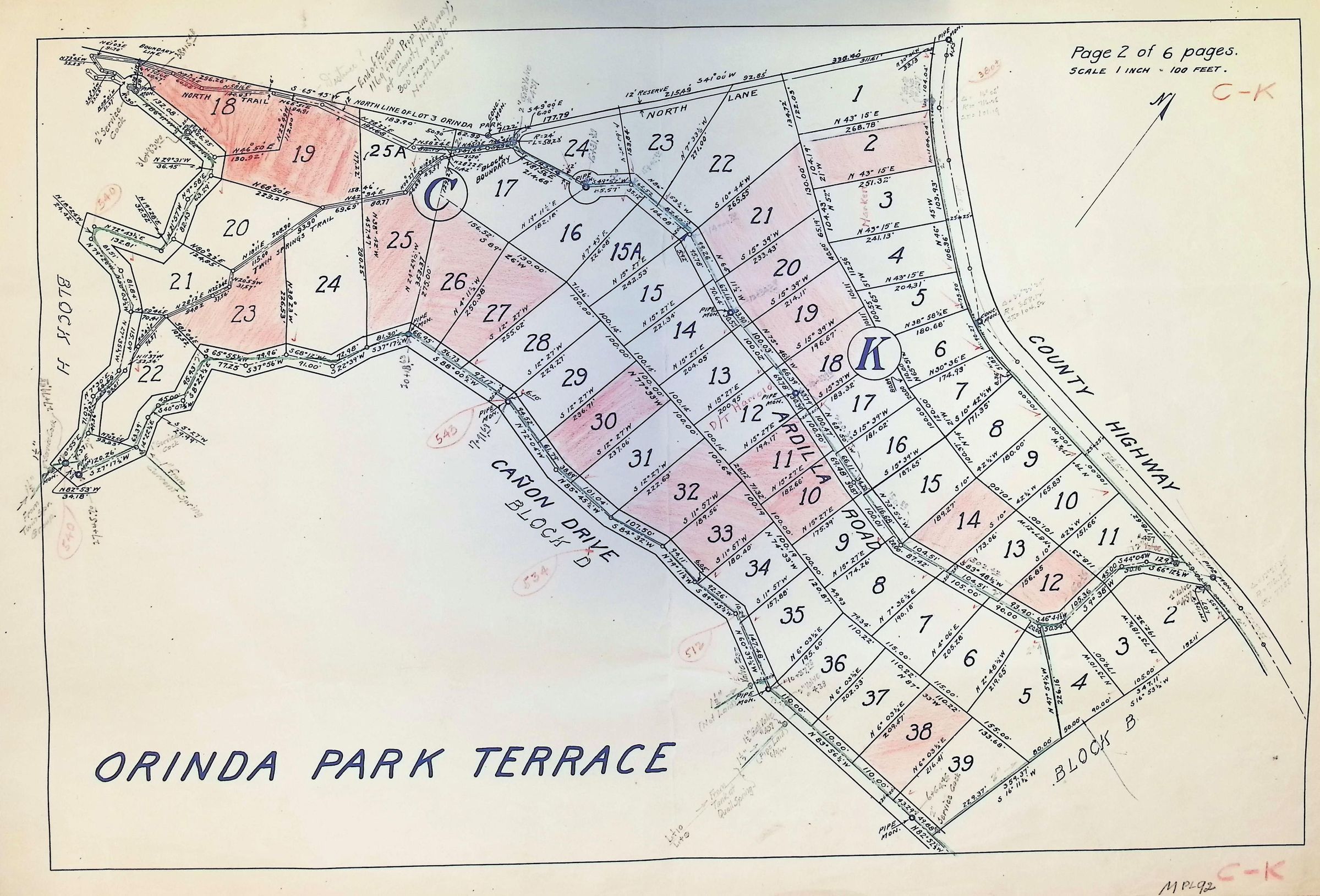
Orinda Park Terrace 2 of 6
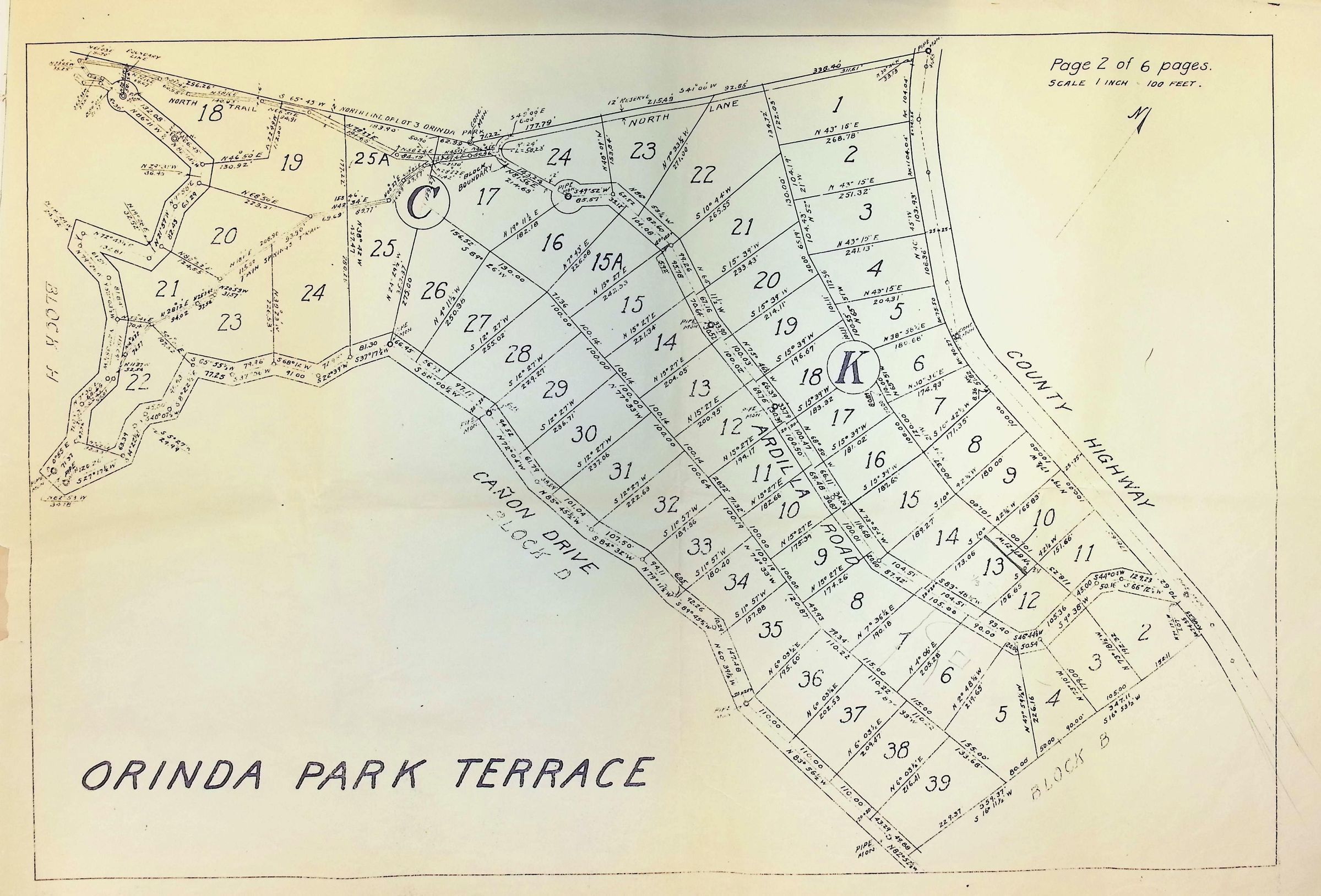
The image depicts a detailed plat map of Orinda Park Terrace, subdivided into numbered lots within blocks labeled C and K, bordered by North Lane, County Highway, and Cañon Drive, and includes measurements and angles for each lot; it's noted as page 2 of 6, with a scale indicating one inch equals 100 feet, providing an organized layout of the development plan.