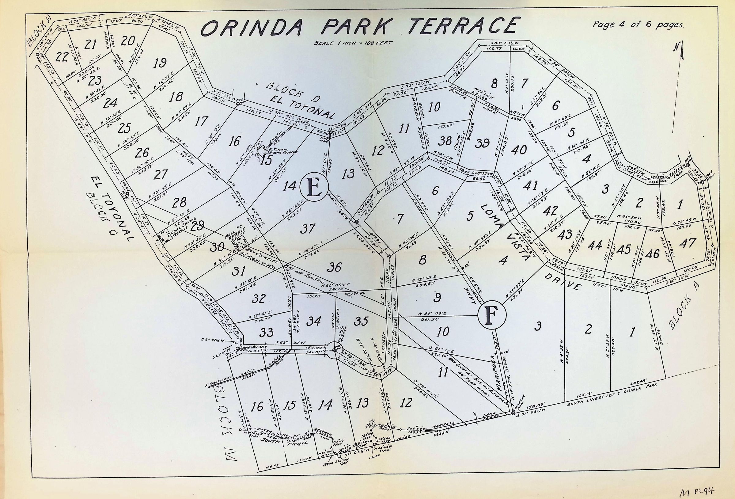
Orinda Park Terrace 4 of 6
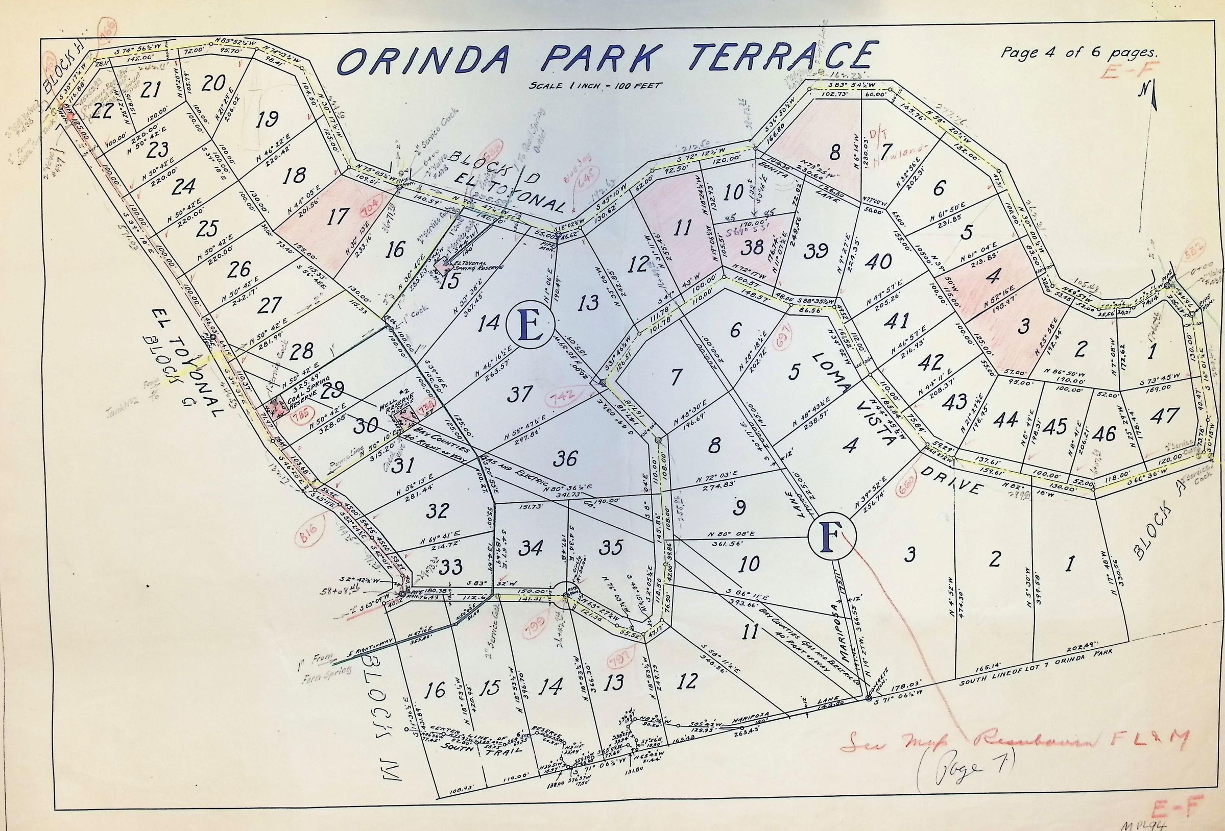
The image depicts a detailed map titled "Orinda Park Terrace" showing various numbered plots of land, each outlined with precise measurements along boundaries marked in different colors, with street names like El Toyonal and Loma Vista clearly indicated; notable features include circled letters E and F, and handwritten annotations in red, possibly denoting changes or additional information, with directional lines pointing north for orientation, and text on the upper right corner. 1922.