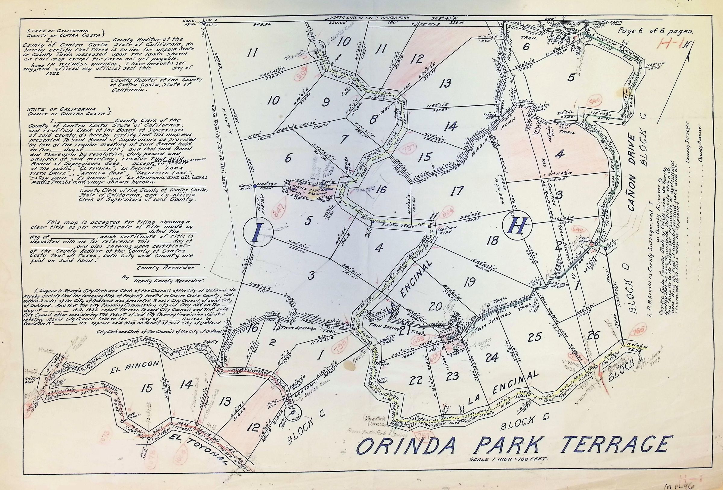
Orinda Park Terrace 6 of 6
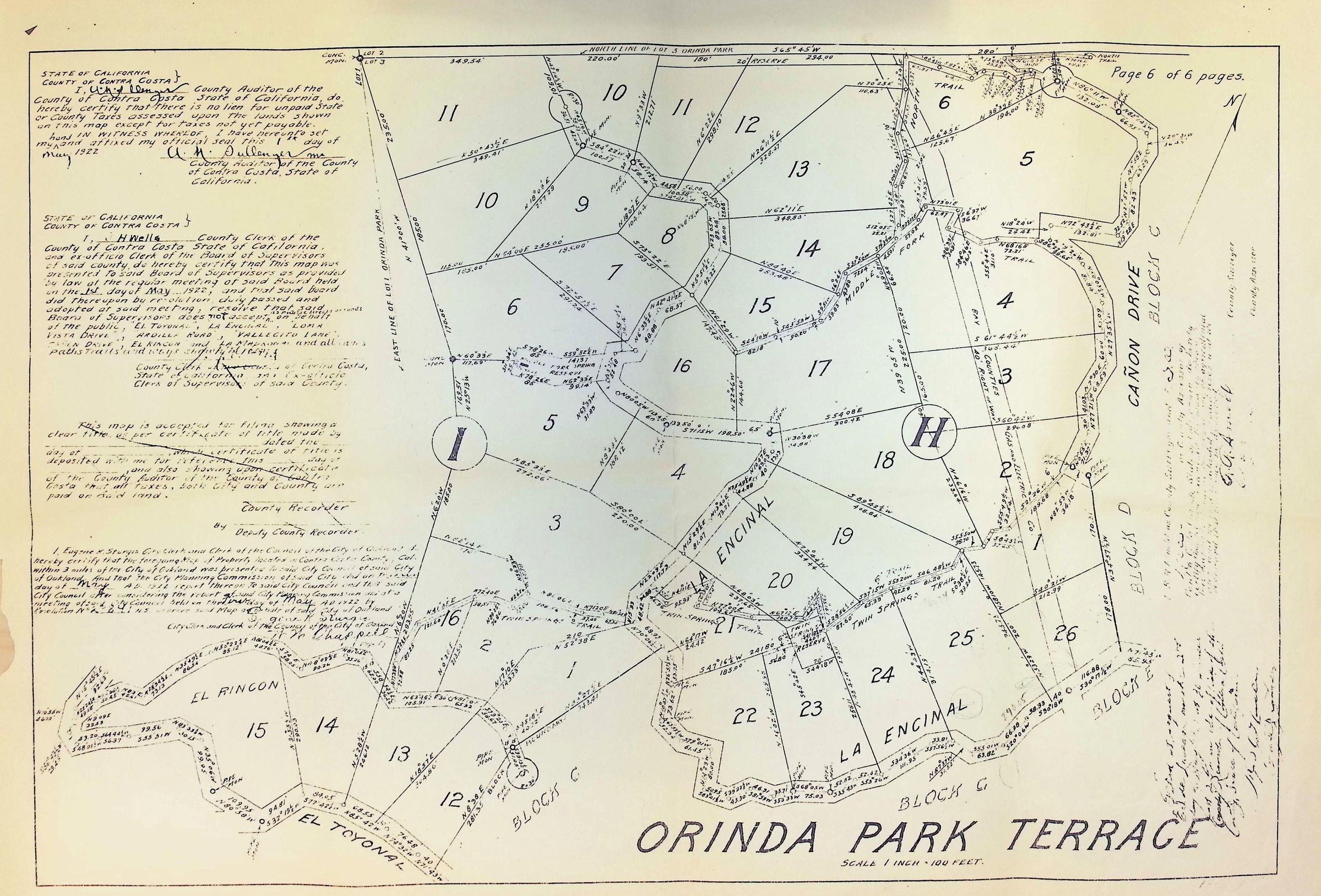
The image depicts a detailed survey map of Orinda Park Terrace, delineating various numbered lots (1 through 26) with intricate boundary lines and dimensions. It includes several handwritten annotations and official inscriptions in the left and bottom sections, confirming the map’s certification by the County Auditor and Clerk for Contra Costa County, California. Sections labeled I and H and roads such as Canon Drive, El Rincon, and El Toyonal are clearly marked, along with geographical identifiers. 1922.