Name/Title
San YsidroDescription
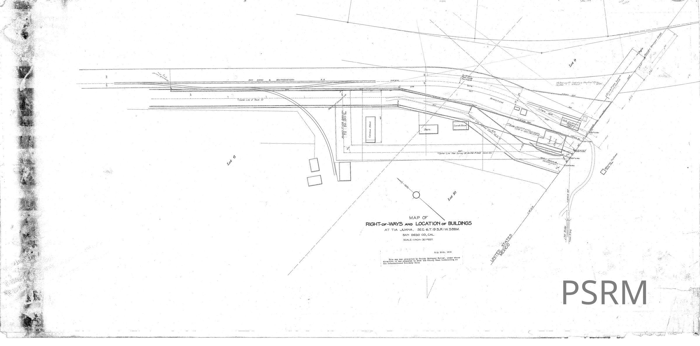
MAP OF RIGHT-oF-WAYS and LOCATION of BUILDINGS
AT TIA JUANA, SEC. 6,T. 19 S.,R. IW. S.BB.M.
SAN DIEGO CO., CAL.
SCALE: I INCH= 30 FEET.
July 20th, 1915
presented by this map was presented by County Surveyor Butler, under whose direction it was prepared to show the County Road terminating at the International Boundary line.