Name/Title
Map of Early Perth SettlementEntry/Object ID
925.75.1Scope and Content
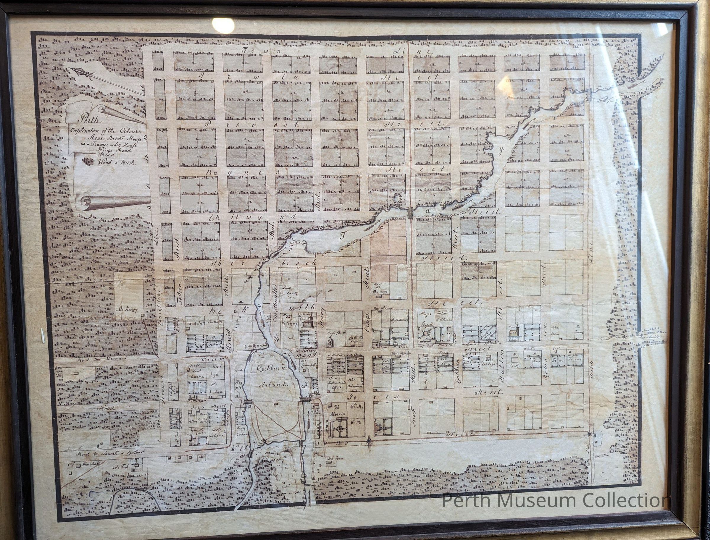
Framed with glass. Hand drawn on what looks like tissue paper. This map indicates who lived in what house, and in some cases the profession of the home owner (E.g.. Doctor Thom, Col. Taylor). Presently located in the Tourist Information Centre of the Perth Museum (Matheson House).
The map has been hand drawn. Very light beige and written in black ink. Notice the spelling of some of the streets. It shows the downtown core; Gore (Gores) and Foster (Fostern) Streets, Herriott (Herriot), etc. Upper left is the map legend.
c.1824
Old Description: Map: "Early Settlement Map of Perth, Ontario":
Brown wooden frame with a white matting and a map of Perth.
Includes a key with a colour scheme that indicates the materiality of the building in question. i.e. pink- stone/brick house; yellow- frame/log house.
NOTE: In 2017 staff is uncertain if the framed map that is on the ramp leading to the Inderwick Gallery is the original or if it is a reproduction.