Title
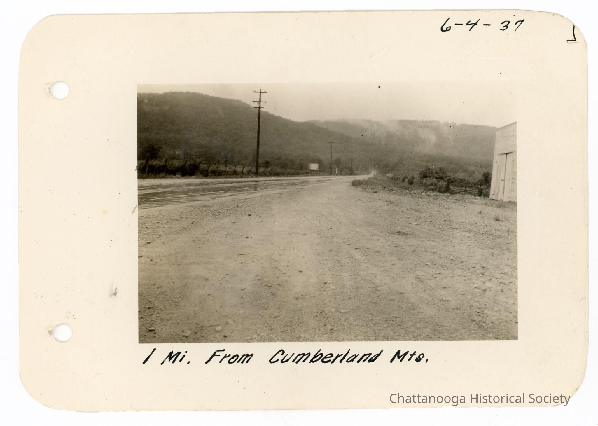
2021.039.003 A - Road from the Cumberland MountainsDescription
Black and white photograph showing a dirt road leading up into mountains. There is a white barn-like structure in the right mid-ground of the photograph. The photograph is labelled "1 Mi. From Cumberland Mts." and is dated 6-4-37.Date(s) of Creation
6/4/1937Title
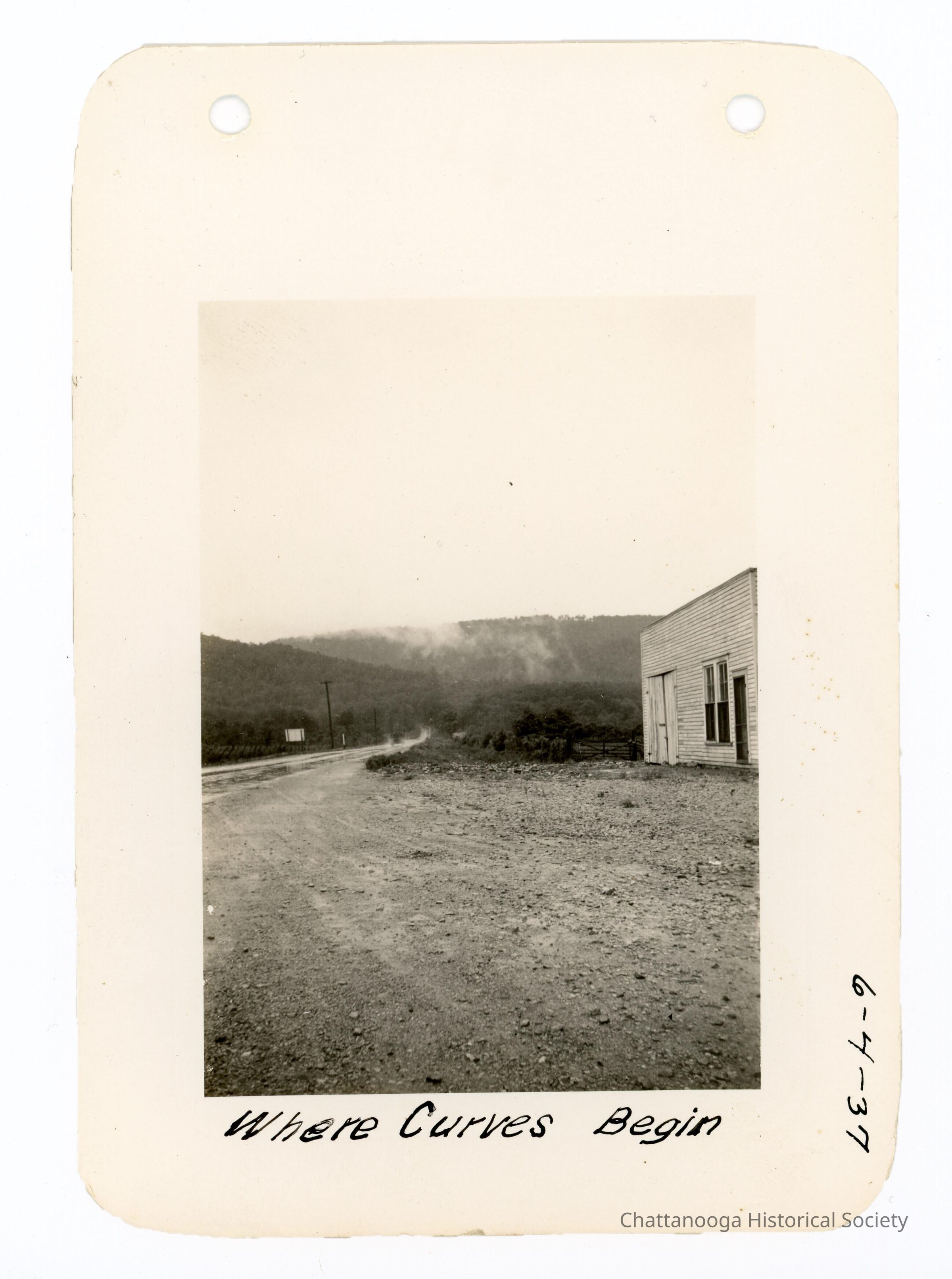
2021.039.003 B - Gravel RoadDescription
Black and white photograph of the same road in photograph 2021.039.003 A. The photograph shows more detail of the wooden structure on the right. The photograph is labelled "Where Curves Begin" and is dated 6-4-37.Date(s) of Creation
6/4/1937Title
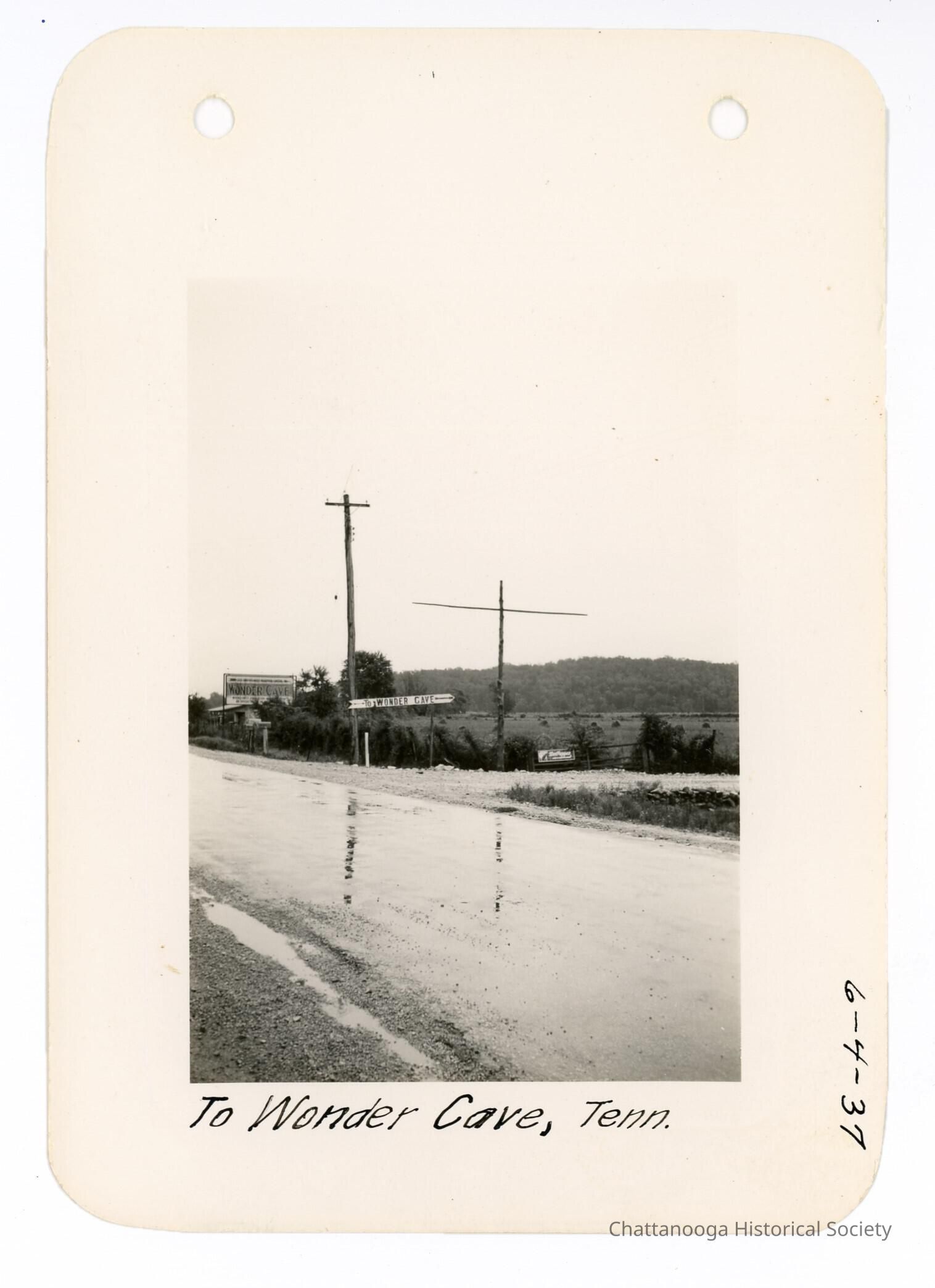
2021.039.003 C - Wonder Cave AdvertisementDescription
Black and white photograph of roadside signs for the Wonder Cave. The snapshot shows a wet gravel road with three advertising signs along the side. One sign, sitting on a gate, advertises "Dr. Pepper" with a graphic of a soda bottle. The other signs advertise Wonder Cave, which is a natural cave in Grundy County, Tennessee visited by tourists from 1800s to early 2000s. One directional sign points down the road "To Wonder Cave". The larger sign further up the road reads "Wonder Cave". The photograph is labelled "To Wonder Cave, Tenn." and is dated 6-4-1937.Date(s) of Creation
6/4/1937Title
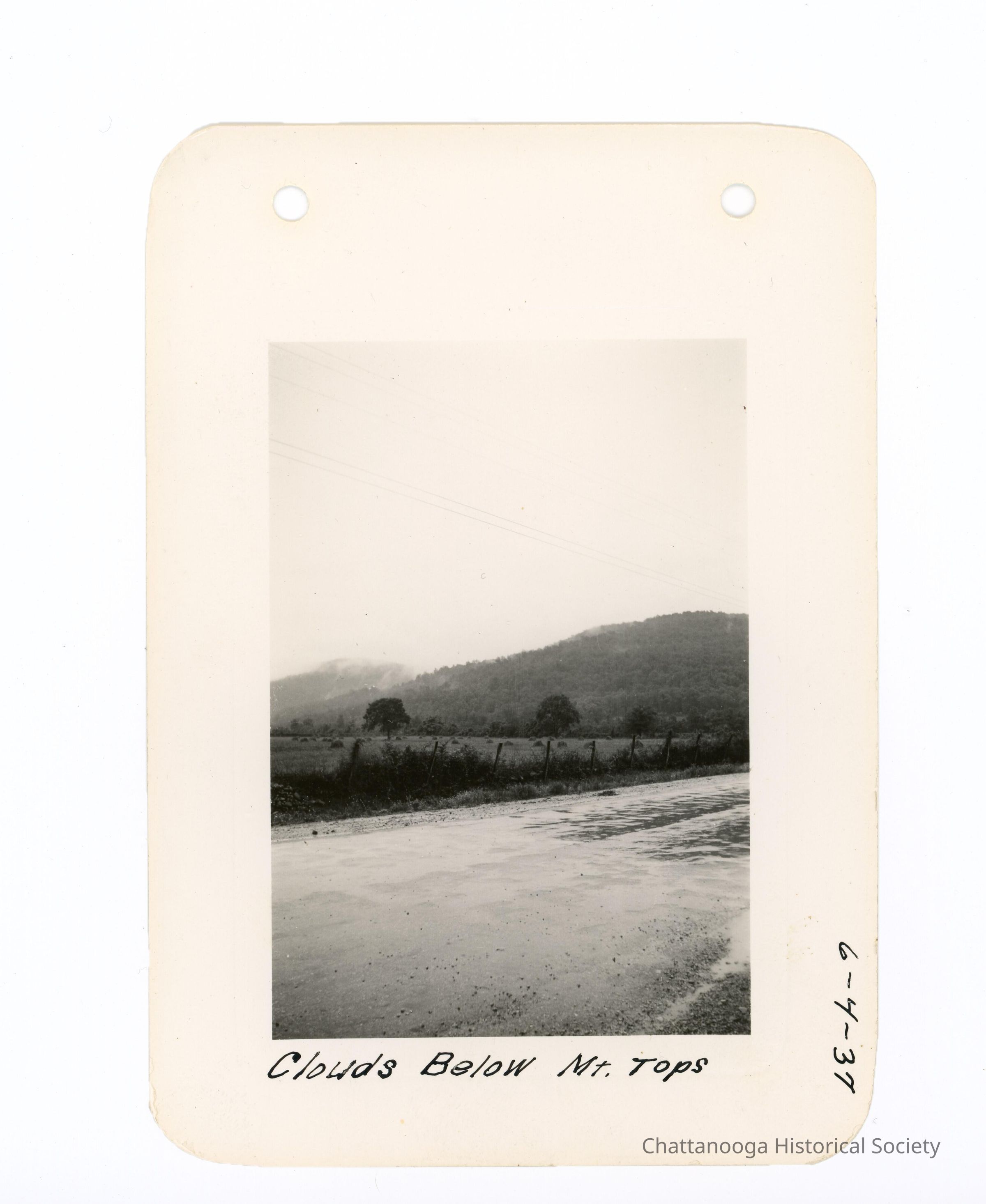
2021.039.003 D - Mountain SceneDescription
Black and white photograph of cloudy mountains behind a wet road. There is a fenced field in the mid ground and what is likely the Cumberland Mountains appear in the background. The photograph is labelled "Clouds Below Mt. Tops" and is dated 6-4-37.Date(s) of Creation
6/4/1937Title
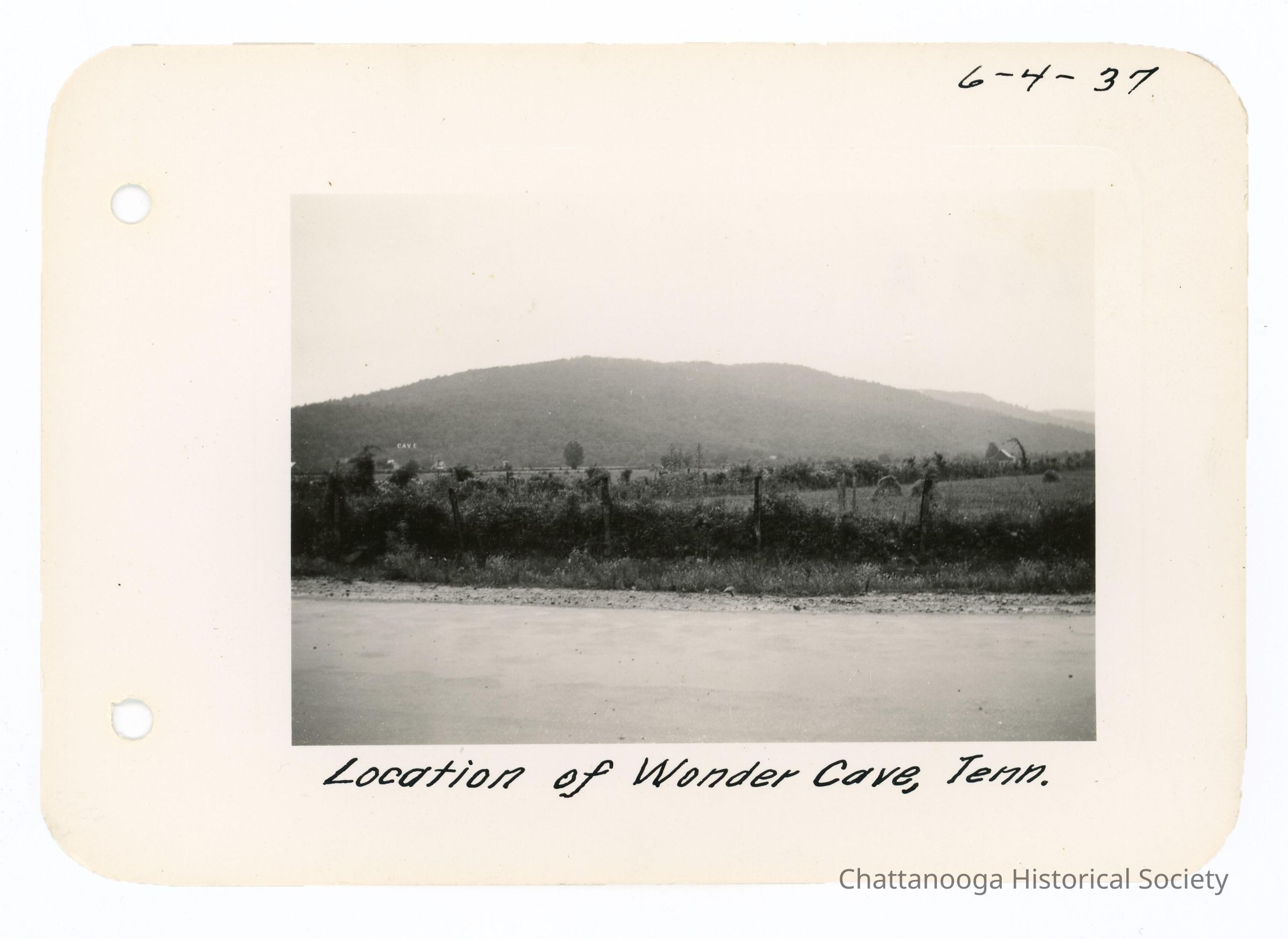
2021.039.003 E - Wonder CaveDescription
Black and white photograph from the road showing the location of the cave within the Cumberland Plateau. The road site in the foreground of the snapshot with a field with grazing animals in the midground. The Cumberland's can be seen in the background with a light sign reading "Cave" seen to the left. The photograph is labelled "Location of Wonder Cave, Tenn." and is dated 6-4-37.Date(s) of Creation
6/4/1937Title
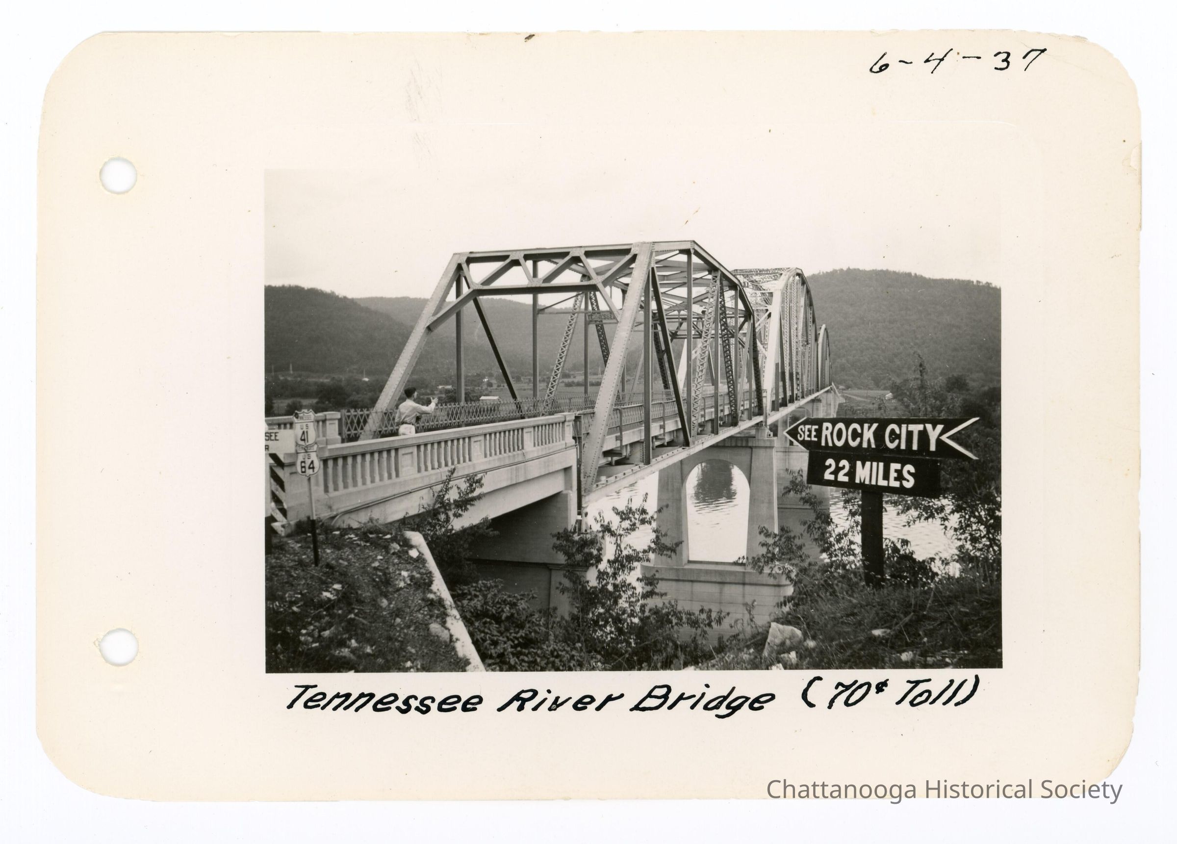
2021.039.003 F - Veteran's Memorial Bridge, Marion CountyDescription
Black and white photograph showing a steel trestle bridge spanning the Tennessee River and Nickajack Lake (Highway US 41) in Marion County, Tennessee. A black and white directional sign reads "See ROCK CITY 22 Miles" and pointing across the bridge. There is a man standing on the bridge deck looking to the other side. The photograph is labelled "Tennessee River Bridge (70c Toll)" and is dated 6-4-37. The bridge was demolished in 2015.Date(s) of Creation
6/4/1937Title
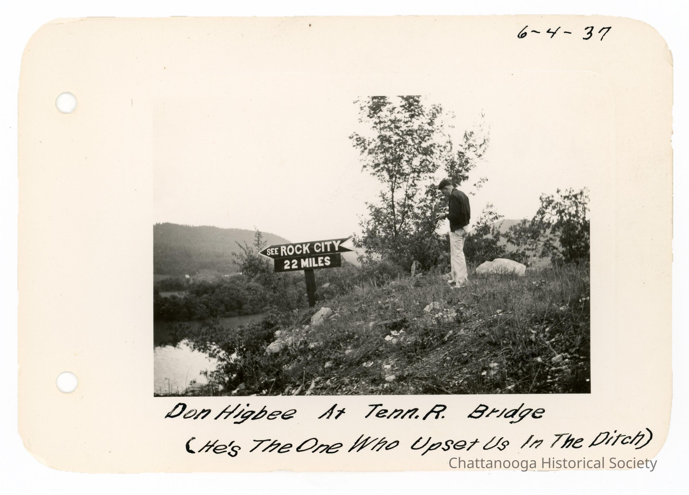
2021.039.003 G - See Rock City SignDescription
Black and white photograph showing a man looking down at a directional sign reading "See ROCK CITY 22 Miles". The Tennessee River is below the sign, to the right. The photograph is labelled "Don Higbee At Tenn. R. Bridge (He's The One Who Upset Us In The Ditch)" and is date 6-4-37.Date(s) of Creation
6/4/1937Title
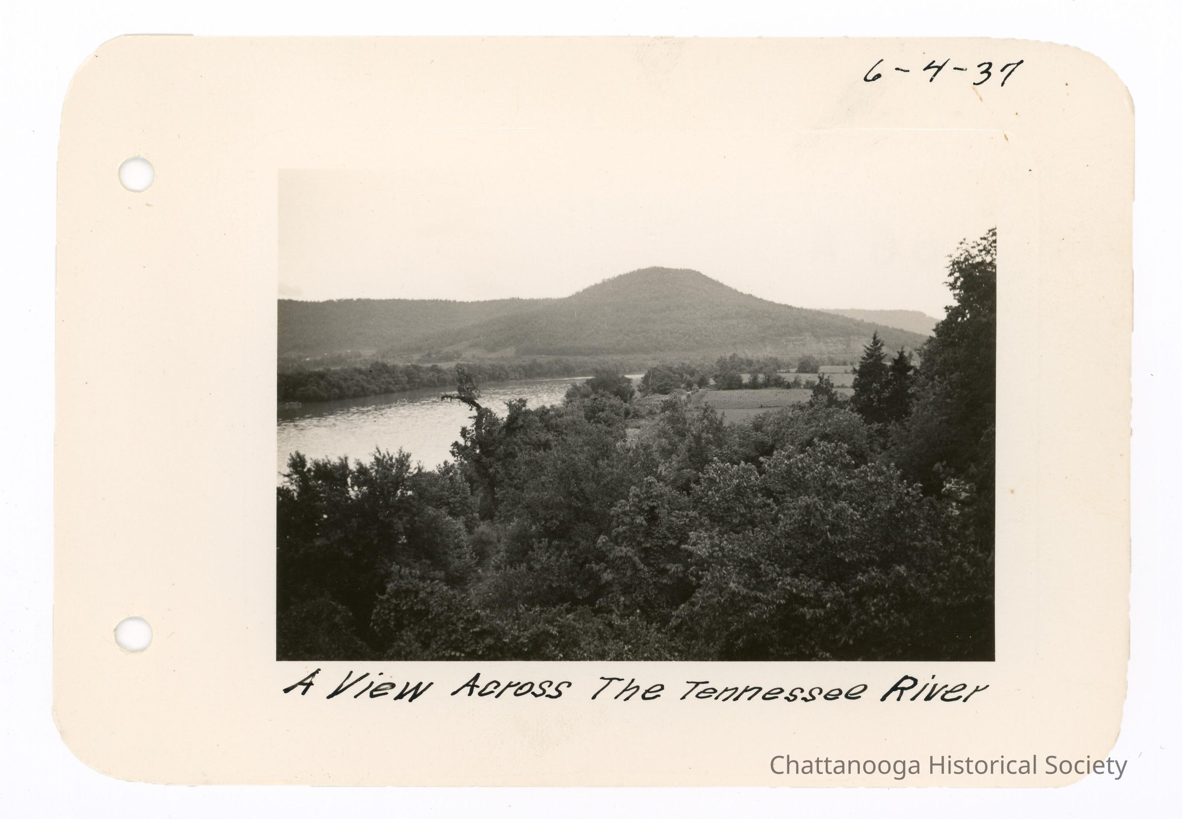
2021.039.003 H - Tennessee RiverDescription
Black and white photograph showing a view of the Tennessee River. The photograph is labelled "A View Across The Tennessee River" and is dated 6-4-37.Date(s) of Creation
6/4/1937