Name/Title
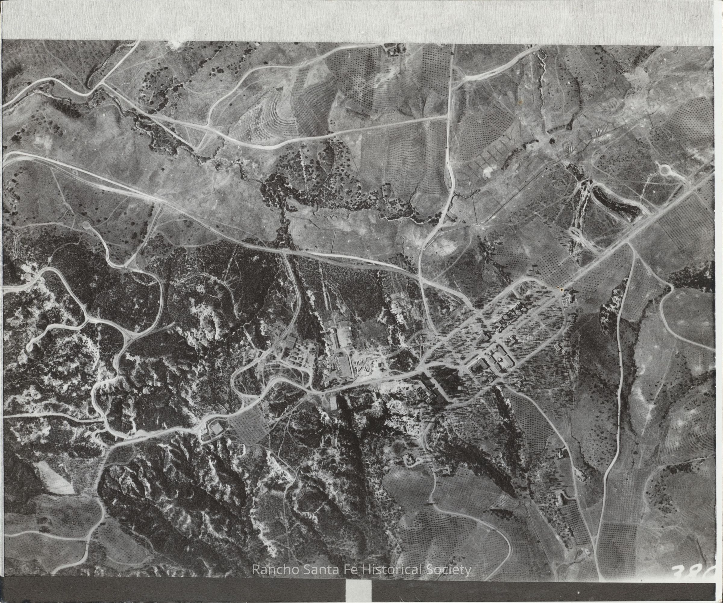
Aerial view of Rancho Santa Fe Village center and surrounding development, circa 1928Entry/Object ID
2026.015.093Description
Black-and-white aerial photograph depicting Rancho Santa Fe Village and the surrounding landscape in Rancho Santa Fe, California, circa 1928. The central portion of the photograph shows a concentration of commercial and community buildings arranged along an emerging network of roads, with additional structures and cleared areas extending into the surrounding terrain. Winding roadways connect the village center to residential properties, agricultural fields, and undeveloped hillsides. Orchards planted in regularly spaced rows occupy portions of the surrounding landscape, while areas of native vegetation and exposed soil extend across the adjacent hillsides. The photograph documents the early development of Rancho Santa Fe Village, including its original street layout, building construction, agricultural land use, and surrounding rural landscape.
Annotations on the reverse identify the subject as an aerial view of Rancho Santa Fe Village, with dates of 1928 and 1929 appearing in separate notations. A reproduction label records photograph number 38 C4, a copy enlargement of 200 percent, and an approximate scale of one inch to 500 feet.Collection
Landscape and Aerial Photographs, Historic Homes and Residential ArchitectureDimensions
Dimension Description
8 x 10 inchRelationships
Related Places
Place
Neighborhood
Rancho Santa FeCounty
San Diego CountyState/Province
CaliforniaCountry
The United States of AmericaContinent
North America