Name/Title
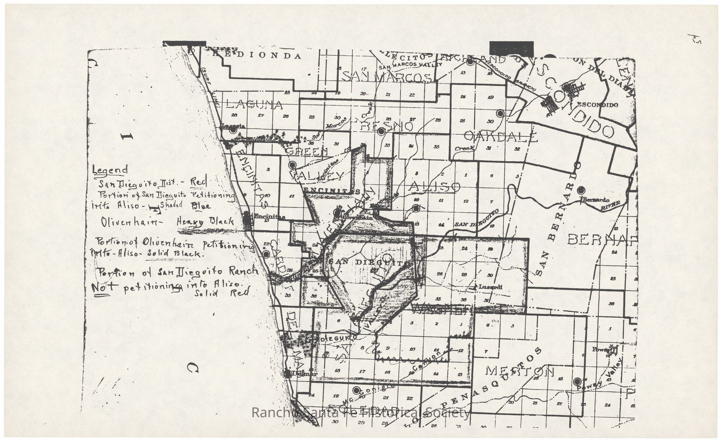
Map showing proposed Aliso School District boundary changes, circa 1924Entry/Object ID
1986.002.069Description
Map of northern San Diego County showing the Aliso, San Dieguito, and Olivenhain school districts and surrounding areas in relation to a proposed school district boundary change. A handwritten legend identifies the San Dieguito School District, the portion of San Dieguito petitioning for inclusion in the Aliso School District, the Olivenhain School District, the portion of Olivenhain petitioning for inclusion in Aliso, and a portion of Rancho San Dieguito not petitioning for inclusion. The map includes Rancho San Dieguito and nearby communities and districts including Encinitas, San Marcos, Escondido, Bernardo, and Merle.Collection
Rancho Santa Fe School District, Rancho Santa Fe MapsDimensions
Dimension Description
8.5 x 11 inchRelationships
Related Person or Organization
Person or Organization
Rancho Santa Fe School DistrictPerson or Organization
Aliso School DistrictRelated Places
Place
Neighborhood
Rancho Santa FeCounty
San Diego CountyState/Province
CaliforniaCountry
The United States of AmericaContinent
North America