Name/Title
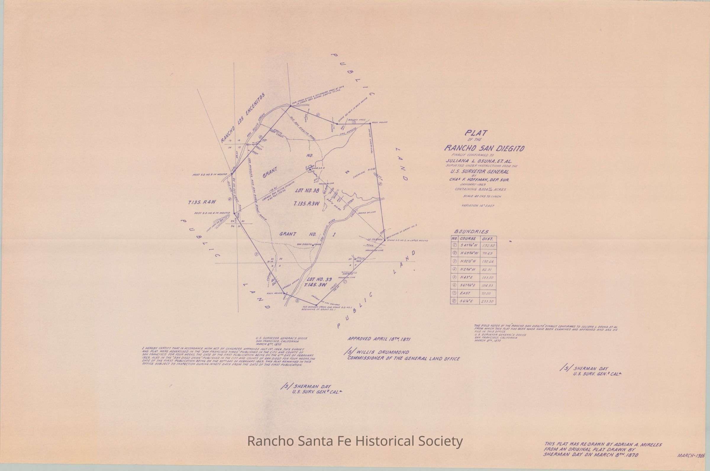
Plat of the Rancho San DieguitoEntry/Object ID
1980.003.019Scope and Content
This plat was re-drawn by Adriana A Mireles from the original plat drawn by Sherman Day on March 8th, 1870. This plat finally confirmed to Juliana L. Osuna the land and grant of land to her under instructions from the U.S. Surveyor General. MAp details acres and boundaries of the area.Collection
The Osuna Collection, Rancho Santa Fe MapsArchive Details
Date(s) of Creation
1985 - 1985Archive Notes
Date(s) Created: March 1985Maintenance
Maintenance Interval
YearlyRelationships
Related Person or Organization
Person or Organization
Adriana A MirelesPerson or Organization
Sherman DayPerson or Organization
López, María Juliana Josepha