Name/Title
Reconnaissance Soil Map of Rancho San Dieguito, 1921Entry/Object ID
2026.003.001Description
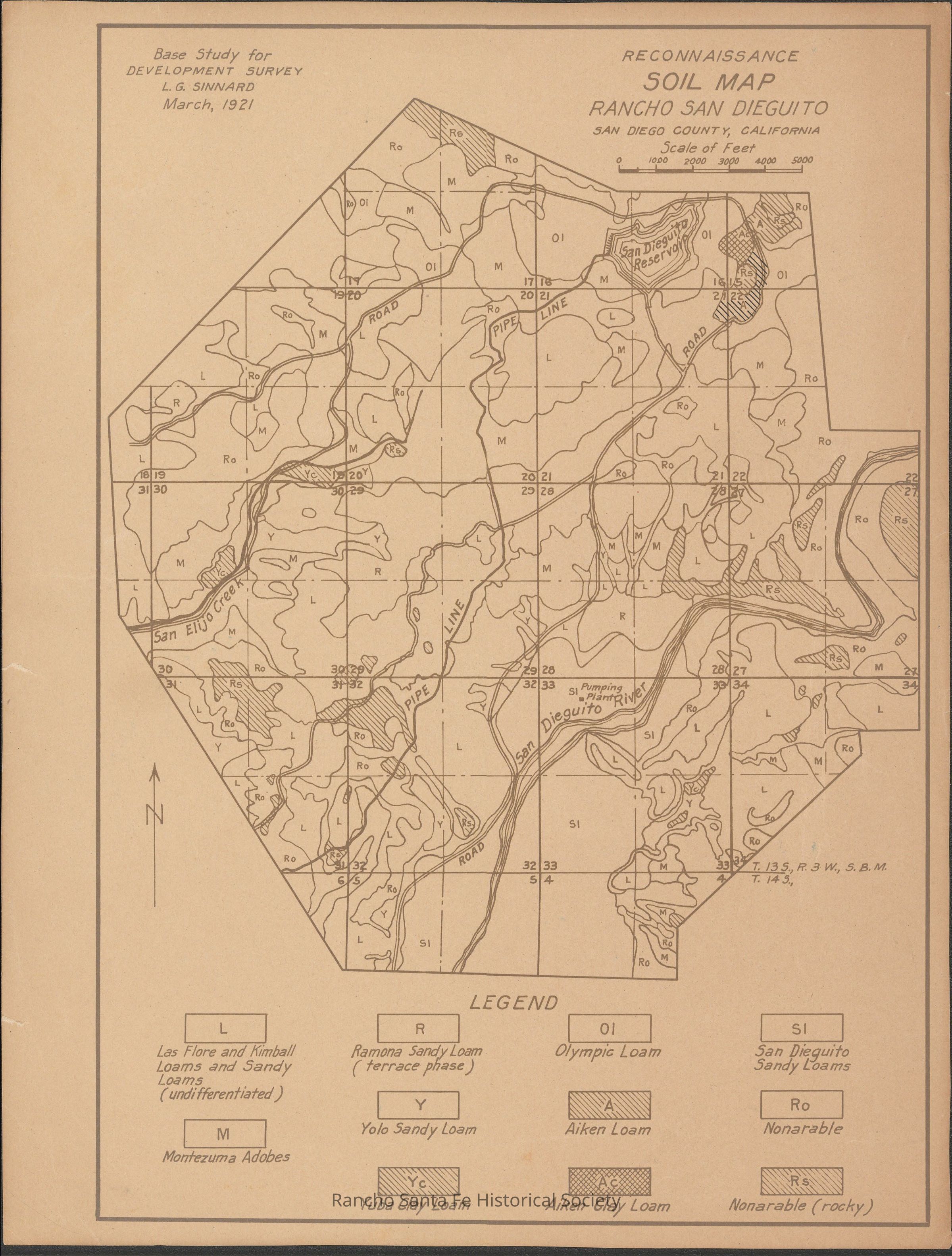
Reconnaissance soil map prepared as part of a base study for a development survey of Rancho San Dieguito in San Diego County, California, depicting soil classifications and land characteristics across the surveyed area. The map identifies and differentiates soil types including sandy loams, clay loams, adobes, and nonarable lands, with a legend defining categories such as Ramona Sandy Loam, Yolo Sandy Loam, Olympic Loam, Aiken Loam, and San Dieguito Sandy Loams. The map includes sectional grid references, roads, pipelines, and natural features, and is presented at a stated scale of feet for use in land evaluation and planning.Collection
Santa Fe Land Improvement Company RecordsMap Details
Maker or Creator
Sinnard, Leone.G.Area or Region
* Untyped Area or Region
Rancho San DieguitoCounty
San Diego CountyState/Province
CaliforniaCountry
The United States of AmericaContinent
North AmericaDate Published
Mar 1921Dimensions
Dimension Description
8.5 x 11 inchRelationships
Related Person or Organization
Person or Organization
Sinnard, Leone.G.Person or Organization
Santa Fe Land Improvement Company