Name/Title
Aerial Photograph of Buffalo Grove between Arlington Heights Rd, Dundee Rd, and Lake Cook RdEntry/Object ID
2024.03.006Description
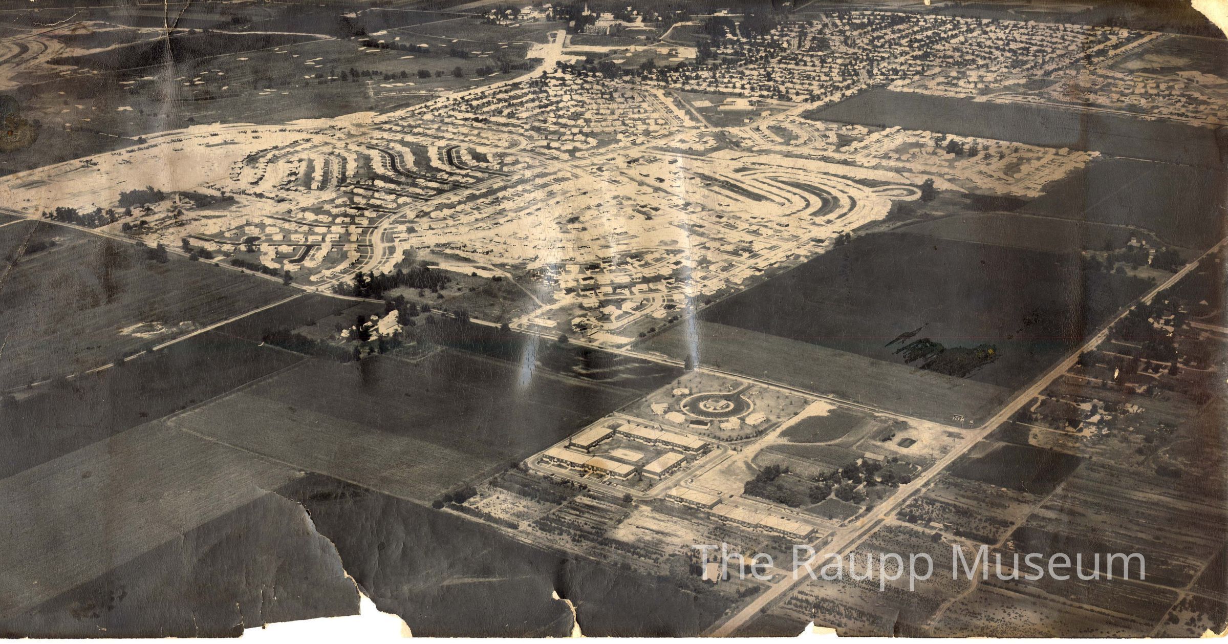
One (1) aerial black-and-white photograph. Obverse: photograph facing northeast showing the subdivision between Lake Cook Rd (diagonal across the top from top-center to top-left), Arlington Heights Rd (diagonal across the center from top-left to bottom-right), and Dundee Rd (diagonal across bottom-right corner). The subdivision occupies upper-center. Outside the roads, mostly farmland is shown. St. Mary's is at the top-center. Golf course is north of Lake Cook Rd.
Reverse: Center has an address stamp from "Kenroy, INC." to "Plan Commission" of Buffalo Grove. Stamp is accented red and the recipient is written in blue marker. Rectangle brown stains around the border from tape or glue.Made/Created
Date made
circa 1965 - 1968Place
City
Buffalo GroveState/Province
IllinoisCountry
United States of AmericaContinent
North America