HUB
Collections
Classifications
About
App
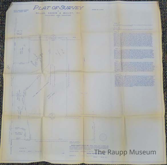
Plat of Survey
Map
-
Raupp Museum
Origformat: Print-Photographic
Name/Title
Plat of Survey
Entry/Object ID
2011.44.001
Description
One-sided blue and white plat of survey of a proposed development on the corner of Arlington Heights Road and Dundee Road. Map drawing on the left with parcels of land sectioned off (A/B/C1/C2/D). Typed descriptions of the parcels on the right side.
Map Details
Maker or Creator
Nelson, Harker, and Mallory, Inc.
Publisher
Nelson, Harker, and Mallory, Inc.
Place Published
Location
6174 N. Northwest Highway, Chicago, IL
Date Published
Jan 17, 1968
Condition
Overall Condition
Good