Name/Title
Ultimate Land Use Plan Official MapEntry/Object ID
2011.37.001Description
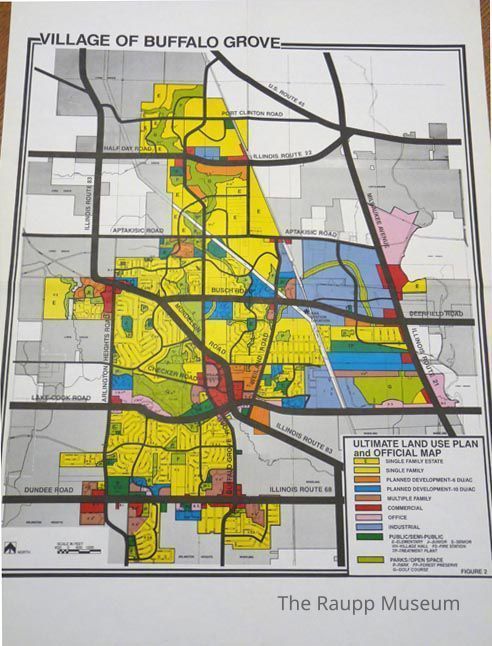
Color single-sided zoning map of Buffalo Grove and Village Planner memo. Map is color-coded to represent area use. Color key located in the lower right corner. Housing is separated into single family and multi-family. Planned development areas are identified by use as industrial or commercial categories. Map also marks public spaces for schools, parks, forest preserves, and golf courses.Relationships
Related Person or Organization
Person or Organization
Pfeil, Robert E