1918 Canadian Infantry Brigade Map Brig

Name/Title

1918 Canadian Infantry Brigade Map "Brig

Entry/Object ID

1990.25.2

Description

1918 11th Cdn. Inf. Brigade Map Boundary Lines 17 Oct-06 Nov 1918

Use

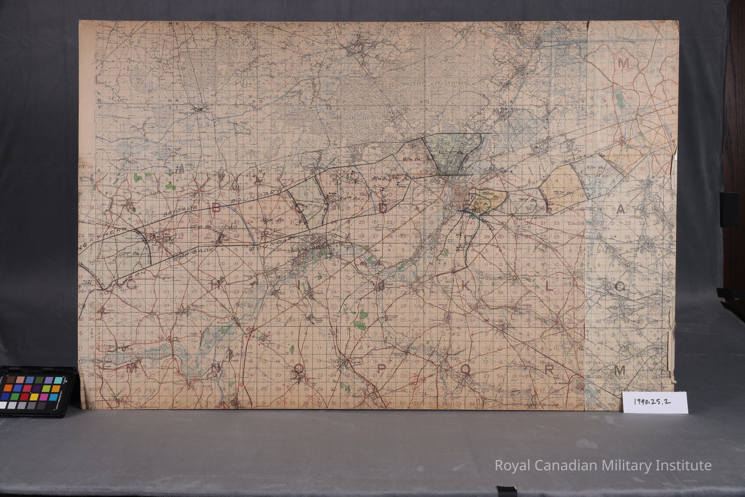
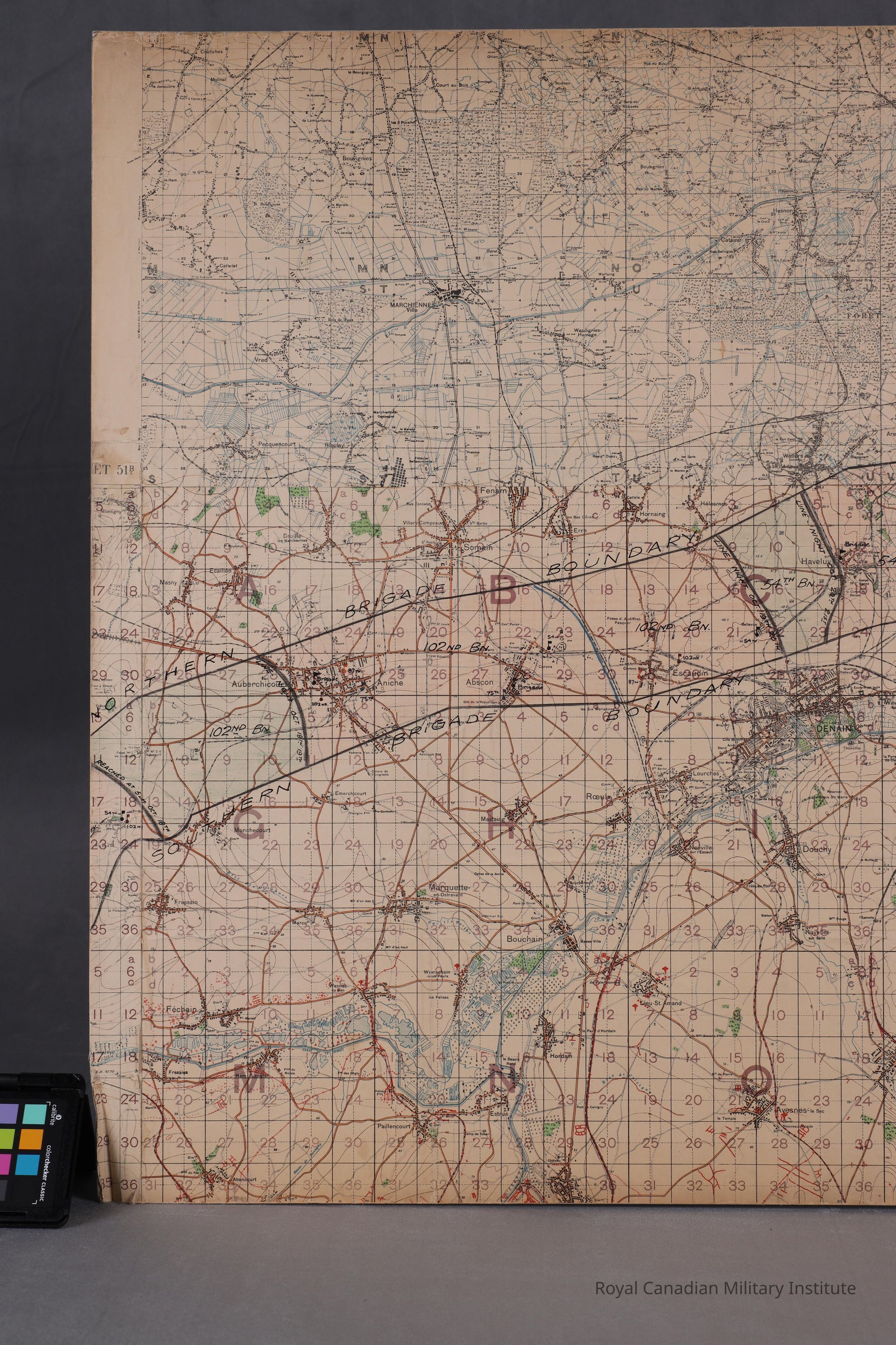
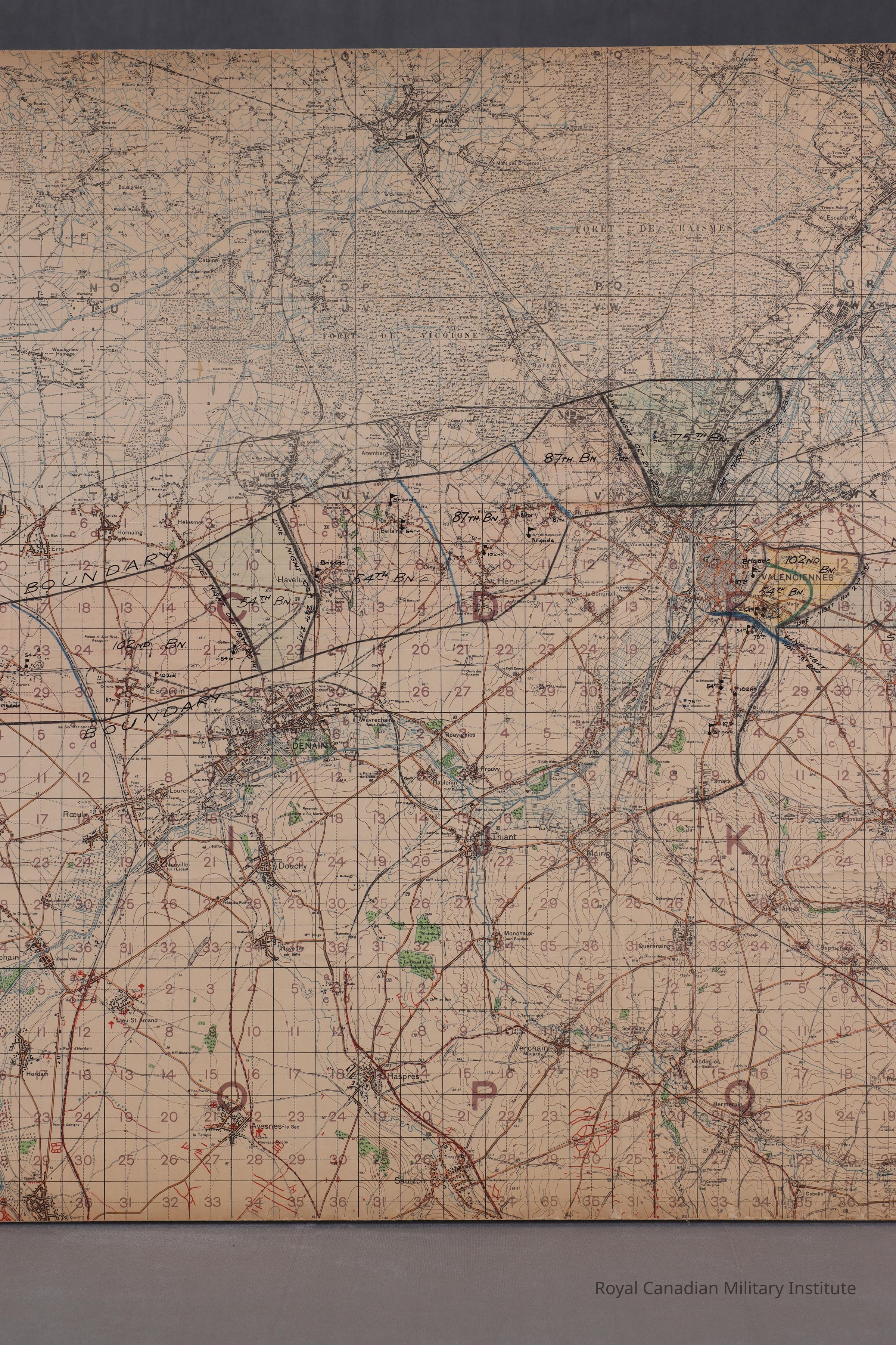
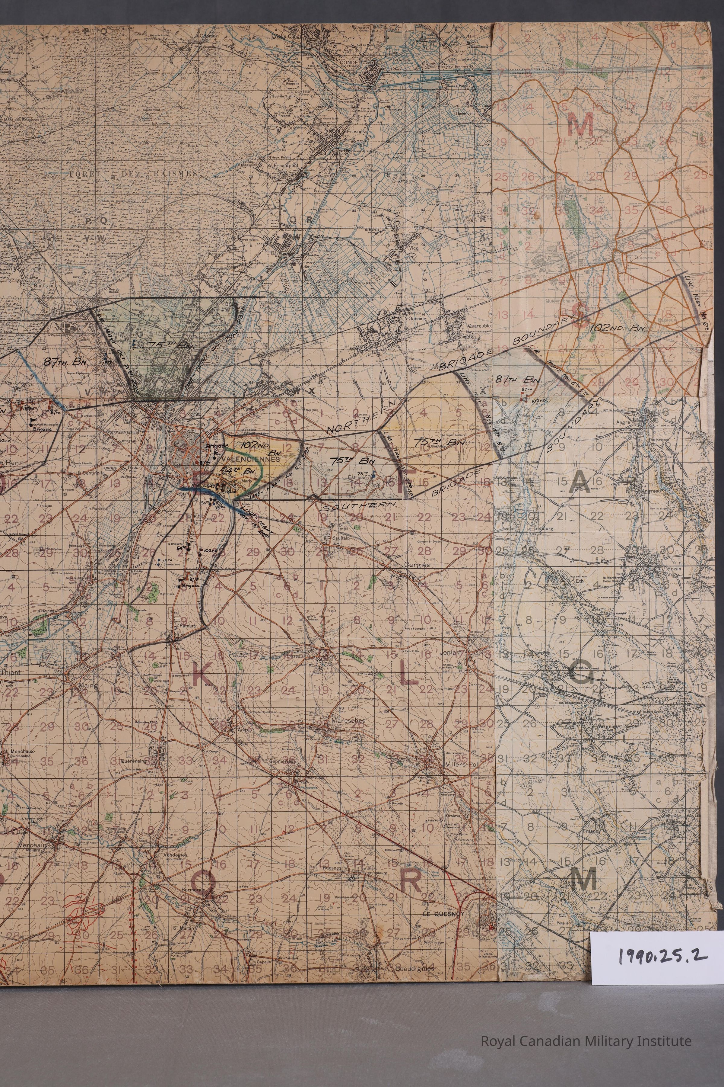
Map of Brigade boundary lines cities Fechain-Baiseux detailing cities, forest outlines, buildings, rivers, canals, bridges, trails, tracks, enemy aerodromes, hospitals, camps. In scale 1:40,000 with 5 foot contour lines.

Context

Map used by 11th Canadian Infantry Brigade to mark 54-75-87-102 Battalion advance boundaries and times. Penciled in green, black, blue, orange, yellow (actual used, marked map).

Made/Created

Artist

11th Canadian Infantry Brigade

Date made

Oct 1918 - Dec 1918

Time Period

20th Century

Place

Region

Western Europe

Continent

Europe

Inscription/Signature/Marks

Type

Inscription

Material/Technique

Pencil

Dimensions

Height

97.2 cm

Width

63.3 cm