Name/Title
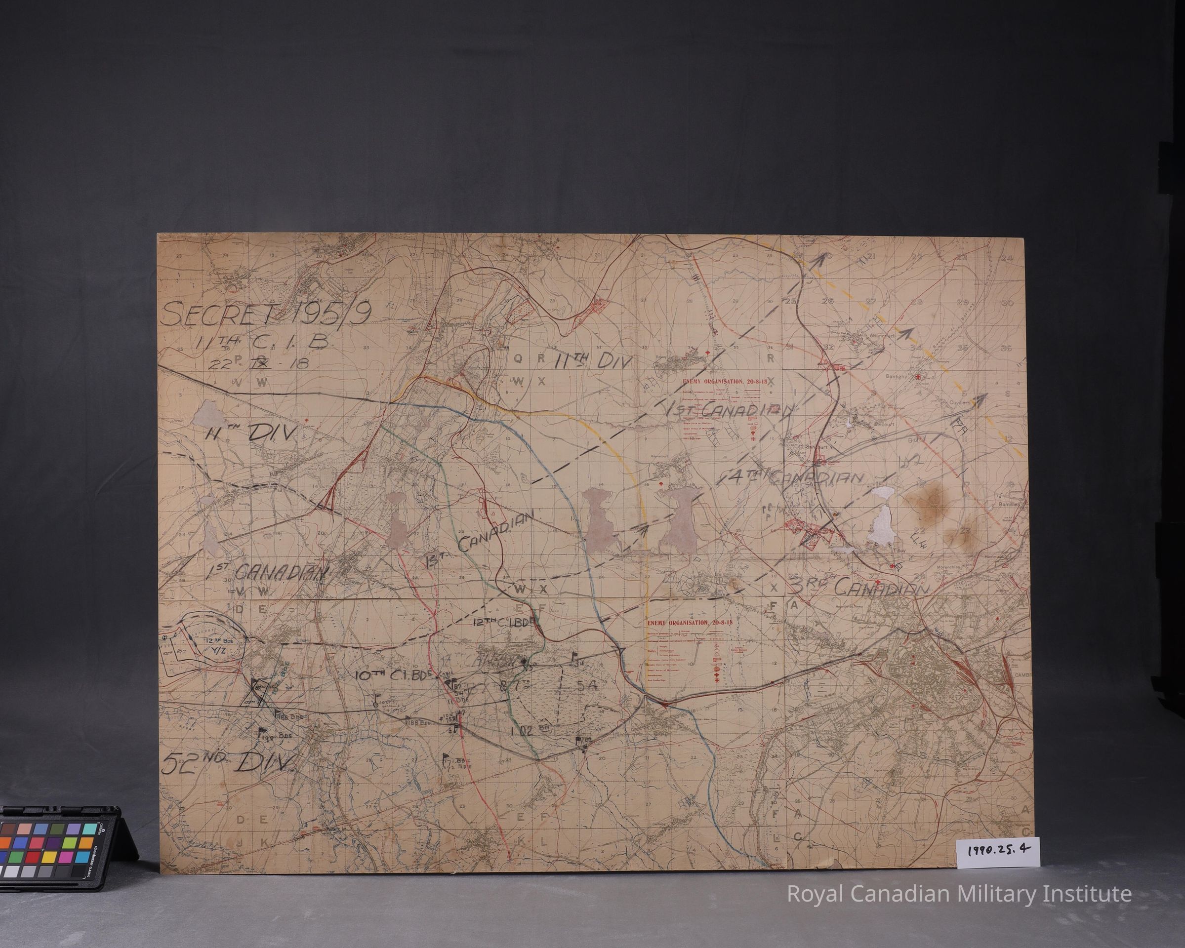
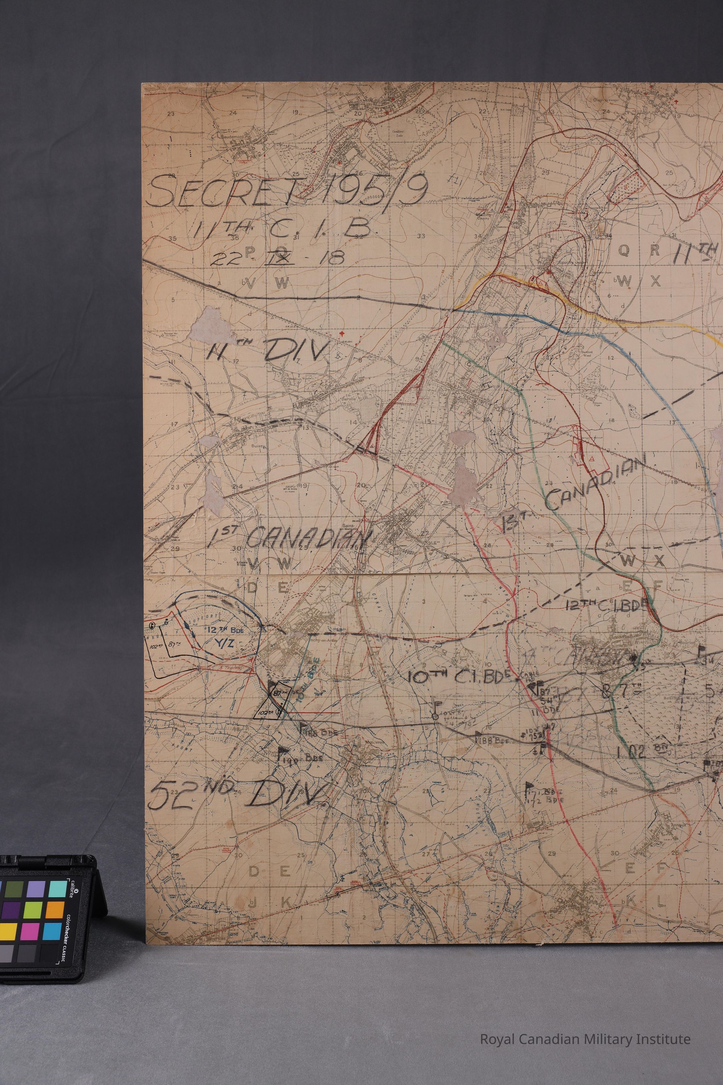
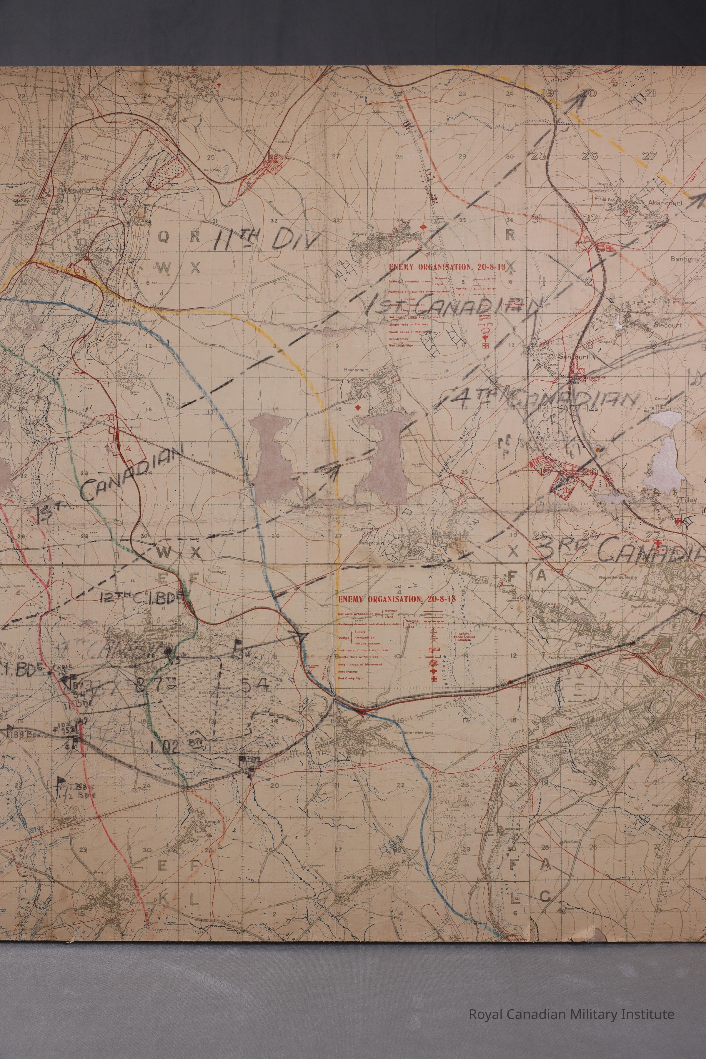
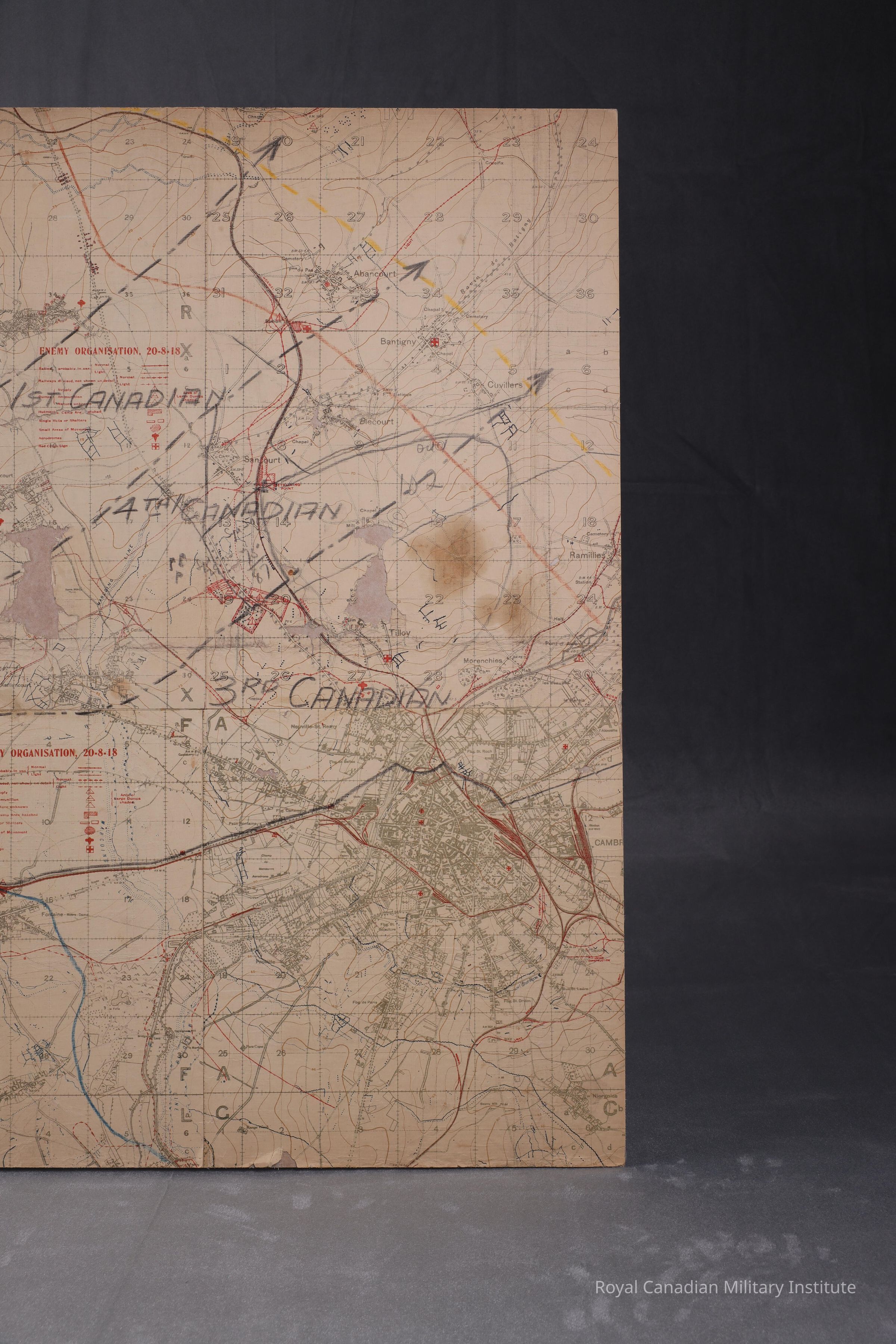
1918 Canadian Infantry Brigade Map "EnemEntry/Object ID
1990.25.4Description
1918 Canadian Infantry Brigade Map "Enemy Organization, 20-8-1918"Use
Map on enemy organization shows details of city, building outlines, roads, canals, railways, trench and barbed wire systems, dumps, camps, aerodromes, hospitals, scale of 1:20,000 with 5 feet interval contour lines.Context
Map used by 11th C.I.B. (54/75/87/102 Battalions) to mark planned advances of British 11th Division, Canadian 3rd/4th Divisions: demarcations in red, green, blue, yellow, black crayon: this is example of a used, marked battle map.Made/Created
Artist Information
Artist
11th Canadian Infantry BrigadeAttribution
created in the fieldDate made
Aug 1918 - Nov 1918Time Period
20th CenturyPlace
Region
Western EuropeContinent
EuropeInscription/Signature/Marks
Location
accession number on back in pencil