1917 Canadian Expeditionary Force trench

Name/Title

1917 Canadian Expeditionary Force trench

Entry/Object ID

1993.15.3

Description

1917 BEF/CEF trench map "Western Road" Farbus-Fresnoy

Use

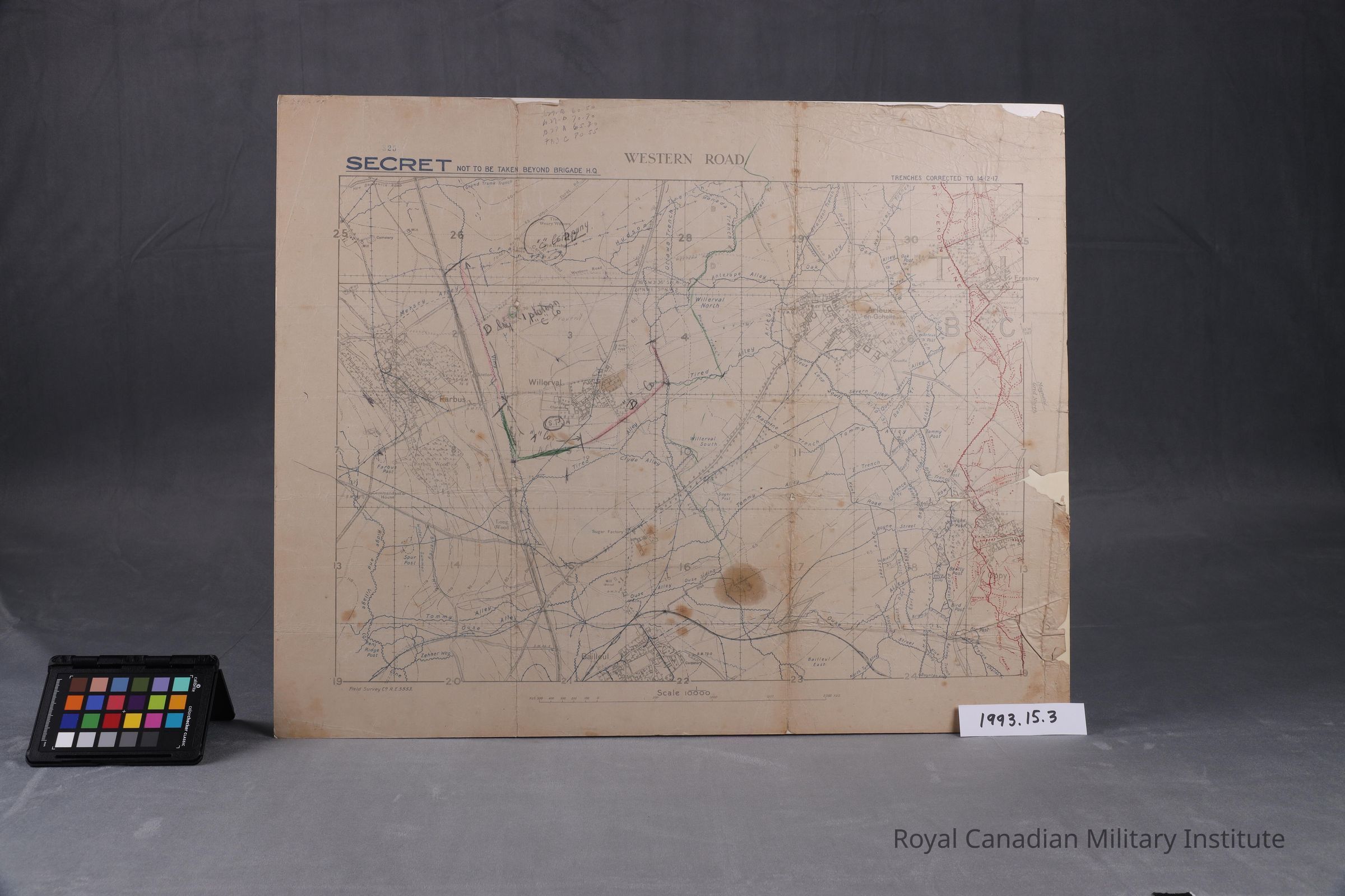
Royal Engineers Field Survey Company map of "Western Road" Farbus-Fresnoy area shows detail of town outlines, road and rail lines, British trench lines are blue, German trench lines are red, also natural features of ditches, marshes, woods. Scale of 1: 10,000

Context

Map of "Western Road" area shows smaller scale platoon and company dispositions of 58th Canadian Infantry Battalion around town of Willerval. Map is not to be taken beyond Brigade Headquarters: is a secret document.

Made/Created

Artist

Royal Engineers Survey Company

Date made

Oct 1917 - Dec 1917

Time Period

20th Century

Inscription/Signature/Marks

Type

Stamp

Transcription

COPY NUMBER 325 SECRET:NOT TO BE TAKEN BEYOND BRIGADE HEADQUARTERS

Dimensions

Dimension Description

map overall

Height

64.4 cm

Width

49 cm

Dimension Notes

map 19.5 x 25 inches folds to 4 x 7.5 inch size