Label Type
Cultural/Historical ContextLabel
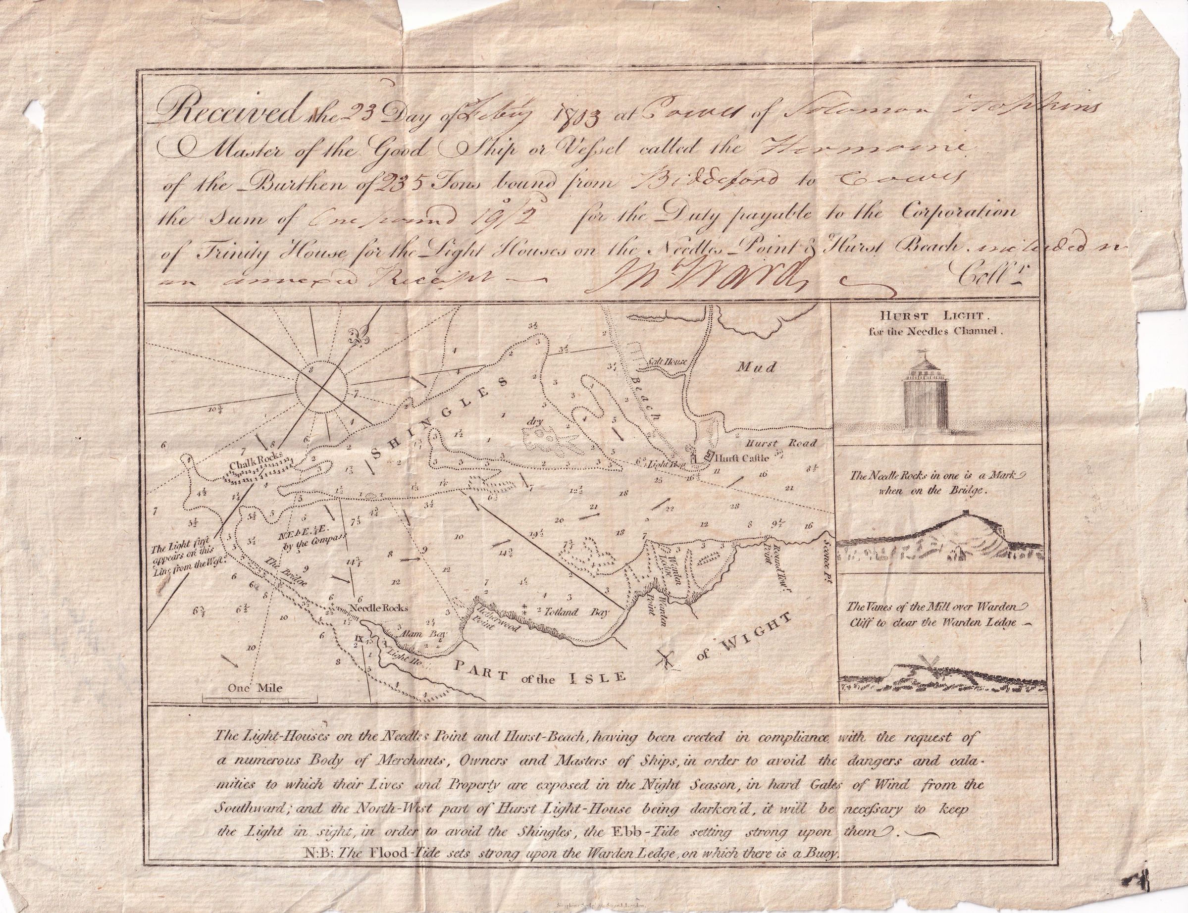
In February 1803, Solomon Hopkins, master of the ship Hermoine, approached the Isle of Wight, off the southern coast of England. He was bound from Biddeford to Cowy, a port on the north side of the island. In order to reach that port he had to sail through the treacherous waters around the Needles on the island's westernmost point. Only a narrow channel was navigable between the Shingles bank of the southern coast of England and the Needles rocks, a narrow chalky peninsula that rises from jagged rocks to 120-meter high cliffs. The map on this document shows the location of Needle Rocks, the Shingles, the location of the Needles lighthouse, as well as indicating the route a vessel should take to pass safely through the area. This receipt also notes that Hopkins paid one pound, nineteen shillings, and two pence to the Corporation of Trinity House, the organization responsible for constructing and maintaining the local lighthouses.