Name/Title
Saugatuck-Douglas Area Map 1975Entry/Object ID
2022.97.11Description
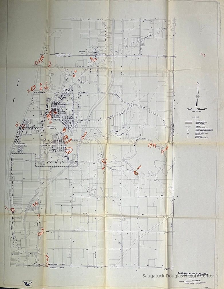
Paper map by Williams & Works, Inc. of Grand Rapids. P-82682.
Map area bound by 138th Street on the north, Lake Michigan on the west, M-89 on the south and 60th street on east.Context
The map shows the state of roads and residential, farm, commercial and industrial development in 1975 plus the routes of Tannery, Orchard and Moores/Goshorn Creek and contours of Silver Lake and Tyler Bayou. Land parcels are indicated by not identified.Collection
MapsCataloged By
Winthers, SallyAcquisition
Accession
2022.97Source or Donor
Wolbrink, Janet (Bogart) 1923-2016, Wolbrink, Robert B. Sr. 1923-1996Map Details
Scale
1 inch = 1000 feetDate Published
Jun 1975Location
Drawer
Flat Files drawer 13 MI and Allegan mapsCreate Date
January 18, 2023Update Date
July 23, 2023