Name/Title
Ox-Bow mapsEntry/Object ID
2023.10.420Description
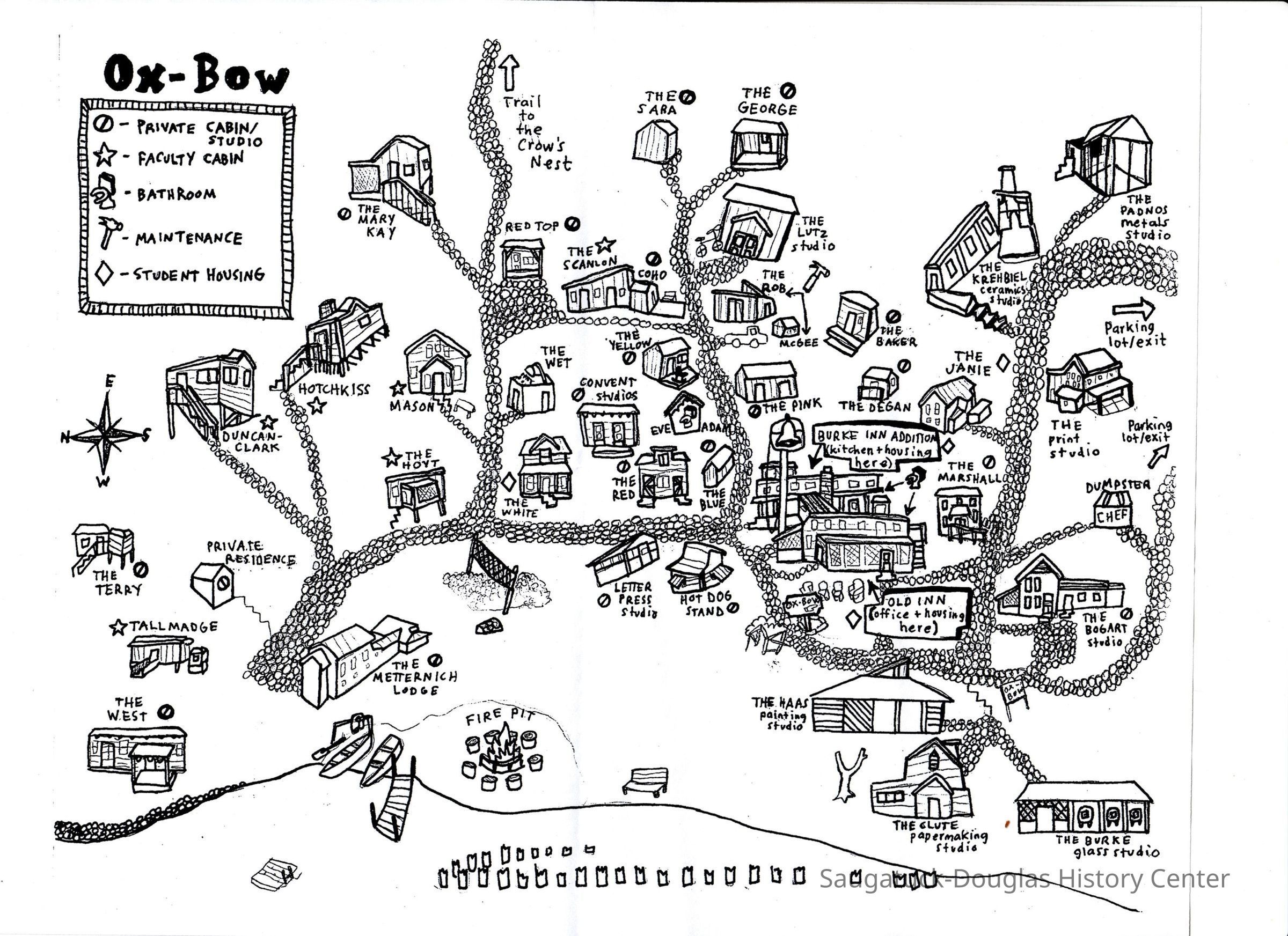
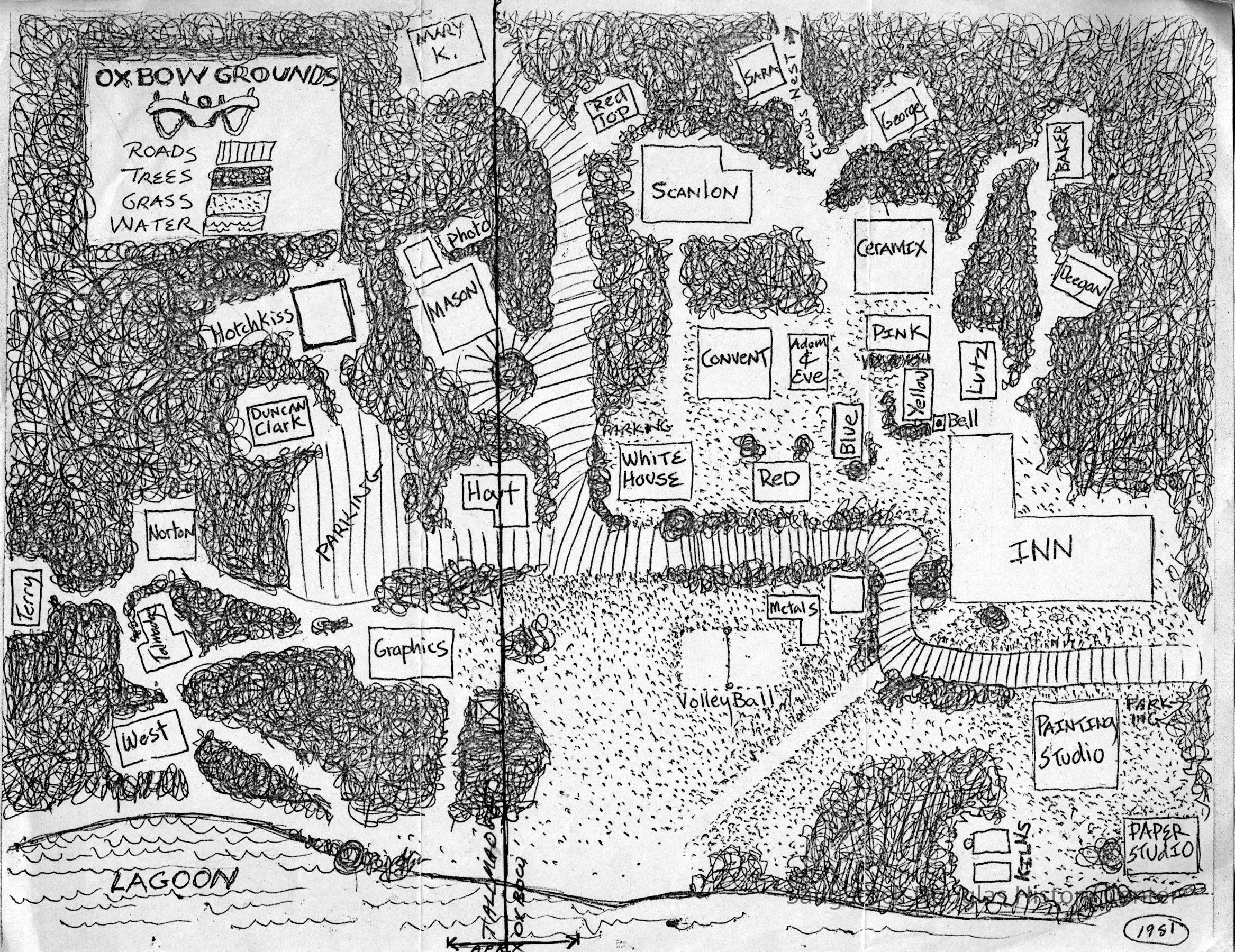
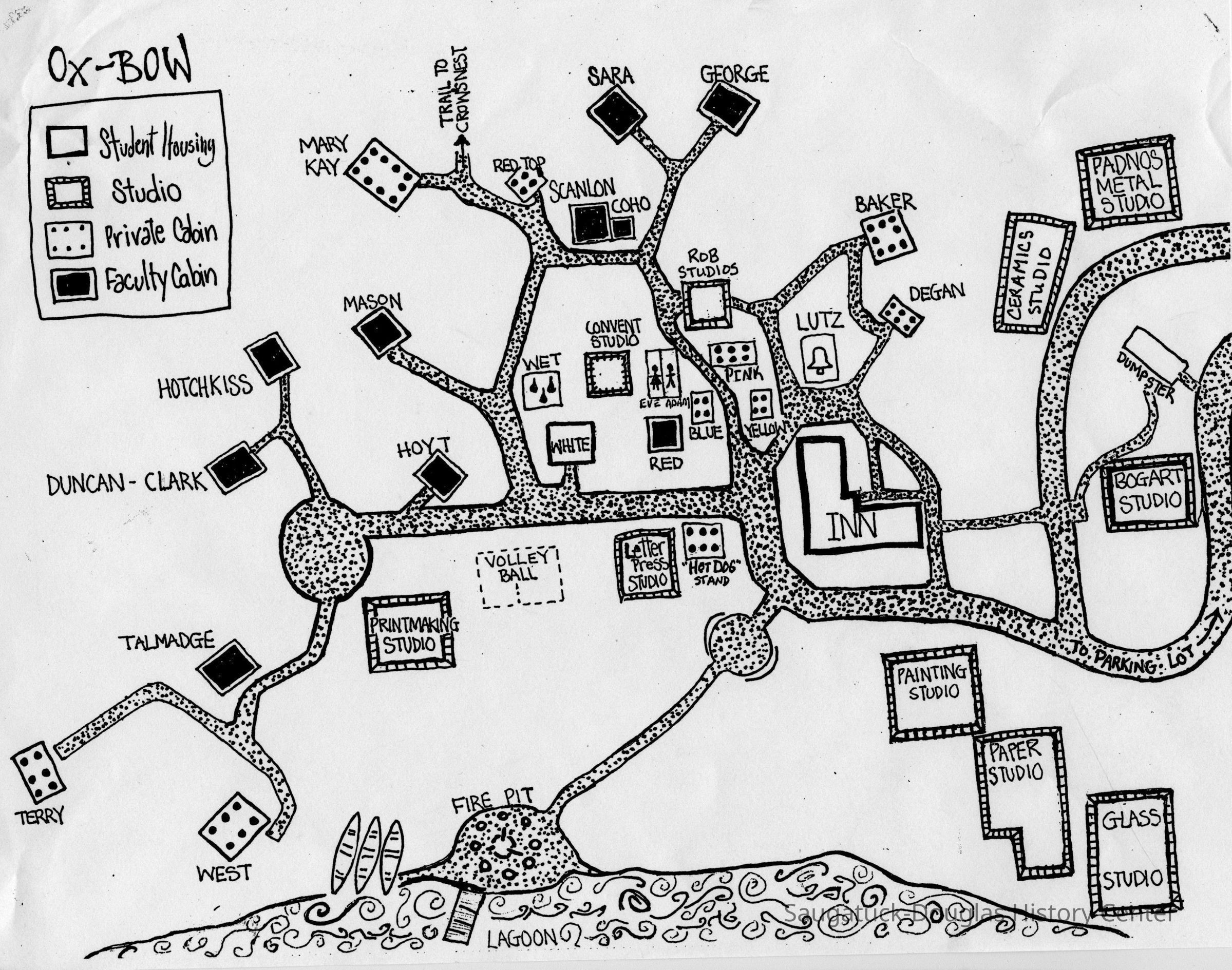
Digital images of the photocopied maps given to visitors and students to help them navigate the Ox-bow campus. One map drawn by Judy Anthrop includes mini-drawings of the buildings.
The images were collected by Jack Sheridan, many for use in Judy Anthrop's book about Ox-Bow and SDHC presentations about the art school.Photograph Details
Type of Photograph
Digital scanSubject Person or Organization
Ox-Bow/Summer School of Art, Tallmadge Cottage at Ox-Bow, Ox-Bow Inn/Riverside Hotel/Shriver family home, Norton Ox-Bow CottageContext
Identifies locations in three different eras of the West, Terry, Talmadge/Tallmadge, Duncan-Clark, Hotchkiss, Mason, Hoyt, Mary Kay, Red Top, Scanlon, Coho, Sara, George, Red, Blue, Pink, Yellow, McGee, Baker, Marshall, Hot Dog Stand and Degan cabins; the Printmaking, Letterpress, Convent, Rob, Lutz, Haas Painting, Clute Papermaking, Burke Glass, Bogart, Krehbiel Ceramics, Print, Graphics and Padnos Metal studios; the Janie and the Old Inn student housing; the lagoon, dock, pergola, meadow, kilns, bell, fire pit, volleyball court, Adan and Eve restrooms, Wet shower house, the Chef dumpster, parking lot, trails and roads.Collection
Pixels only, 1910 Ox-BowCataloged By
Winthers, SallyAcquisition
Accession
2023.10Acquisition Method
Found in CollectionLocation
* Untyped Location
Digital data in CatalogItGeneral Notes
Note
These image(s) were copied from the SDHC photo blog [or the Jack Sheridan drive if that was a superior version] in preparation for updating the SDHC website in 2023. The location of an original or printed version of these photos was unknown at the time of cataloging.Create Date
September 20, 2025Update Date
October 3, 2025