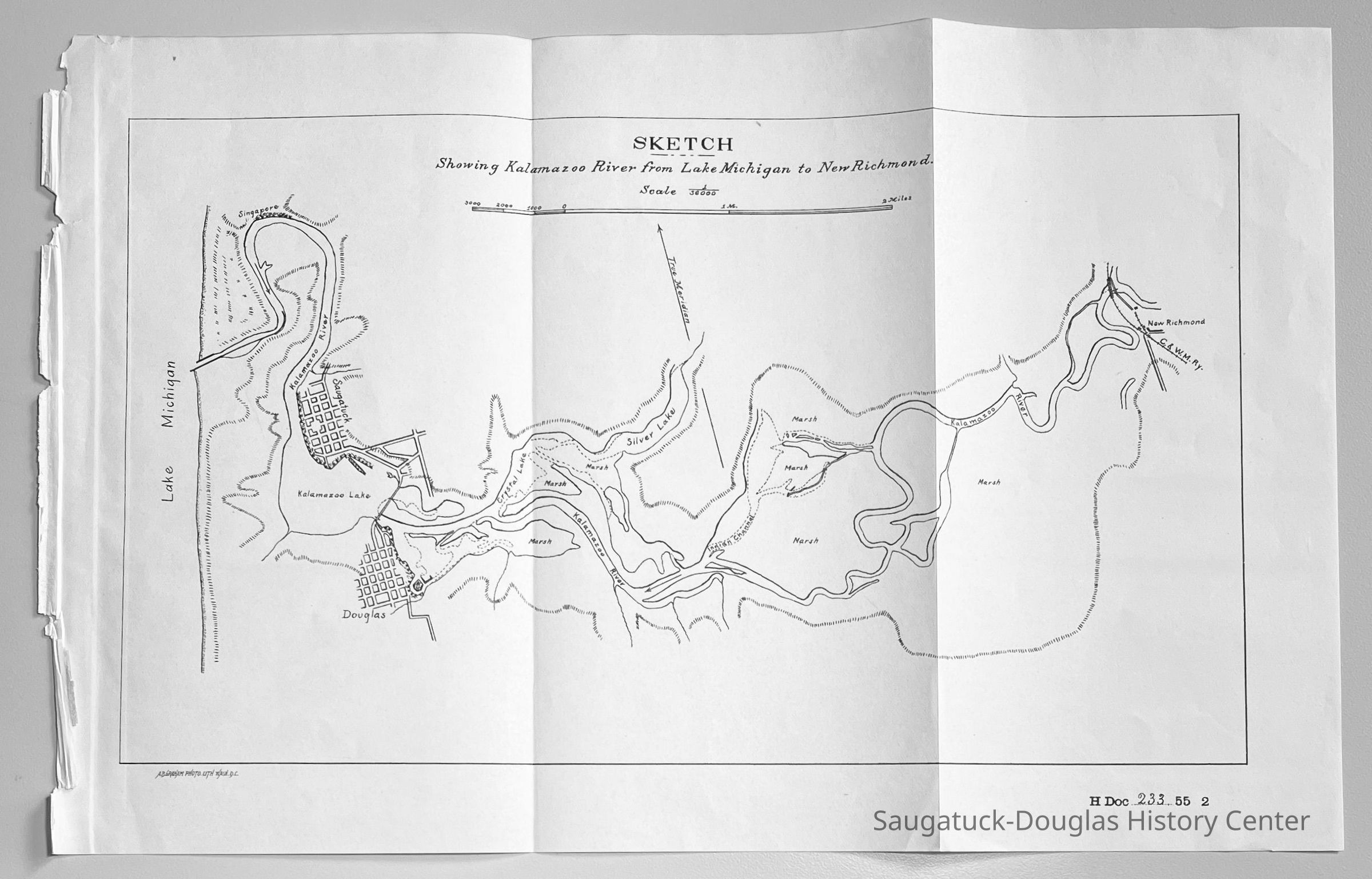
Name/Title
Kalamazoo River from Lake to New RichmondEntry/Object ID
2024.38.01Description
Paper map torn from the Government Printing Office for the 2nd Session of the 55th Congress, 1897-1898 that includes Singapore, Saugatuck flats, Douglas, Crystal Lake, Silver Lake, Indian Channel [Indian Cut], New Richmond bridge, the C. & N.W. Railroad, extensive marshland and the True Meridian. Labeled "A.B. Graham Photo Lith Wash. D.C." on lower left corner.
Printed black ink on beige paper. Blank back.
Landmarks visible but unlabeled include the H.B. Moore docks on the southeast edge of Douglas and the boom into Lake Kalamazoo from Saugatuck.Context
Singapore is shown as a thin layer of development on the river bank. The hill in Saugatuck has yet to be platted.Collection
Maps, 0000 Geology, Transportation: water, Transporation: Rail - other than InterurbanCataloged By
Winthers, SallyAcquisition
Accession
2024.38Source or Donor
Clark, ChrisAcquisition Method
Donation, unconditionalMap Details
Scale
1/36000Date Published
circa 1897Location
Drawer
Flat Files drawer 11 Local mapsRelationships
Related Person or Organization
Person or Organization
Chicago and West Michigan Railway 1881-1899, New Richmond/Richmond, Bridge, New Richmond Swing and Park, The Boom/Dock Island/Griffin & Henry Lumber Dock, Red Dock/Keewatin Dock/Tower Harbor Village/Eastland/Crawford Trans. Co. Dock, Interurban Railroad 1899-1927, Old Harbor/Channel piers pre-1906/Ox-Bow Lagoon, Saugatuck Harbor Piers/Channel 1906-presentCreate Date
September 6, 2024Update Date
September 10, 2024