Name/Title
Land Use Map, Douglas, 2000Entry/Object ID
2025.01.15Description
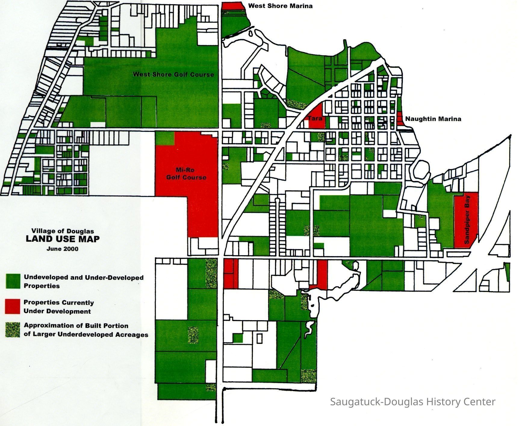
Digital image of Douglas with "undeveloped and underdeveloped" properties marked in green, "properties currently under development" marked in red, and "Approximation of built portion of larger underdeveloped acreages" marked in a speckled green.
Labeled properties included West Shore Marina, West Shore Golf Course, Mi-Ro Golf Course, Tara, Naughtin Marina and Sandpiper Bay.Collection
Development, land, Development, resistance toCataloged By
Winthers, SallyAcquisition
Accession
2025.01Acquisition Method
Found in CollectionNotes
Source of map unknown.Location
* Untyped Location
Digital data in CatalogItRelationships
Related Person or Organization
Person or Organization
West Shore Golf Course 1920-, Isabel's Market & Eatery/NorthernLights/310 BSHwy/Zing/Blue Moon/Mi-Ro, Tara Restaurant/Spencer House/200 Center, Naughtin's Marina - burned 2000s, Sandpiper Bay, West Shore Marine/West Shore Ferry landing/Tisdale Boat LiveryCreate Date
April 9, 2025Update Date
April 9, 2025