Name/Title
Shell station mapEntry/Object ID
2017.38.08Description
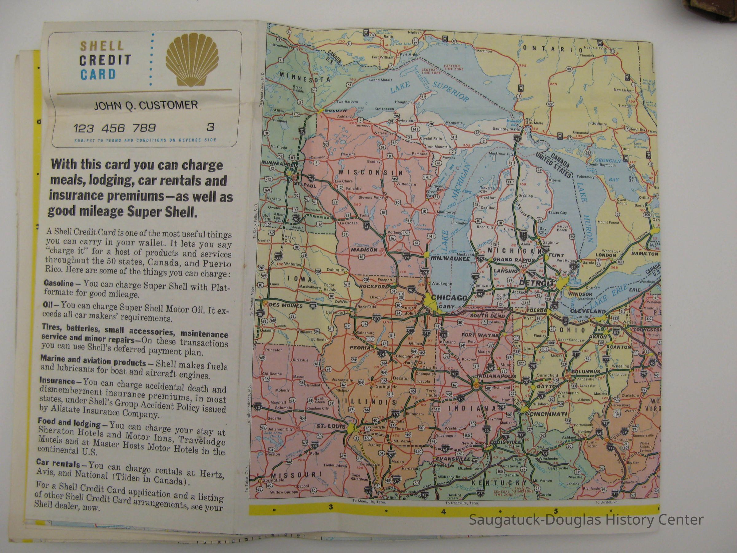
Shell station map of Michigan which shows all the major roadways in the state. The purpose of the map was to provide people with the locations of Shell stations along their route. Saugatuck and Holland are included on the map and there is also a marker for a proposed highway between the two. This indicates that the map dates before 1970, when the highway was built. Most likely that dates the map to around 1969.Collection
MapsCataloged By
Stevens, MeghannAcquisition
Accession
2017.38Source or Donor
Moker, DianneAcquisition Method
DonationLocation
Drawer
Flat Files drawer 13 MI and Allegan mapsCondition
Overall Condition
ExcellentNotes
There is only a slight amount of wear to the map. This is mainly due to age and is only noticeable as fading in the colors on the map.Create Date
July 19, 2018Update Date
July 23, 2023