Name/Title
Mouth of the Kalamazoo River 1844Entry/Object ID
2022.77.09Scope and Content
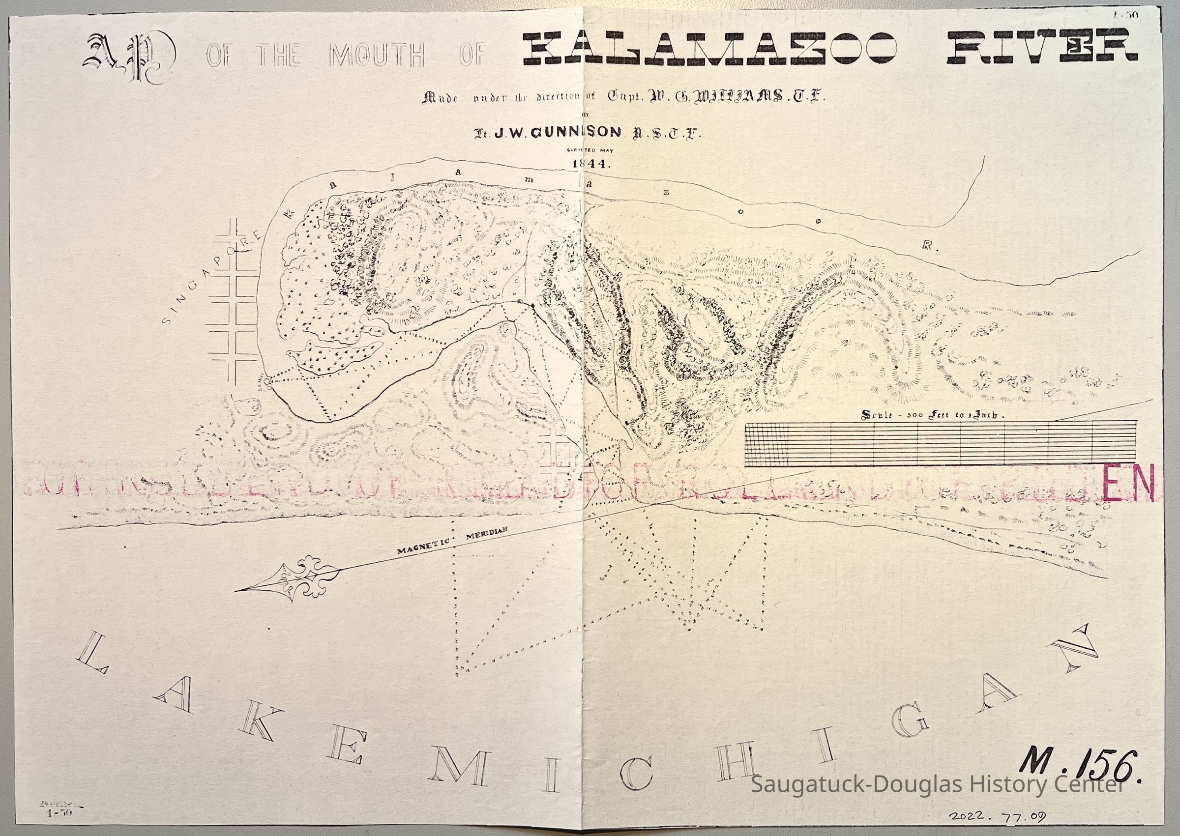
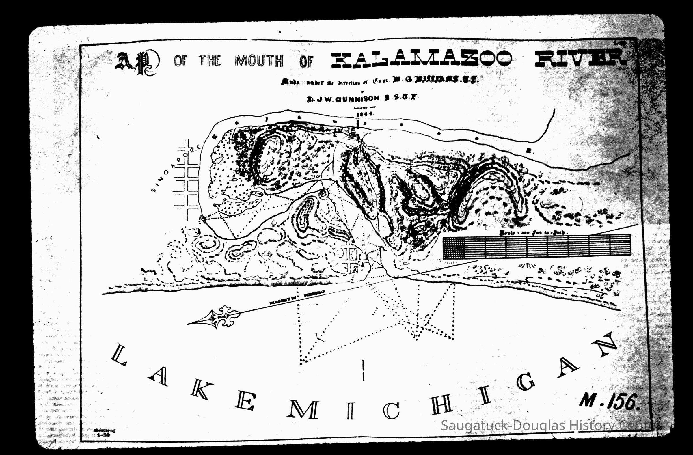
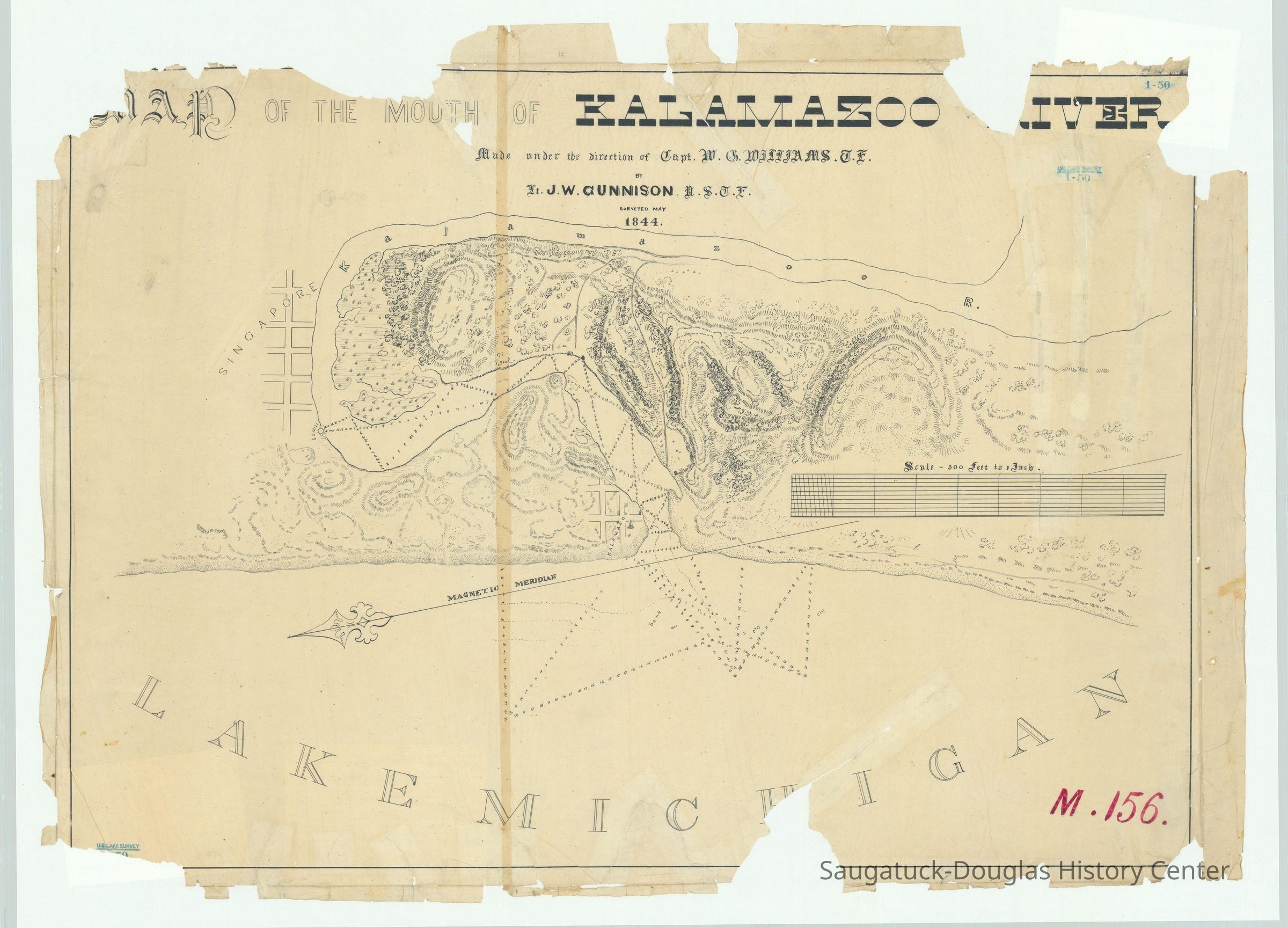
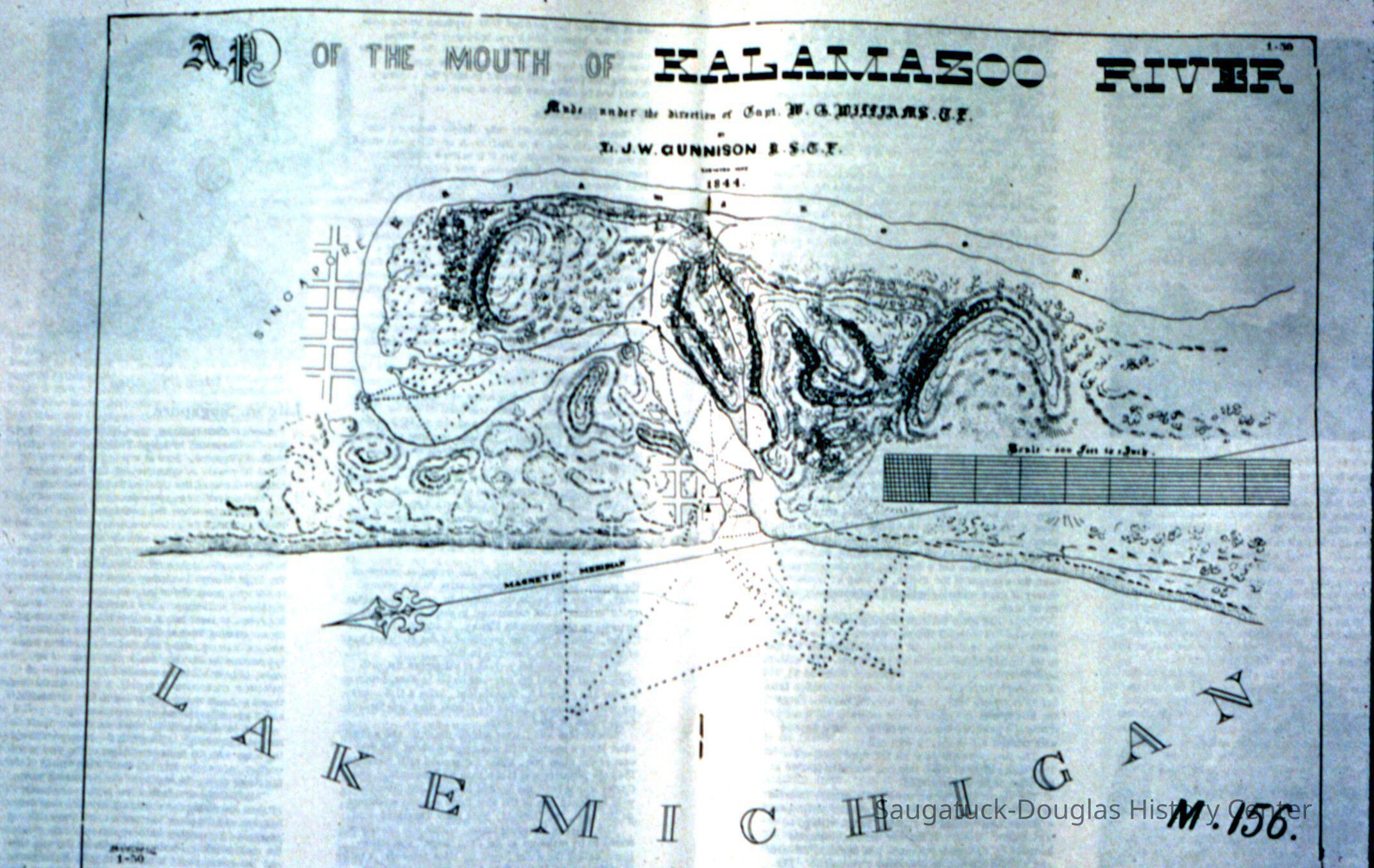
Pale photocopy of a Map of the Mouth of the Kalamazoo River made under the direction of Captain W. ? Williams? by Lt. J.W. Gunnison, surveyed May 1844. The map shows the Lake Michigan shoreline, water depths (that look like dotted lines until examined more closely), the dune contours and trails and the line of the magnetic meridian. Streets are indicted for Singapore and another village at the mouth of the river that is marked "Kalamazoo." Near Singapore a "S S Mill" is indicated with a circle. "M.156" is indicated in the lower right corner.
A pink smudge across the center of the map is an "end of roll" warning from the copy machine paper supply.Context
A very early navigational mapCollection
1830 Settlement, pioneer era, 1836 Singapore, NauticalCataloged By
Winthers, SallyAcquisition
Accession
2022.77Source or Donor
Garner, LynneAcquisition Method
Donation, unconditionalLocation
Drawer
Flat Files drawer 11 Local mapsCreate Date
November 3, 2022Update Date
October 18, 2024