Name/Title
Saugatuck Harbor 1875 MapEntry/Object ID
2022.68.02Description
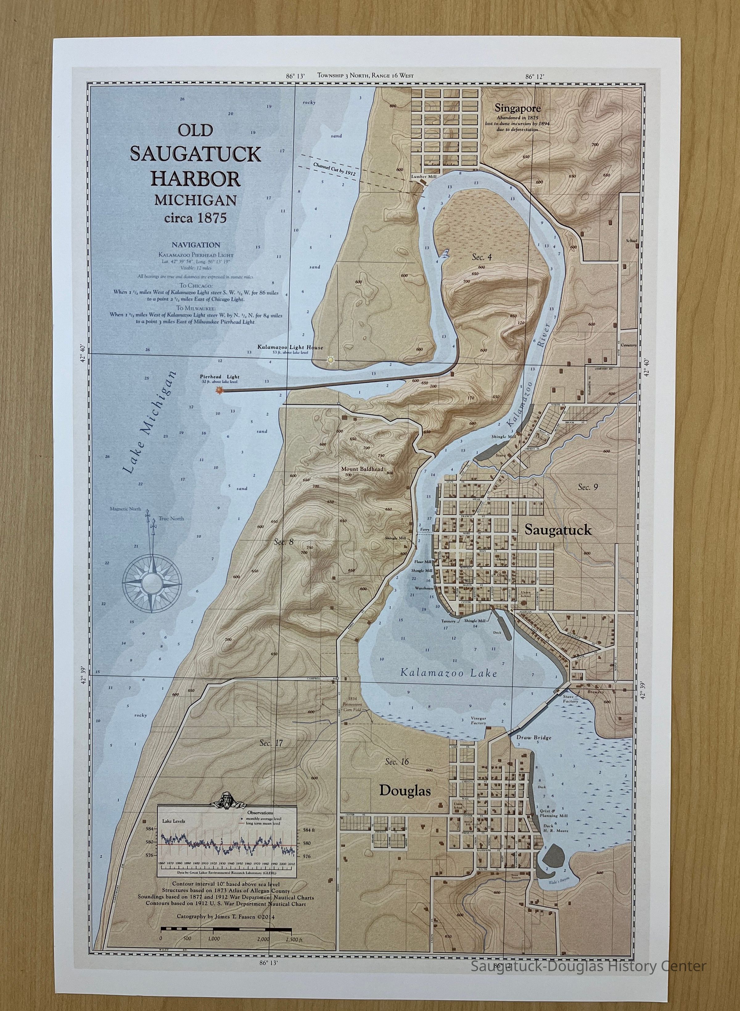
Highly detailed map that shows Saugatuck, Douglas, Singapore and surroundings from the northern boundary of Saugatuck Township to Wiley Road. Map includes the future 1912 channel, land elevations and contours, street names, locations of schools, mills, docks, factories, streams, section numbers, and details of interest like the 1834 Potawatomi Corn Field.
According to the legend in the lower left, the "contour interval 10 feet based above sea level. Structures based on 1873 Atlas of Allegan County [Titus]. Soundings based on 1877 and 1912 War Department Nautical Charts [NOAA]. Contours based on 1912 U.S. War Department Nautical Chart. Cartography by James T. Faasen copyright 2014." The legend also includes a lake water levels scale from 1860 to 2010 from data by Great Lakes Environmental Research Laboratory (GLERL).Context
This is a modern map that combines historical and geographic information.Collection
MapsCataloged By
Winthers, SallyAcquisition
Accession
2022.68Source or Donor
Faasen, James T.Acquisition Method
DonationMap Details
Maker or Creator
Faasen, James T.Location
Drawer
Flat Files drawer 11 Local mapsRelationships
Related Person or Organization
Person or Organization
Faasen, James T.Related Places
Place
City
Singapore, Michigan 1837-1875Create Date
May 13, 2024Update Date
July 15, 2025