Name/Title
Lakeshore Map 1913 by OgleEntry/Object ID
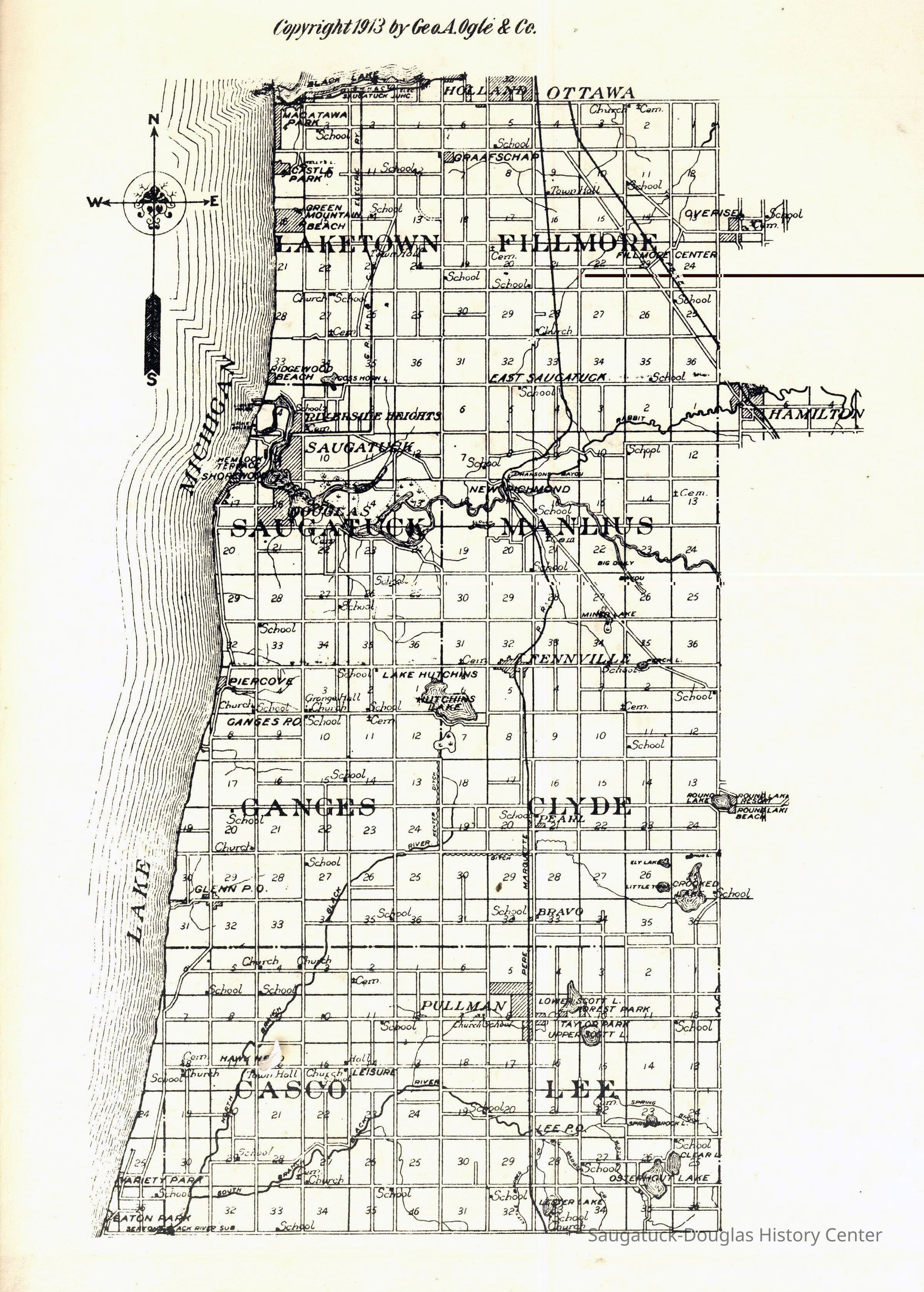
2023.10.65Description
The map has a copyright 1913 by Geo. A. Ogle & Co. The map's coverage is bordered by Black Lake (Macatawa) and 32nd Street to the North and Baseline Road (North of South Haven) to the South.
The map includes section numbers, rivers, marshes, town names, railroad tracks and symbols for school, church, town hall, post office and cemetery locations.
Places indicated include Macatawa Park, Holland, Castle Park, Green Mountain Beach, Graafschap, Overisel, Filmore Center, Ridgewood Beach, Gosh Horn [Goshorn], East Saugatuck, Hamilton, Riverside Heights, Hanson Bayou, Rabbit River, Hemlock Terrace, Shorewood, New Richmond, Piercove, Gennville, Hutchins Lake, Round Lake, Ely Lake, Crooked Lake, Little Tom Lake, Bravo, Glenn, Pullman, Leisure, Hawk Head, Lower Scott L. Forest Park, Taylor Park, Scott Lake, Clear, Osterhout Lake, Lester Lake, Variety Park, Easton Park.Collection
MapsCataloged By
Winthers, SallyAcquisition
Accession
2023.10Acquisition Method
Found in CollectionLocation
* Untyped Location
Digital data in CatalogItGeneral Notes
Note
This map was copied from the SDHC website in preparation for updating the SDHC website in 2023. The location of an original or printed version of this map was unknown at the time of cataloging.Create Date
April 26, 2023Update Date
November 18, 2023