Name/Title
Singapore Plat Map, 1830sEntry/Object ID
2024.04.123Description
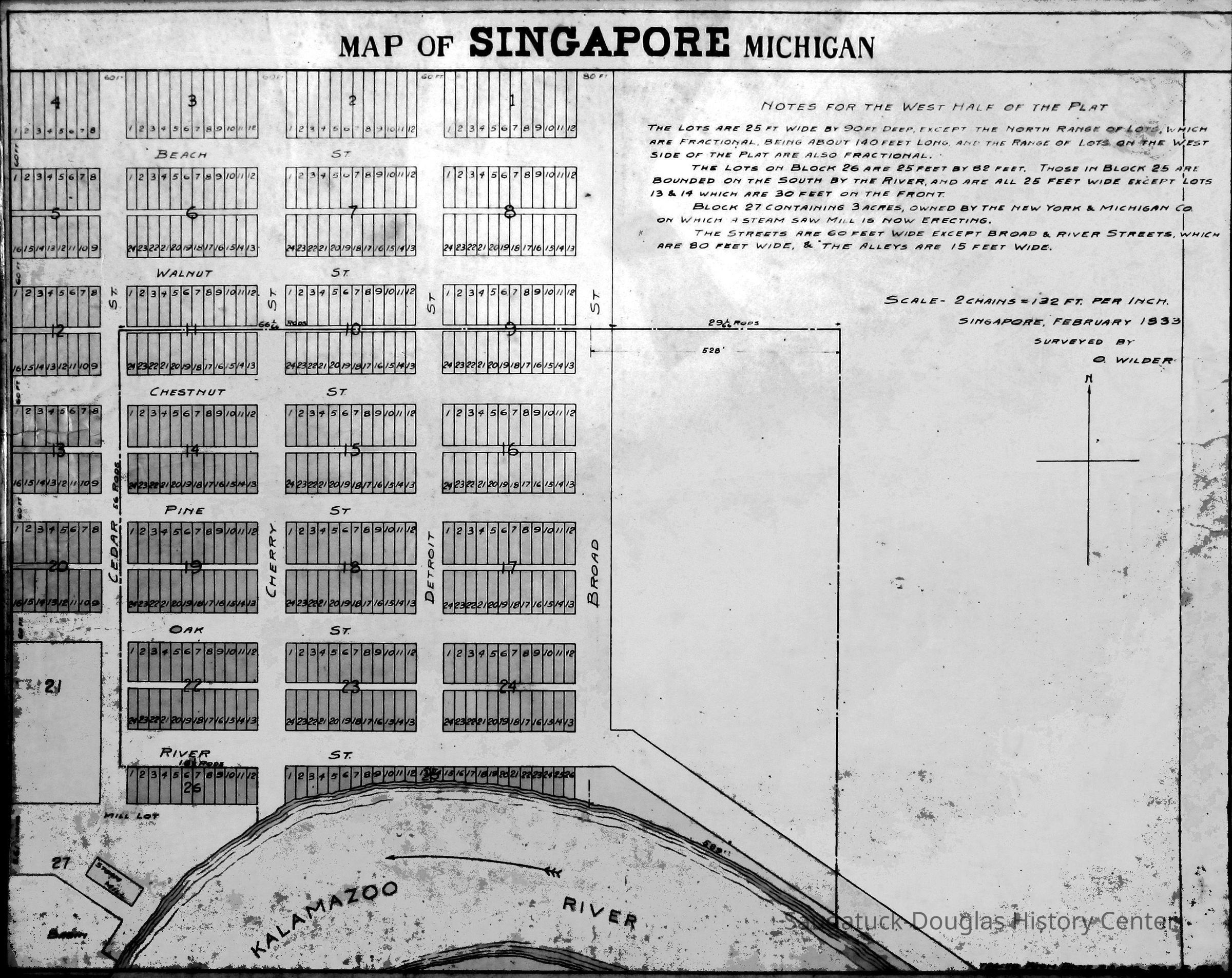
Plat map of Singapore, Michigan found on a CD donated to the SDHC by Dr. James Schmiechen. Source of the map is unknown. The plat shows the curve of the Kalamazoo River along the south edge of 28 blocks of property and ten names streets. The notes section indicates the lot sizes and that the scale is "2 chains = 132 ft. per inch, Singapore 1833 [or 1838], Surveyed by O. Wilder"Context
An aspirational rendering of properties in Singapore.Collection
1836 Singapore, Development, land, 1830 Settlement, pioneer era, 1835 Logging and LumberingCataloged By
Winthers, SallyAcquisition
Accession
2024.04Acquisition Method
Found in CollectionLocation
* Untyped Location
Digital data in CatalogItRelationships
Related Person or Organization
Person or Organization
Wilder, Oshea, Port Kalamazoo (before 1836)Related Places
Place
City
Singapore, Michigan 1837-1875Research Notes
Person
Clark, ChrisDate
Dec 1, 2024Notes
Wilder's company purchased the land in December 1836.
The plat was registered on February 5, 1838.
Whoever made the map probably meant 1838 instead of 1833.Person
Faasen, James T.Date
Dec 2, 2024Notes
The date on that map might be significant and not just written off as a typo to support an established narrative.
Tillitson and Carlos Barnes first acquired the land from the government, and that was not recorded in Washington until 1835, but who knows when they purchased it at the land office at White Pigeon. Judging from Butler’s letters, there is almost a two-year delay in that process.
To my understanding, Wilder never owned the property but did survey it and set up the plat map. He may have been the on-site manager and ran a bank and store there in 1838, but he never owned it.
In addition, there is that 1837 news article about that steamboat ride up the Kalamazoo River. Doesn’t that mention Col. Wilder building a Hotel there and planning to build a sawmill soon?
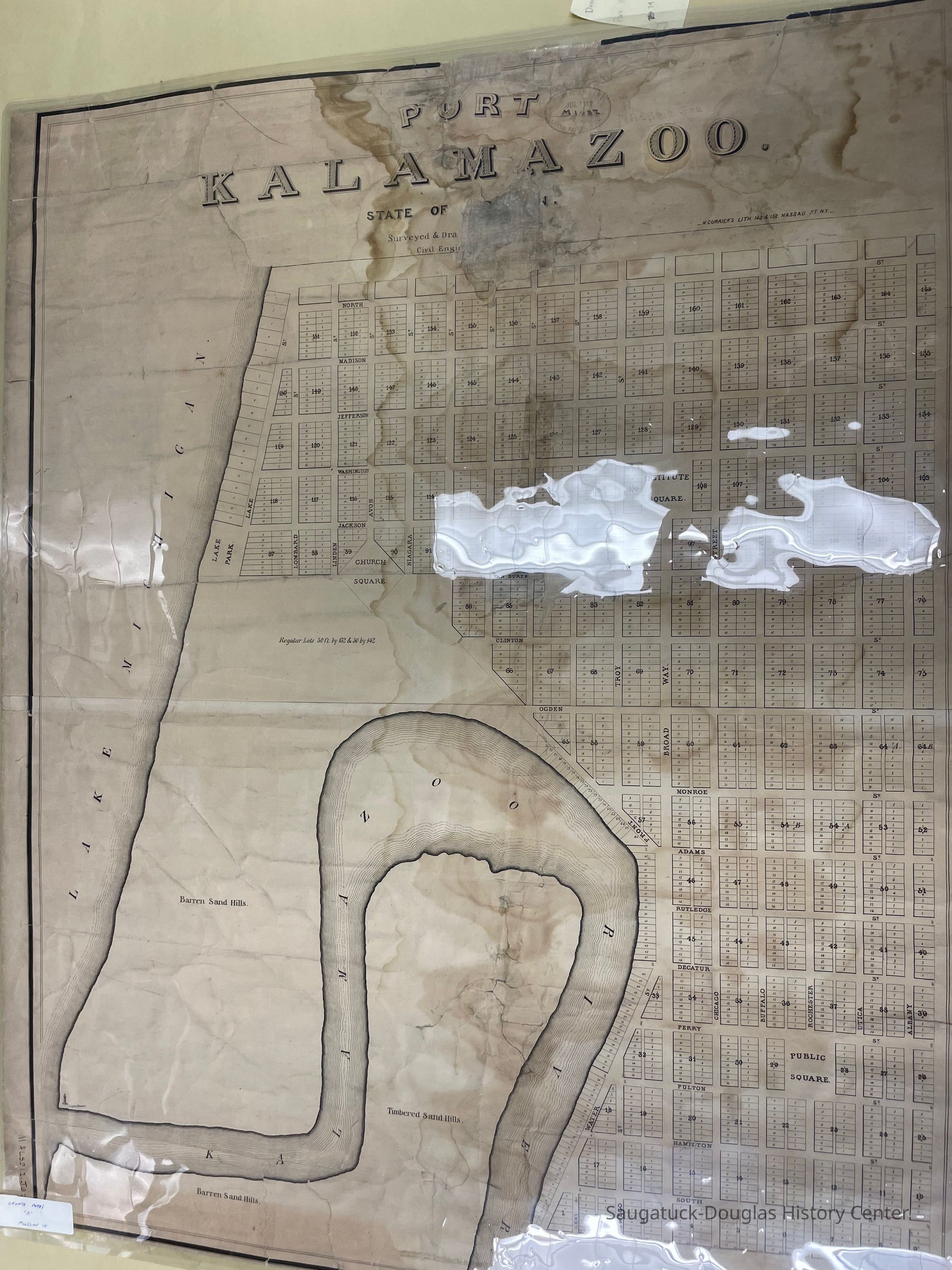
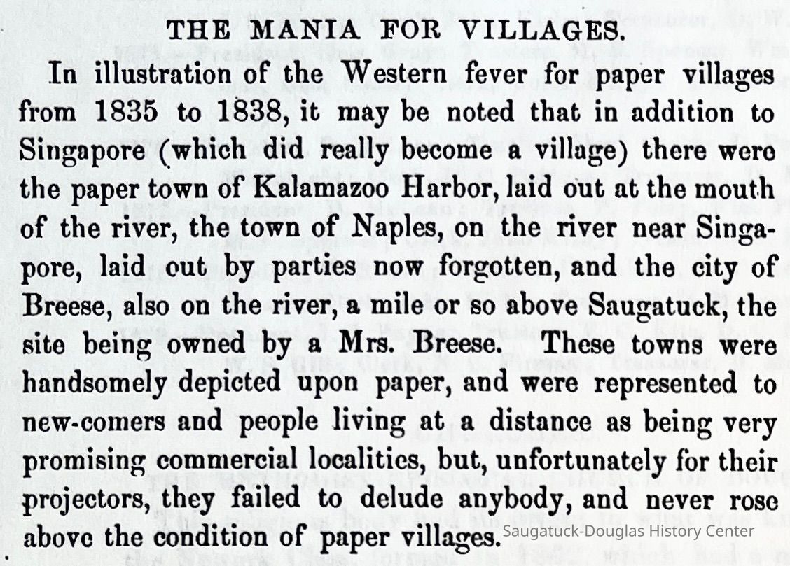
I haven’t platted it out yet, but that circa 1835 paper town of Port Kalamazoo might match up well to a preexisting plat of Singapore and Kalamazoo Harbor as well
No, I would think that the 1833 date on the Singapore map might be plausible. Remember 200 pages of deeds are missing in Kalamazoo records from about Jan 1835 to Dec 1835. I figure that’s about 150 missing deeds and recorded agreements and all would be a year or two old.
I think there might be a lot more going on at Kalamazoo Harbor, Shriver’s Bend, and Singapore in those early years than is stated in traditional understandings of the development of Saugatuck.Create Date
November 30, 2024Update Date
August 15, 2025