Name/Title
Kalamazoo Lake and Sewer Authority 2011 Water Reliability StudyEntry/Object ID
2023.12.01Scope and Content
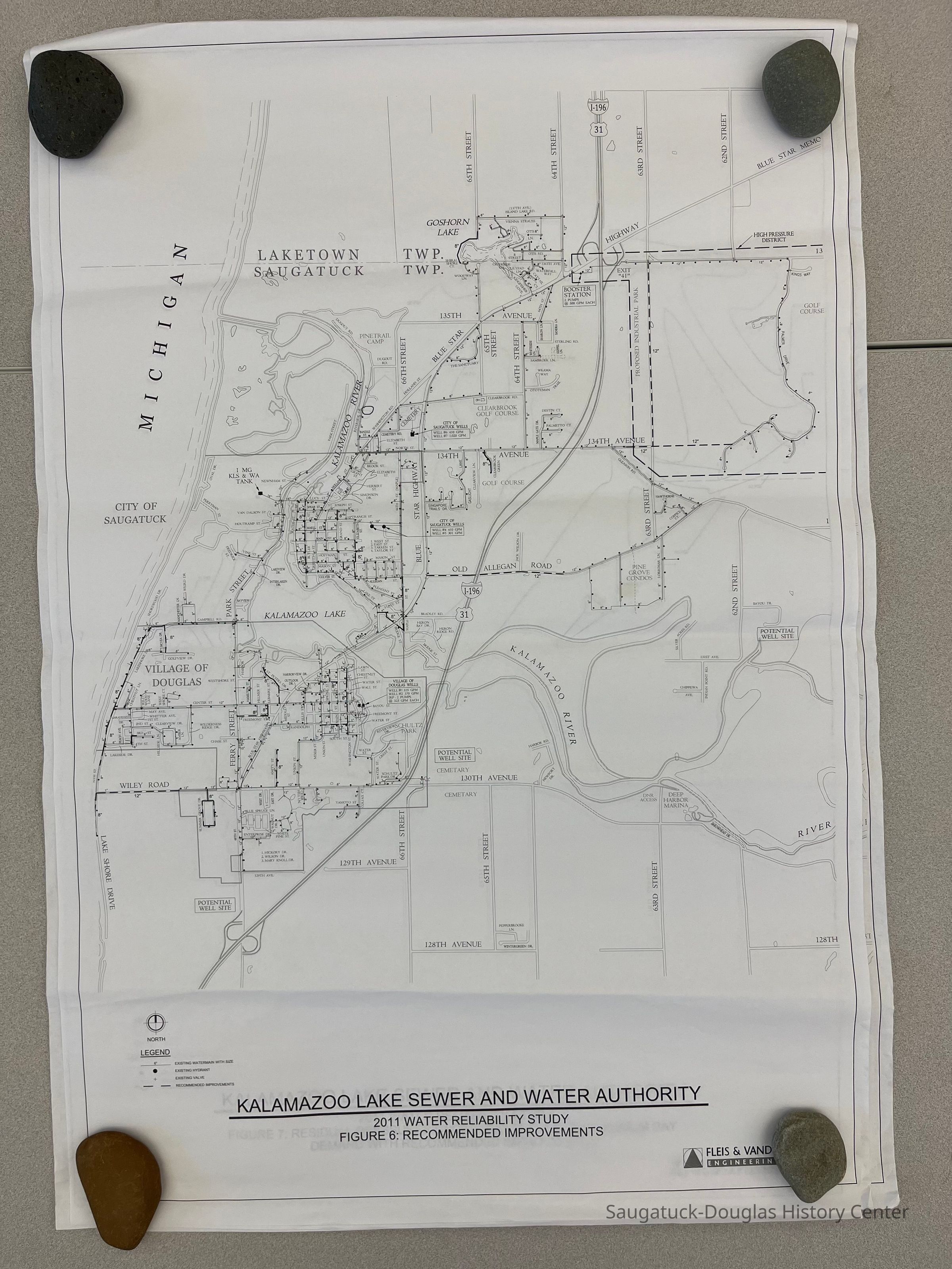
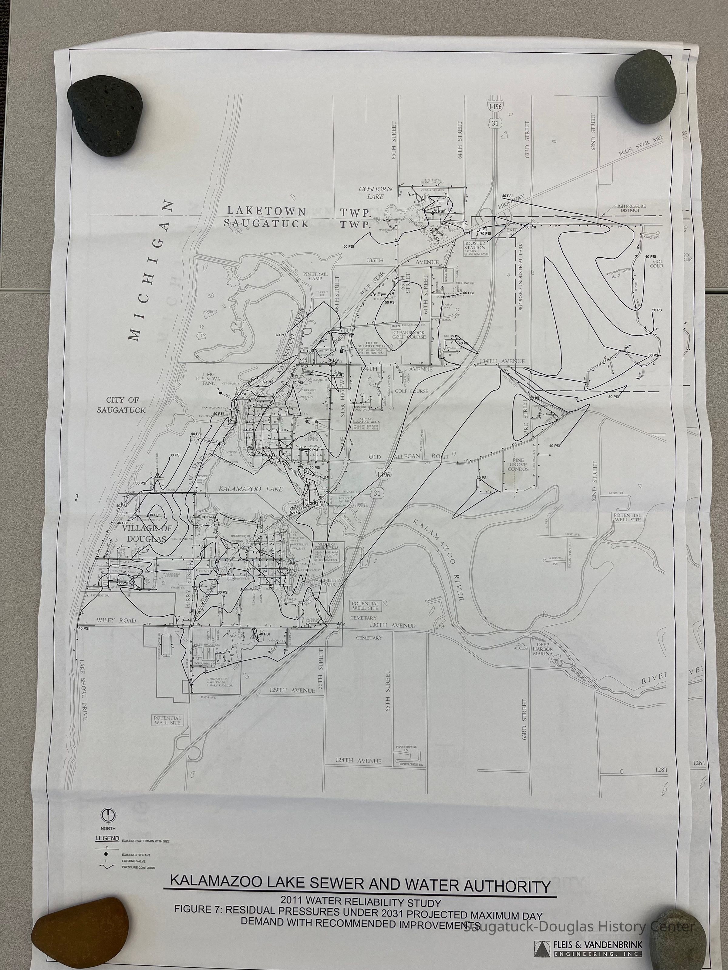
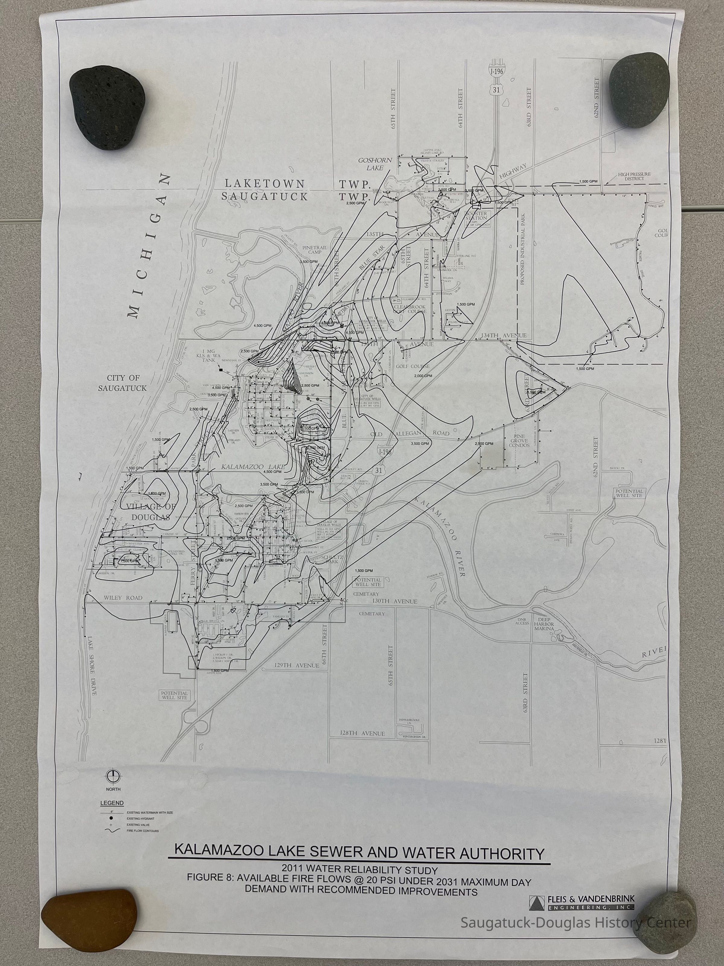
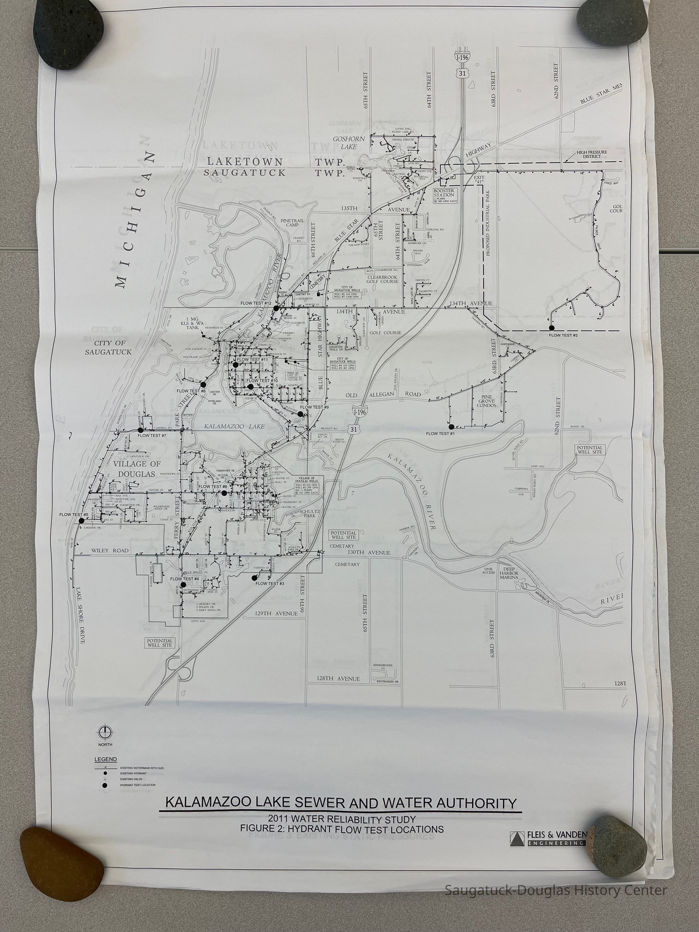
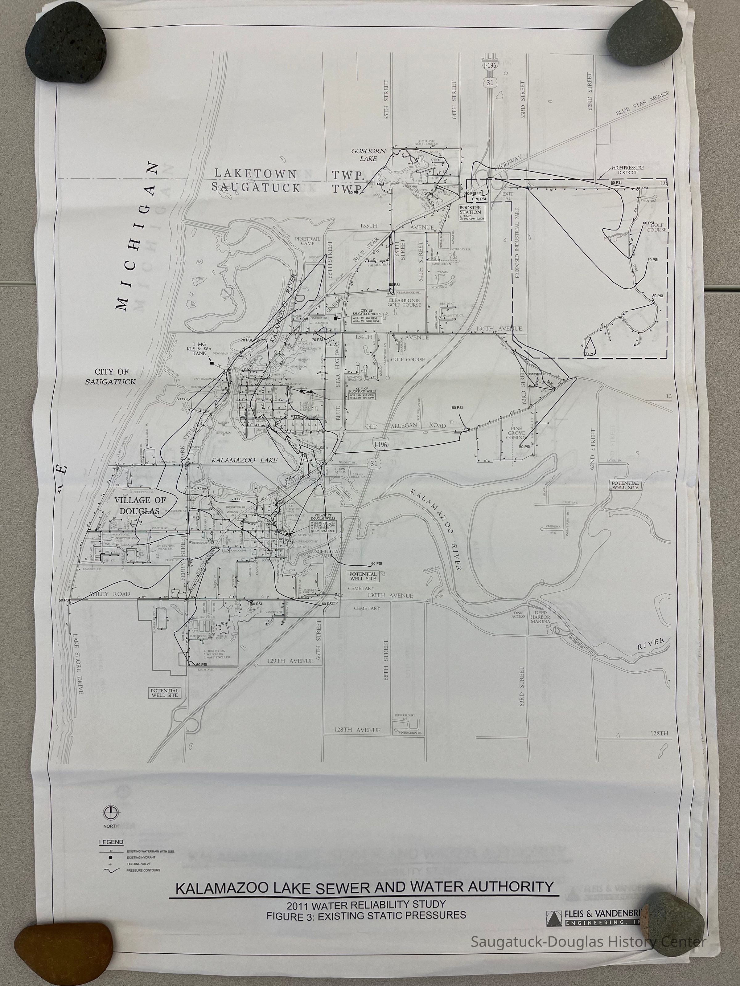
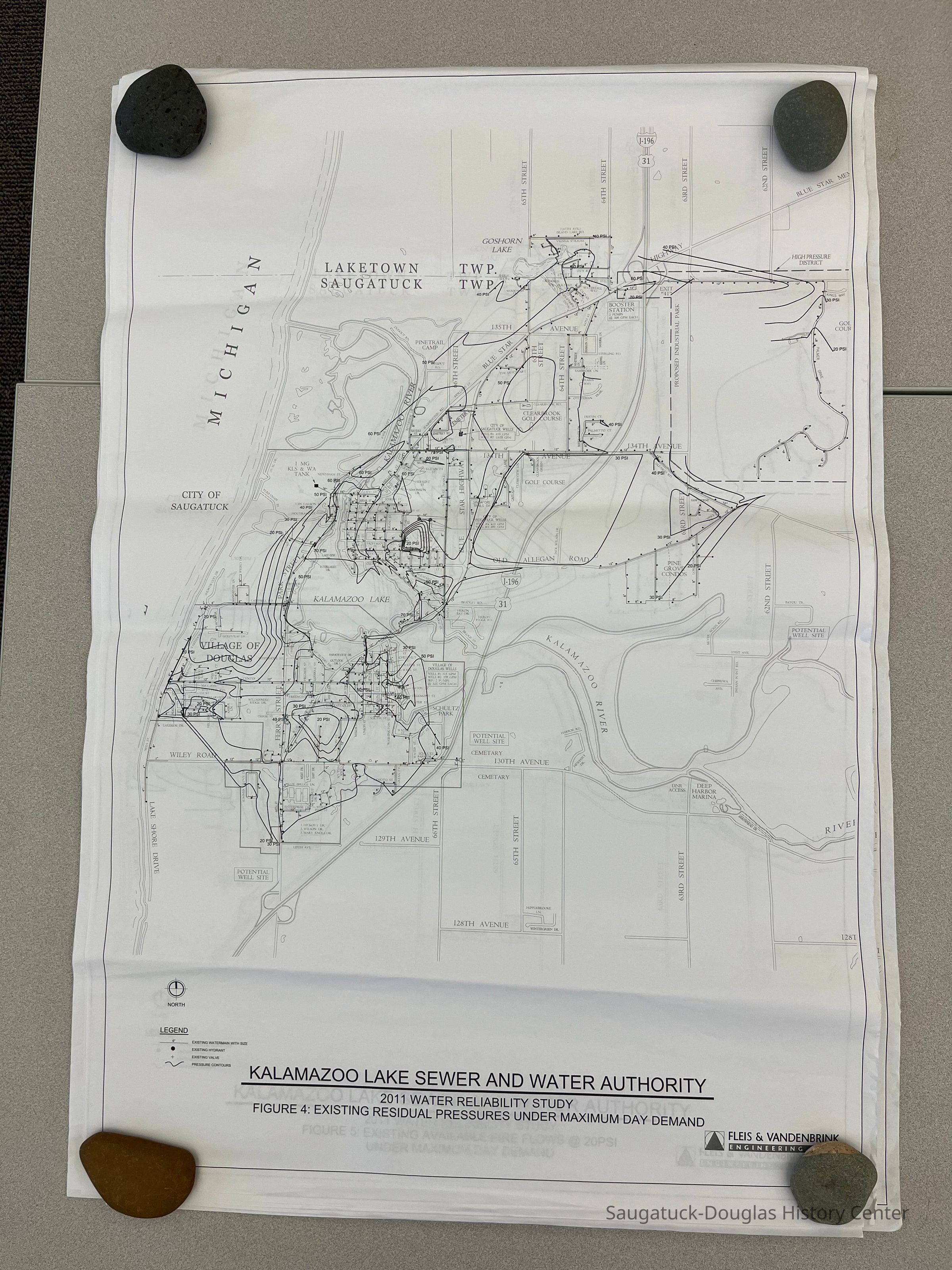
Eight large prints on paper used as documentation for the Kalamazoo Lake Sewer and Water Authority for a 2011 Water Reliability Study. Drawings by Fleis & Vandenbrink Engineering, Inc., #809570-1 thru 8. The map-like drawings cover Saugatuck Township from Lake Michigan to 62nd Street and from the 128th Street to the Township's northern border. The drawings indicate the diameter of water mains, hydrant locations, hydrant test locations, street and highway with names, current and potential well sites, water pressure contours, fire flow contours, recommended improvements and site of a proposed industrial park with a high-pressure district at the SE corner of the Blue Star Highway and 63rd Street.Context
The documents give a detailed overview of the water system in 2011.Cataloged By
Winthers, SallyAcquisition
Accession
2023.12Source or Donor
Royce, Frederick EagleAcquisition Method
Donation, unconditionalLexicon
Search Terms
Public Utilities, Development, Resource management, Civil Engineering, resource management, engineering study, capacity, projected needsLocation
Drawer
Flat Files drawer 05 plansCondition
Overall Condition
Very GoodCreate Date
March 20, 2023Update Date
July 23, 2023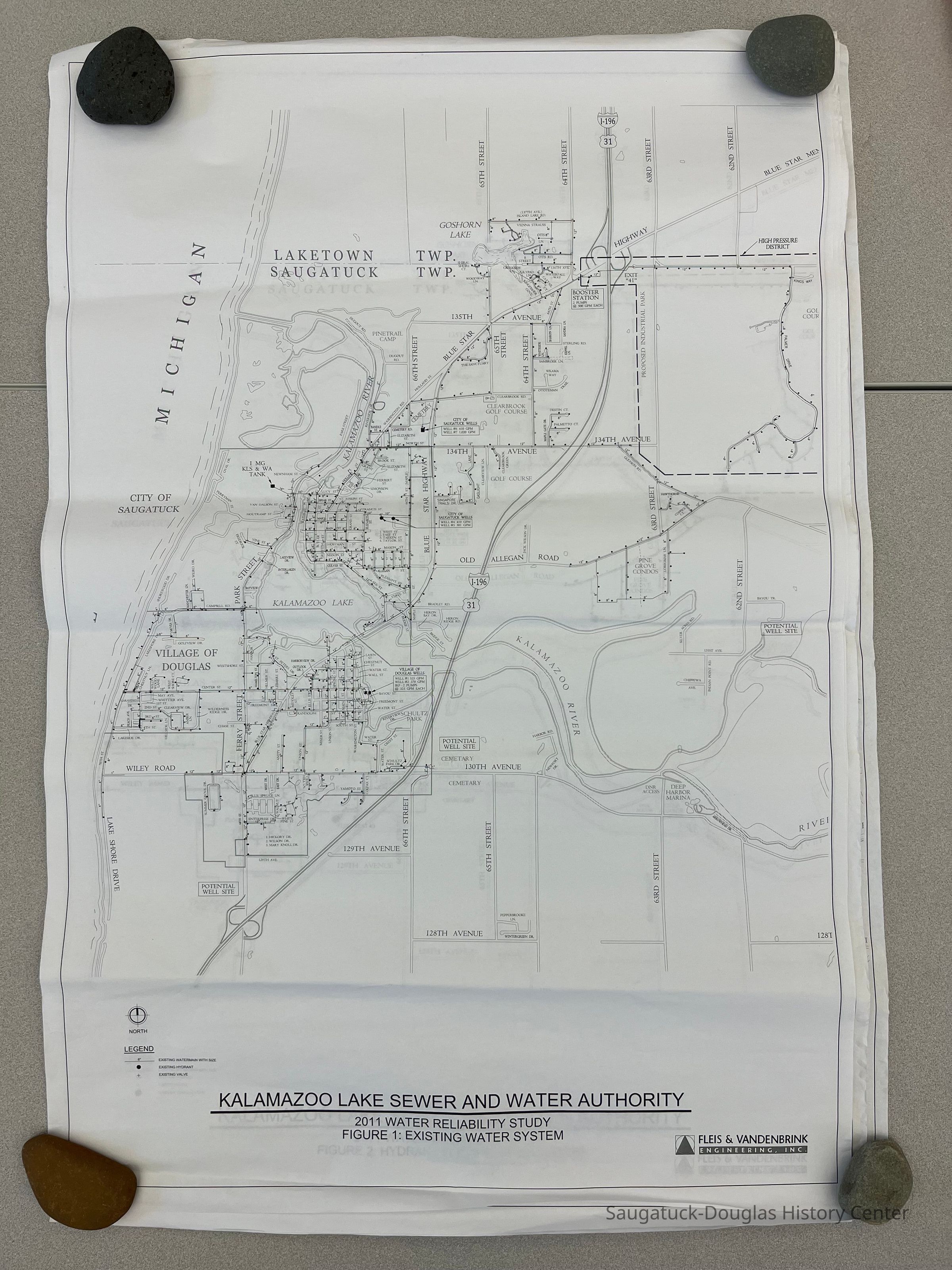
![Figure 5 Existing Available Fire Flows at 20 PSI [pounds per square inch]](https://d8e7jbdw4fu0e.cloudfront.net/4124/61b49b51-c7ce-11ed-80bc-01e2531d7396-v0m9GfH.lg@2x.jpg)