Name/Title
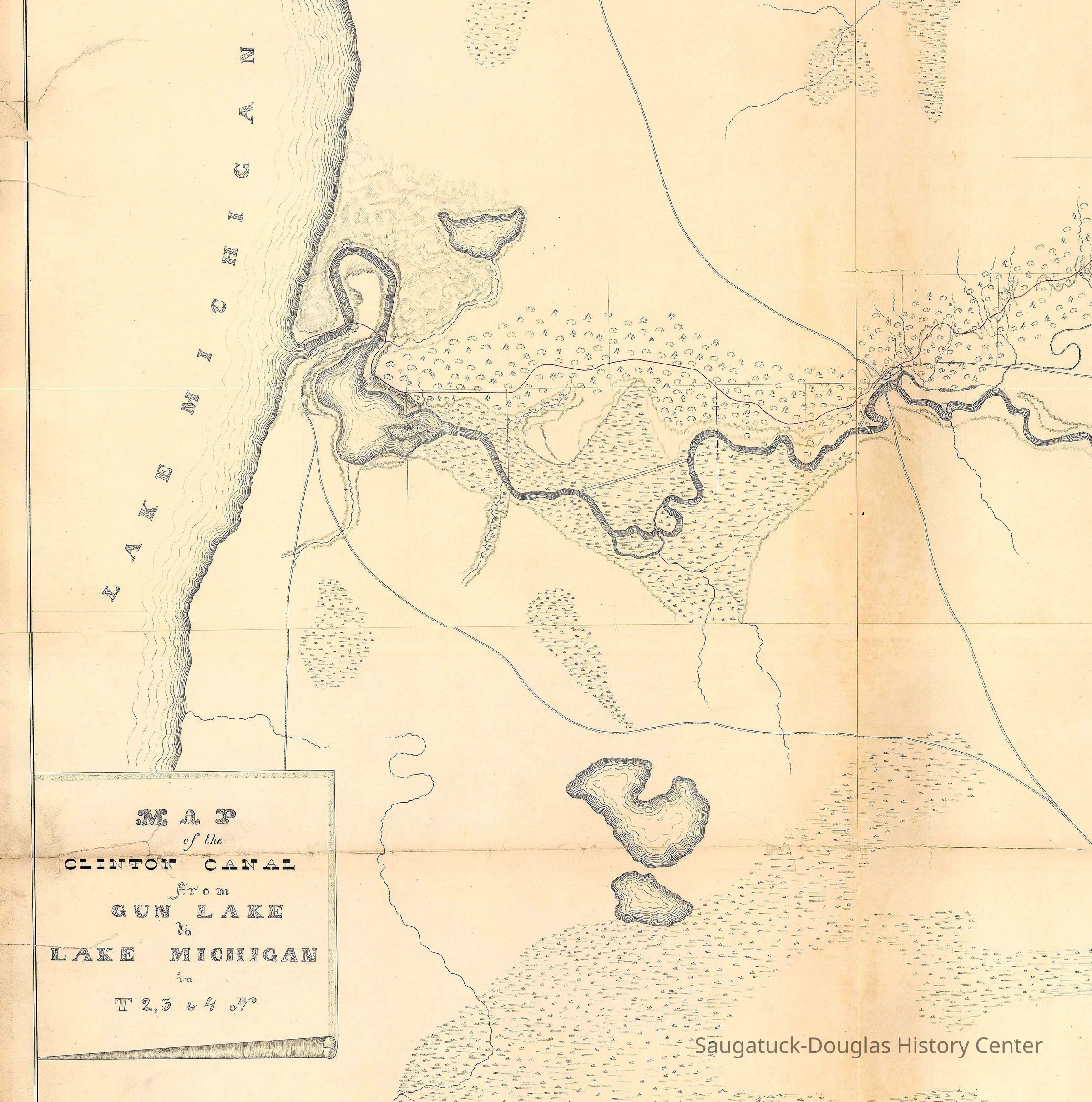
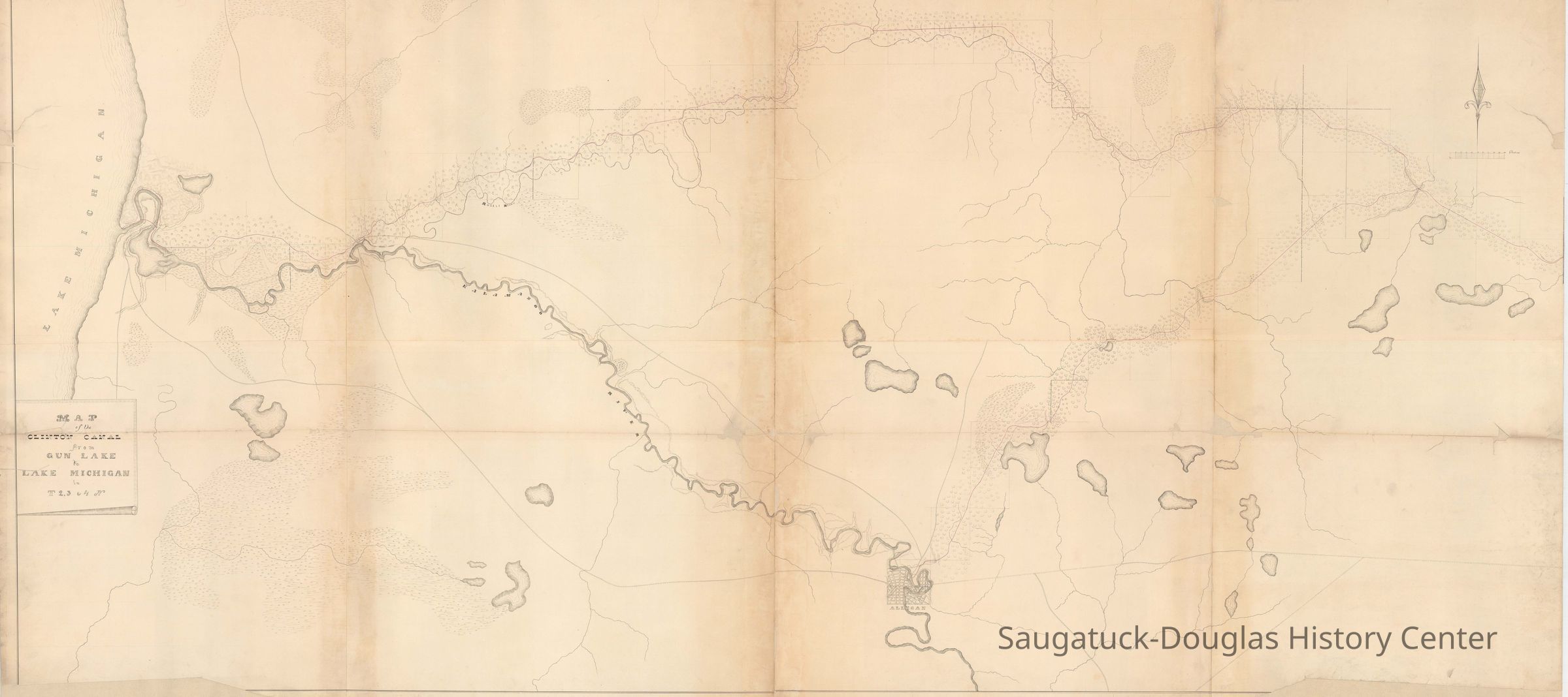
Clinton-Kalamazoo Canal map 1837Entry/Object ID
2024.42.02Description
Digital scan of hand drawn map of the Kalamazoo River meanderings.Context
This map illustrated a proposed canal that was never completed.
The success of the Erie Canal inspired early Michigan politicians and entrepreneurs to build a canal that would bisect the lower peninsula to create a safer route for travel and commerce than sailing on the Great Lakes.
The proposed 216-mile Clinton-Kalamazoo Canal was to run from Lake St. Clair up the Clinton River, near modern-day Mount Clemens, and west to the Kalamazoo River.
Proposed by Governor Mason in 1837, construction began in 1838 but the project was abandoned in 1843 after only 13 miles had been completed.
Nevertheless, the prospect that a canal was in the works, drew the attention of 1830s land speculators to many points along the Kalamazoo and probably inspired the invention of the paper city of Breese.Collection
Transportation: water, Maps, 1830 Settlement, pioneer eraCataloged By
Winthers, SallyAcquisition
Accession
2024.42Source or Donor
Clark, ChrisAcquisition Method
Donation, unconditionalNotes
Sent via email by Chris Clark, Oct. 2024. Please contact the Archives of Michigan for permission to publish.Location
* Untyped Location
Digital data in CatalogItRelationships
Related Person or Organization
Person or Organization
Old Harbor/Channel piers pre-1906/Ox-Bow Lagoon, Indian Point, Gerber's Landing/Peach Tree Landing/BreeseGeneral Notes
Note
"I believe the canal map is from 1837, in spite of what the web page says [1839]. It’s part of a set where the title page says the surveys were done in 1837." -- Chris ClarkCreate Date
October 5, 2024Update Date
October 5, 2024