Name/Title
Kalamazoo River survey 1895Entry/Object ID
2024.42.01Description
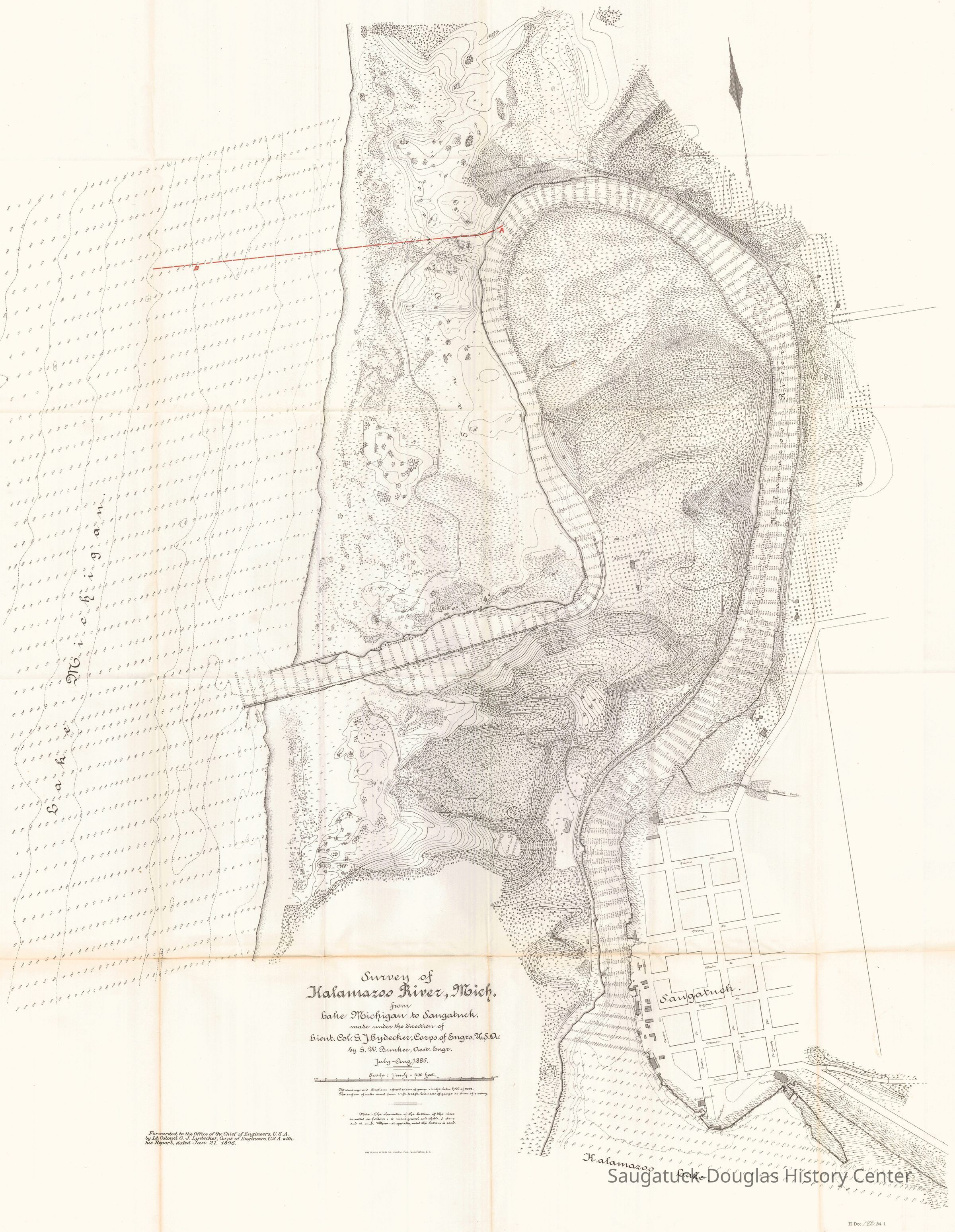
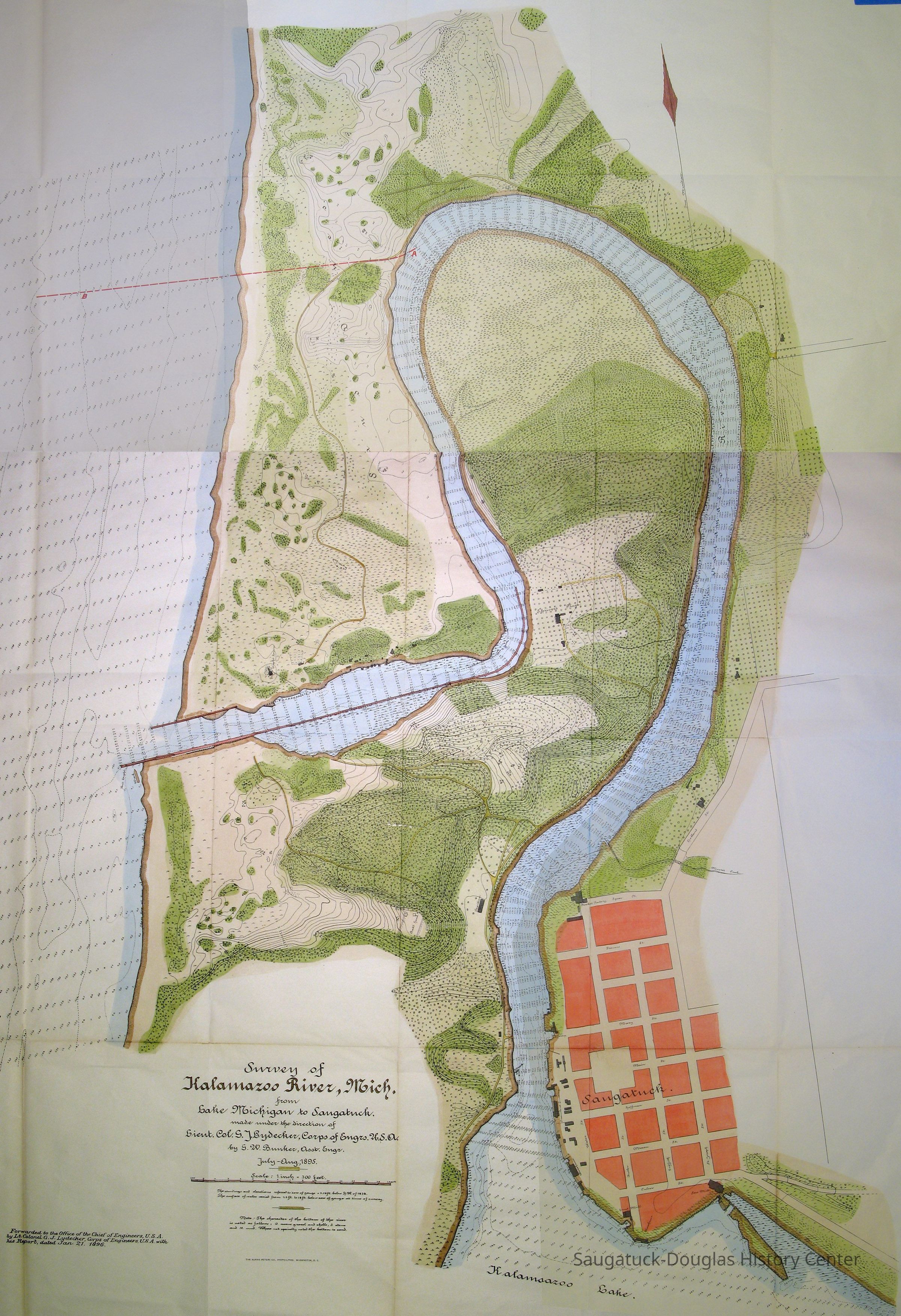
The map has extensive water depth soundings and land elevations. Also shows ship wrecks, a road winding through the dunes that are now the Saugatuck Harbor Natural Area, roads to the (abandoned) Singapore site (Dugout Road), Slumber Bluff, House family orchards, Moore's Creek, Holland St., the Basket Factory on Spear St. in Saugatuck, the chain ferry route, the pavilion at Mount Baldhead Park (the Parklands), Steamboat landing, warehouse at Mason St. end, Grist Mill and warehouse at Butler St. end, the sawmill and boom island at St. Joseph St. end.Context
This survey shows the state of the mouth of the river as politician considered the costs and rewards of cutting a new channel to aid navigation. Map includes red line indicating the propose route for the new (completed 1906) river mouth.Collection
Nautical, Transportation: water, Shipwrecks, Nature, ecology, the landscapeCataloged By
Winthers, SallyAcquisition
Accession
2024.42Source or Donor
Clark, ChrisAcquisition Method
Donation, unconditionalMap Details
Scale
1:3,600Area or Region
* Untyped Area or Region
Kalamazoo RiverDate Published
1896Location
* Untyped Location
Digital data in CatalogItRelationships
Related Person or Organization
Person or Organization
Old Harbor/Channel piers pre-1906/Ox-Bow Lagoon, Shriver's Bend, Kalamazoo Lighthouses 1839/1858/1956-present, The Boom/Dock Island/Griffin & Henry Lumber Dock, Mount Baldhead Dune/Park, Fishtown, Pine Trail Camp/Camp Oak Openings/Slumber Bluff, Kasten/House's Cherry Cider Co. at Riverside Fruit Farm, 40 Butler/Hotel Butler/Grist Mill/Haymarket/Dutch windmill, Wise Residence/515 Park/Ferry Store/Heath Shop 1917-1980s?, Griffin & Henry Lumber Yard/Griffin & Henry Sawmill/Griffin & Williams/Stockbridge & Johnson/Wells & Johnson/M.B. Spencer MillCreate Date
September 17, 2024Update Date
October 22, 2024