Name/Title
Saugatuck Harbor 2017 MapEntry/Object ID
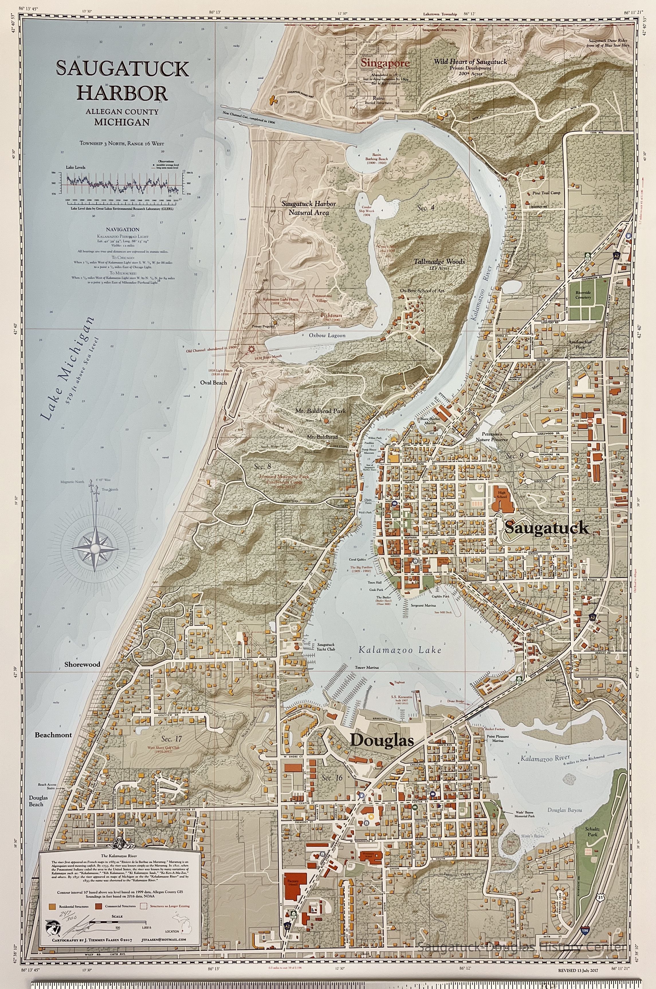
2022.68.01Description
Highly detailed map that shows Saugatuck, Douglas and surroundings from the northern boundary of Saugatuck Township to Wiley Road and from Lake Michigan to the Blue Star Highway. Historic sites like Singapore and the Basket Factory are marked (in red) along with contemporary street names and buildings.
Numbered 247/300 and signed by J. Tiemmen FaasenAcquisition
Accession
2022.68Source or Donor
Faasen, James T.Acquisition Method
DonationMap Details
Maker or Creator
Faasen, James T.Date Published
Jul 13, 2012Location
Drawer
Flat Files drawer 11 Local mapsCreate Date
September 9, 2022Update Date
May 13, 2024